Category:Baddinsgill Burn
Jump to navigation
Jump to search
stream in Scottish Borders, Scotland, UK, tributary of Lyne Water  | |||||
| Upload media | |||||
| Instance of | |||||
|---|---|---|---|---|---|
| Location |
| ||||
| Elevation above sea level |
| ||||
| Mouth of the watercourse |
| ||||
 | |||||
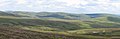
Baddinsgill Burn rises on moorland on the West Lothian - cottish Borders border; the burn is a tributary of the Lyne Water.
Media in category "Baddinsgill Burn"
The following 9 files are in this category, out of 9 total.
-
 Baddinsgill Burn - geograph.org.uk - 1509362.jpg 480 × 640; 139 KB
-
 Baddinsgill Burn - geograph.org.uk - 32133.jpg 640 × 209; 29 KB
-
 Field, Baddinsgill - geograph.org.uk - 1509386.jpg 640 × 480; 87 KB
-
 Headwater of the Baddinsgill Burn - geograph.org.uk - 1558468.jpg 640 × 427; 96 KB
-
 The Baddinsgill Burn - geograph.org.uk - 331342.jpg 480 × 640; 101 KB
-

-
 Valley of the Baddinsgill Burn - geograph.org.uk - 1209261.jpg 640 × 480; 82 KB
-
 Dam in the Baddinsgill Burn - geograph.org.uk - 331336.jpg 640 × 480; 105 KB
-
 Lochan in the Baddinsgill Burn - geograph.org.uk - 331321.jpg 640 × 480; 103 KB


