Category:Badachro
Jump to navigation
Jump to search
human settlement in Highland, Scotland, UK  | |||||
| Upload media | |||||
| Instance of | |||||
|---|---|---|---|---|---|
| Location |
| ||||
 | |||||
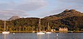
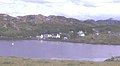
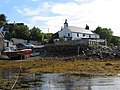
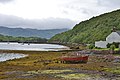
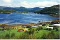
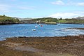
English: Badachro ( Gaelic Bad a' Chrodha) is a remote fishing village about 3 km south of Gairloch, in the north west Highlands of Scotland. It sits on the shore of Gair Loch, and is considered one of the best natural harbours in the United Kingdom . It is scenic and has a pub and a small restaurant. Approximately 2 miles to the SE are located the Fairy Lochs, the site of a 1945 plane crash which is now a designated war grave. The crash site has been preserved as a memorial to the USAAF servicemen who lost their lives in the accident, and is accessible by a rough track near the Shieldaig Lodge Hotel.
Nederlands: Badachro ( Schots-Gaelisch: Bad a' Chrodha) is een vissesdorp in het westen van de Schotse Lieutenancy Ross and Cromarty in de council Highland, ongeveer 3 kilometer ten zuiden van Gairloch aan de oevers van Loch Gairloch.
Media in category "Badachro"
The following 114 files are in this category, out of 114 total.
-
 A corner of Badachro Bay - geograph.org.uk - 1215742.jpg 640 × 480; 115 KB
-
 A corner of Badachro Bay - geograph.org.uk - 5132301.jpg 640 × 481; 49 KB
-
 Admiralty Chart No 3441 Gairloch, Published 1904.jpg 16,193 × 10,900; 75.15 MB
-
-
 Anchors, Redpoint Bay - geograph.org.uk - 532068.jpg 640 × 440; 94 KB
-
 B8056, approaching Red Point - geograph.org.uk - 47121.jpg 640 × 480; 247 KB
-
 Badachro - geograph.org.uk - 3146104.jpg 640 × 480; 89 KB
-
 Badachro - geograph.org.uk - 5106398.jpg 640 × 480; 563 KB
-
 Badachro - geograph.org.uk - 7494.jpg 640 × 353; 122 KB
-
 Badachro Bay - geograph.org.uk - 1079256.jpg 640 × 436; 79 KB
-
 Badachro Bay - geograph.org.uk - 1215705.jpg 640 × 481; 131 KB
-
 Badachro Bay - geograph.org.uk - 1526707.jpg 640 × 480; 44 KB
-
 Badachro Bay - geograph.org.uk - 3322714.jpg 1,000 × 664; 362 KB
-
 Badachro bay - geograph.org.uk - 5847940.jpg 1,024 × 682; 929 KB
-
 Badachro Bay - geograph.org.uk - 923135.jpg 640 × 234; 32 KB
-
 Badachro Inn - geograph.org.uk - 3576822.jpg 1,200 × 800; 966 KB
-
 Badachro Inn from the jetty - geograph.org.uk - 829670.jpg 640 × 480; 105 KB
-
 Badachro Inn sign - geograph.org.uk - 829338.jpg 640 × 483; 81 KB
-
 Badachro Pier with two boats - geograph.org.uk - 1526704.jpg 640 × 480; 62 KB
-
 Badachro River - geograph.org.uk - 254257.jpg 640 × 480; 173 KB
-
 Badachro River - geograph.org.uk - 401320.jpg 640 × 480; 104 KB
-
 Badachro Shoreline - geograph.org.uk - 3982441.jpg 640 × 474; 204 KB
-
 Badachro shoreline, boat and pub - geograph.org.uk - 3534672.jpg 1,152 × 768; 504 KB
-
 Boat and jetty at Badachro - geograph.org.uk - 4519550.jpg 1,024 × 682; 218 KB
-
 Boats at anchor off Badachro - geograph.org.uk - 3534683.jpg 1,152 × 768; 497 KB
-
 Boats at Badachro - geograph.org.uk - 4001720.jpg 640 × 479; 67 KB
-
 Boats on the beach at Badachro - geograph.org.uk - 2266414.jpg 1,500 × 1,125; 472 KB
-
 Boats pulled up on the grass at Badachro.jpg 640 × 434; 84 KB
-
 Carn Dearg Youth Hostel - geograph.org.uk - 531183.jpg 640 × 427; 73 KB
-
 Eilean Horrisdale - geograph.org.uk - 2984421.jpg 1,500 × 983; 1.26 MB
-
 Gairloch , Badachro - geograph.org.uk - 2226325.jpg 3,008 × 2,000; 1.28 MB
-
 Gairloch , Badachro - geograph.org.uk - 2226326.jpg 2,000 × 3,008; 754 KB
-
 Gairloch , Badachro - geograph.org.uk - 2226327.jpg 3,008 × 2,000; 1.48 MB
-
 Gairloch , Badachro - geograph.org.uk - 2226329.jpg 2,000 × 3,008; 869 KB
-
 Gairloch , Badachro - geograph.org.uk - 2226333.jpg 3,008 × 2,000; 1.49 MB
-
 Gairloch , Badachro - geograph.org.uk - 2226340.jpg 3,008 × 2,000; 1.46 MB
-
 Gairloch , Badachro Inn - geograph.org.uk - 2226335.jpg 3,008 × 2,000; 1.51 MB
-
 Gairloch , Badachro Inn - geograph.org.uk - 2226339.jpg 3,008 × 2,000; 1.4 MB
-
 Gairloch , Foreshore at Badachro - geograph.org.uk - 2226334.jpg 2,000 × 3,008; 897 KB
-
 Gairloch , Foreshore at Badachro - geograph.org.uk - 2226337.jpg 3,008 × 2,000; 1.51 MB
-
 Gairloch , Sea Thrift at Badachro - geograph.org.uk - 2226336.jpg 3,008 × 2,000; 1.61 MB
-
 Gate at Badachro - geograph.org.uk - 34801.jpg 640 × 480; 94 KB
-
 Hairy Hulk - geograph.org.uk - 5106512.jpg 640 × 480; 536 KB
-
 Jetty and boats at Badachro - geograph.org.uk - 829326.jpg 640 × 480; 126 KB
-
 Jetty at Badachro - geograph.org.uk - 5477188.jpg 800 × 549; 118 KB
-
 Jetty, Badachro - geograph.org.uk - 6152952.jpg 1,024 × 683; 238 KB
-
 New housing at Badachro - geograph.org.uk - 2960487.jpg 1,500 × 843; 978 KB
-
 No longer seaworthy - geograph.org.uk - 5889400.jpg 4,608 × 3,456; 5.91 MB
-

-
 Ordnance Survey One-Inch Sheet 19 Gairloch, Published 1958.jpg 8,238 × 9,933; 7.8 MB
-
 Ordnance Survey One-Inch Sheet 25 Raasay & Applecross, Published 1947.jpg 10,459 × 12,911; 11.33 MB
-
 River Erradale - geograph.org.uk - 761892.jpg 640 × 480; 101 KB
-
 Slipway at Badachro - geograph.org.uk - 4001731.jpg 640 × 480; 54 KB
-
 Small boats tied up at the jetty Badachro - geograph.org.uk - 5889416.jpg 3,440 × 4,596; 5.75 MB
-
 The Badachro Inn, Badachro - geograph.org.uk - 35316.jpg 640 × 480; 77 KB
-
 The eastern shore of Loch Braigh Horrisdale - geograph.org.uk - 677143.jpg 1,000 × 661; 263 KB
-
 The jetty at Badachro Bay - geograph.org.uk - 5132306.jpg 640 × 481; 70 KB
-
 Towards Eilean Tioram at Badachro - geograph.org.uk - 5457985.jpg 1,600 × 1,200; 875 KB
-
 Tributary joining unnamed river - geograph.org.uk - 735100.jpg 640 × 480; 87 KB
-
 View from the decked area outside the Badachro Inn - geograph.org.uk - 5889392.jpg 4,524 × 3,340; 6.01 MB
-
 View towards Loch Clàir - geograph.org.uk - 735148.jpg 640 × 480; 86 KB
-
 Water storage above Leacnasaide - geograph.org.uk - 721932.jpg 640 × 480; 76 KB
-
 Weir on the Badachro - geograph.org.uk - 913036.jpg 525 × 394; 73 KB
-
 Wreck at Badachro - geograph.org.uk - 3548357.jpg 1,440 × 964; 319 KB
-
-
 Aird from Dry Island - geograph.org.uk - 254249.jpg 640 × 480; 144 KB
-
 Allt a' Chaol Thuill - geograph.org.uk - 1184090.jpg 640 × 480; 99 KB
-
 Allt a' Chaol Thuill - geograph.org.uk - 1184094.jpg 480 × 640; 97 KB
-

-

-
 Assortment of Baths, Redpoint Farm - geograph.org.uk - 531611.jpg 427 × 640; 65 KB
-
 At Badachro - geograph.org.uk - 996604.jpg 640 × 394; 65 KB
-
 Auld alliance BandB - geograph.org.uk - 1512089.jpg 640 × 360; 68 KB
-
 Badachro and Sidhean Mor - geograph.org.uk - 279278.jpg 640 × 480; 86 KB
-
 Big Sand Beach From Ceann a'Chreagain - geograph.org.uk - 530050.jpg 640 × 427; 92 KB
-
 Birch by unnamed river - geograph.org.uk - 735022.jpg 640 × 480; 84 KB
-
 Birchwood and moorland - geograph.org.uk - 52526.jpg 640 × 480; 121 KB
-
 Bridge in South Erradale - geograph.org.uk - 773319.jpg 640 × 480; 68 KB
-
 Bridge over the Badachro River - geograph.org.uk - 254262.jpg 640 × 480; 142 KB
-
 Burn above Lòn Doire nan Eala - geograph.org.uk - 735127.jpg 640 × 480; 99 KB
-
 Camasnaharry by Camas na h-Airigh - geograph.org.uk - 734965.jpg 640 × 499; 56 KB
-
 Camping sauvage - geograph.org.uk - 515230.jpg 640 × 406; 80 KB
-
 Ceann a'Chreagain - geograph.org.uk - 530041.jpg 640 × 427; 77 KB
-
 Chapels, Strath - geograph.org.uk - 532126.jpg 640 × 427; 57 KB
-
 Crags above the Badachro River - geograph.org.uk - 401781.jpg 640 × 480; 104 KB
-

-
 Fraoch-eilean - geograph.org.uk - 434544.jpg 640 × 480; 96 KB
-

-

-

-
 Hut circle near Leacnasaide - geograph.org.uk - 401798.jpg 640 × 480; 164 KB
-
 Hut circle near Loch Fuar - geograph.org.uk - 401844.jpg 640 × 480; 128 KB
-
 Incoming Tide, Near Ceann a'Chreagain - geograph.org.uk - 530045.jpg 640 × 427; 60 KB
-
 Loch Bad a' Chròtha - geograph.org.uk - 382755.jpg 640 × 480; 105 KB
-
 Lochan Fuar - geograph.org.uk - 401836.jpg 640 × 480; 82 KB
-
 Lochan nam Breac Odhar - geograph.org.uk - 382805.jpg 640 × 480; 120 KB
-
 Moorland above Port Henderson - geograph.org.uk - 382831.jpg 640 × 480; 104 KB
-
 Near Leacnasaide - geograph.org.uk - 278308.jpg 640 × 480; 70 KB
-
 Old Fishing Station at Red Point - geograph.org.uk - 424985.jpg 640 × 422; 110 KB
-
 Red Point beach - geograph.org.uk - 424980.jpg 640 × 480; 56 KB
-
 Red Point Farm - geograph.org.uk - 425004.jpg 600 × 422; 259 KB
-
 Redpoint Beach - geograph.org.uk - 460749.jpg 640 × 480; 30 KB
-
 Redpoint Farm - geograph.org.uk - 532073.jpg 640 × 427; 62 KB
-
 River as it runs into the sea at Redpoint - geograph.org.uk - 433886.jpg 640 × 480; 108 KB
-

-
 Shore near Sands, NW of Gairloch - geograph.org.uk - 637787.jpg 481 × 640; 75 KB
-
 Shoreline, Redpoint - geograph.org.uk - 665638.jpg 640 × 454; 78 KB
-
 Sròn na Caillich - geograph.org.uk - 532077.jpg 640 × 480; 88 KB
-
 Strath - geograph.org.uk - 567266.jpg 640 × 427; 78 KB
-
 Strath - geograph.org.uk - 567270.jpg 640 × 427; 79 KB
-
 Strath Bay, Gairloch - geograph.org.uk - 498019.jpg 640 × 480; 78 KB
-
 The south end of Sands beach - geograph.org.uk - 601701.jpg 800 × 600; 122 KB
-
 The track from Lonemore - geograph.org.uk - 332461.jpg 640 × 480; 102 KB
-


