Category:Bachlaig, Islay
Jump to navigation
Jump to search
Bachlaig is a traditional geographic name of an uninhabited section of the lower slopes of Sgarbh Breac north of Bunnahabhain, Islay. Rubha Bhachlaig, a promontory of the Sound of Islay, is named after it, as is Allt Bhachlaig, a burn that borders it to the south.
Media in category "Bachlaig, Islay"
The following 10 files are in this category, out of 10 total.
-
 Bog, Cnoc Dubh - geograph.org.uk - 760111.jpg 640 × 480; 84 KB
-
 Cnoc na Piobaireachd - geograph.org.uk - 989238.jpg 640 × 480; 103 KB
-
 Margadale River - geograph.org.uk - 989219.jpg 640 × 480; 155 KB
-
 Path to Rubh'a' Mhàil - geograph.org.uk - 989276.jpg 640 × 480; 80 KB
-
 Peat cuttings, Bunnahabhain - geograph.org.uk - 761839.jpg 640 × 480; 80 KB
-
 Powerline to the lighthouse - geograph.org.uk - 760115.jpg 640 × 476; 74 KB
-
 Rock Arch - geograph.org.uk - 592784.jpg 640 × 480; 155 KB
-
-
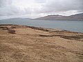
 Sound of Islay from Bachlaig - geograph.org.uk - 761788.jpg 640 × 480; 48 KB
-
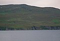
 Bachlaig - geograph.org.uk - 761778.jpg 640 × 480; 71 KB


