Category:B976 road (Scotland)
Jump to navigation
Jump to search

B road in Aberdeenshire, Scotland, UK | |||||
| Upload media | |||||
| Instance of |
| ||||
|---|---|---|---|---|---|
| Location | Aberdeenshire, Scotland | ||||
| Transport network |
| ||||
| Has part(s) |
| ||||
| |||||
Media in category "B976 road (Scotland)"
The following 44 files are in this category, out of 44 total.
-
 A new avenue near Dalliefour Farm - geograph.org.uk - 1316287.jpg 640 × 428; 130 KB
-
 A straight stretch of the B976 - geograph.org.uk - 3029944.jpg 1,824 × 1,368; 853 KB
-
 Access to Clachanturn from B976 - geograph.org.uk - 3029962.jpg 1,781 × 1,144; 642 KB
-
 B976 at Easter Balmoral - geograph.org.uk - 3030218.jpg 1,813 × 1,051; 698 KB
-

-
 Bridge of Muick - geograph.org.uk - 870080.jpg 633 × 475; 162 KB
-
 Cattle grid on B976 - geograph.org.uk - 443238.jpg 640 × 480; 105 KB
-
 Gate entrance - geograph.org.uk - 1104138.jpg 640 × 480; 76 KB
-
 Junction of B976 with B974 - geograph.org.uk - 1906703.jpg 1,024 × 617; 94 KB
-
 Looking down on B976 - geograph.org.uk - 603357.jpg 640 × 480; 81 KB
-
 Mains of Abergeldie. - geograph.org.uk - 662151.jpg 640 × 290; 54 KB
-
 Memorial drinking fountain near Dinnet - geograph.org.uk - 1538408.jpg 640 × 479; 131 KB
-
 Memorial near Littlemill - geograph.org.uk - 1538294.jpg 640 × 480; 181 KB
-
 Strachan view looking west 2013.jpg 2,000 × 1,500; 648 KB
-
 Telephone box, Littlemill - geograph.org.uk - 1538330.jpg 640 × 480; 134 KB
-
 The B976 South Deeside road west of Ballater - geograph.org.uk - 646577.jpg 1,704 × 2,272; 5.14 MB
-
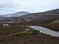 View NE from summit of B976 - geograph.org.uk - 443153.jpg 640 × 480; 65 KB
-
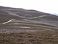 View SW from The Strone - geograph.org.uk - 443044.jpg 640 × 480; 76 KB
-
 Water bailiff's office - geograph.org.uk - 632326.jpg 640 × 480; 74 KB
-
 Access to Ardoch - geograph.org.uk - 443442.jpg 640 × 480; 140 KB
-
 Access to Crathienaird - geograph.org.uk - 443301.jpg 640 × 369; 53 KB
-
 Access to Lawsie - geograph.org.uk - 443435.jpg 640 × 480; 146 KB
-
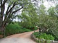
 Access to Newton Farmhouse (December) - geograph.org.uk - 632198.jpg 640 × 480; 108 KB
-

-
 Approach to Glen Tanar schoolhouse - geograph.org.uk - 632280.jpg 640 × 480; 50 KB
-
 Approach to road junction at Gairnshiel - geograph.org.uk - 442955.jpg 640 × 480; 117 KB
-
 B976 alongside the River Gairn - geograph.org.uk - 443018.jpg 640 × 480; 90 KB
-

-
 Ballogie Petrol Pump and TCB - geograph.org.uk - 99468.jpg 640 × 427; 119 KB
-
 Bridge End, Ballogie - geograph.org.uk - 99483.jpg 640 × 427; 121 KB
-
 Bridge over Crathie Burn - geograph.org.uk - 443319.jpg 640 × 480; 106 KB
-
 Bridge over Lawsie Burn - geograph.org.uk - 443439.jpg 640 × 455; 109 KB
-
 Bridge over the Crathie Burn - geograph.org.uk - 443191.jpg 640 × 480; 121 KB
-
 Cave Juggernautes - geograph.org.uk - 443450.jpg 640 × 468; 106 KB
-
 Dardanus Stone, Corsedarar Hill - geograph.org.uk - 35784.jpg 640 × 496; 160 KB
-
 Descent towards Balmoral - geograph.org.uk - 443250.jpg 563 × 640; 73 KB
-
 Heath Cottage - geograph.org.uk - 443177.jpg 640 × 480; 128 KB
-
 Sawmill. - geograph.org.uk - 445042.jpg 640 × 480; 59 KB
-
 Scottish ROW Society sign - geograph.org.uk - 443170.jpg 640 × 480; 68 KB
-
 South Deeside Road, Inchmarnoch - geograph.org.uk - 220406.jpg 640 × 436; 126 KB
-
 Starrypool - geograph.org.uk - 603343.jpg 640 × 480; 80 KB
-
 Track to Blairglass - geograph.org.uk - 443216.jpg 640 × 480; 105 KB
-
 Trees beside B976 below Braenaloin - geograph.org.uk - 443021.jpg 640 × 480; 101 KB
-
 Woodland edge - geograph.org.uk - 443223.jpg 640 × 480; 144 KB


_-_geograph.org.uk_-_632198.jpg)


