Category:B664 road (England)
Jump to navigation
Jump to search

road in England | |||||
| Upload media | |||||
| Instance of |
| ||||
|---|---|---|---|---|---|
| Location | England | ||||
| Transport network |
| ||||
| |||||
Subcategories
This category has only the following subcategory.
S
Media in category "B664 road (England)"
The following 16 files are in this category, out of 16 total.
-
 Ashley & Weston former station geograph-3239500-by-Ben-Brooksbank.jpg 2,406 × 1,457; 2.98 MB
-
 Brick Road Bridge. - geograph.org.uk - 385856.jpg 640 × 480; 105 KB
-
 Bridge on the County Boundary. - geograph.org.uk - 385899.jpg 640 × 480; 94 KB
-
 Bridge over Eye Brook - geograph.org.uk - 310863.jpg 640 × 428; 99 KB
-

-
 From B664 towards Stockerston Hall - geograph.org.uk - 310922.jpg 640 × 402; 81 KB
-
 Homestead House - geograph.org.uk - 565916.jpg 640 × 427; 99 KB
-
 Lodge Farm, near Stockerston - geograph.org.uk - 232387.jpg 640 × 480; 79 KB
-
 Medbourne Village Hall. - geograph.org.uk - 385817.jpg 640 × 480; 106 KB
-
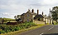
 Old Ashley Station at Welland Bank. - geograph.org.uk - 385926.jpg 640 × 480; 89 KB
-
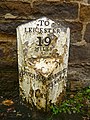 Old Milepost by the B664, North Street West, (geograph 6037419).jpg 600 × 800; 162 KB
-
 The Queens Head. - geograph.org.uk - 385685.jpg 640 × 480; 77 KB
-
 Undulating Uppingham Road - geograph.org.uk - 566600.jpg 509 × 640; 95 KB
-
 Weston by Welland, Northamptonshire - geograph.org.uk - 569534.jpg 640 × 452; 98 KB
-

-
 New Lodge, Uppingham Road - geograph.org.uk - 232461.jpg 640 × 480; 91 KB


.jpg)


