Category:B6478 road (England)
Jump to navigation
Jump to search

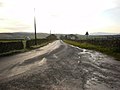
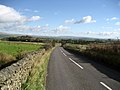
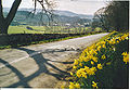
English: The B6478 is 18 miles long and passes through attractive Bowland scenery linking Clitheroe with the A65 at Long Preston via Waddington and Slaidburn.
road in England | |||||
| Upload media | |||||
| Instance of |
| ||||
|---|---|---|---|---|---|
| Location | England | ||||
| Transport network |
| ||||
| |||||
Subcategories
This category has the following 5 subcategories, out of 5 total.
B
- Brungerley Bridge (6 F)
C
- Cow Bridge, North Yorkshire (5 F)
N
- New Bridge, Slaidburn (12 F)
- Newton Bridge, Lancashire (16 F)
Media in category "B6478 road (England)"
The following 9 files are in this category, out of 9 total.
-
 B6478 - geograph.org.uk - 1067625.jpg 640 × 480; 59 KB
-
 B6478 near Tosside - geograph.org.uk - 595679.jpg 640 × 480; 75 KB
-
 Bus on the B6478 - geograph.org.uk - 1674913.jpg 640 × 480; 74 KB
-
 Church Street, Slaidburn - geograph.org.uk - 874584.jpg 640 × 480; 110 KB
-
 Coronation Gardens Waddington - geograph.org.uk - 882192.jpg 640 × 480; 100 KB
-
 Entering Slaidburn from the East - geograph.org.uk - 1268914.jpg 640 × 480; 81 KB
-
 Slaidburn from the North. - geograph.org.uk - 131414.jpg 640 × 443; 132 KB
-
 Summit of the B6478 - geograph.org.uk - 889616.jpg 640 × 454; 66 KB
-
 The Moorcock Inn - geograph.org.uk - 742181.jpg 640 × 480; 227 KB


