Category:B6051 road (England)
Jump to navigation
Jump to search

road in England | |||||
| Upload media | |||||
| Instance of |
| ||||
|---|---|---|---|---|---|
| Location | England | ||||
| Transport network |
| ||||
| |||||
Media in category "B6051 road (England)"
The following 18 files are in this category, out of 18 total.
-
 Barlow - geograph.org.uk - 542579.jpg 428 × 640; 85 KB
-
 Barlow - Methodist Church - geograph.org.uk - 1526981.jpg 640 × 480; 97 KB
-
 Barlow - Millcross Lane - geograph.org.uk - 690807.jpg 640 × 480; 49 KB
-
 Barlow Village Scene - geograph.org.uk - 690819.jpg 640 × 480; 51 KB
-
 Horsleygate Road (B6051) View - geograph.org.uk - 839518.jpg 640 × 480; 141 KB
-
 Horsleygate Road (B6051) View - geograph.org.uk - 839529.jpg 640 × 480; 115 KB
-
 Horsleygate Road (B6051) View - geograph.org.uk - 839535.jpg 640 × 480; 113 KB
-
 Horsleygate Road (B6051) View - geograph.org.uk - 839569.jpg 640 × 480; 116 KB
-
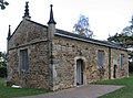 Eyre Chapel Newbold Geograph-2647301-by-Dave-Bevis.jpg 1,600 × 1,180; 577 KB
-
 The Old Pump, Barlow - geograph.org.uk - 542568.jpg 640 × 428; 111 KB
-
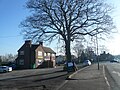
 Upper Newbold - Four Lane Ends - geograph.org.uk - 829647.jpg 640 × 480; 65 KB
-
 Upper Newbold - Four Lane Ends - geograph.org.uk - 829651.jpg 640 × 480; 72 KB
-
 Wheatsheaf, Newbold.jpg 640 × 480; 110 KB
-
 Barlow - Gift Shop - Cafe View - geograph.org.uk - 690761.jpg 640 × 480; 57 KB
-

-
 Junction of Mill Lane with B6051 New Road - geograph.org.uk - 557415.jpg 640 × 480; 130 KB
-
 Upper Newbold - Four Lane Ends - geograph.org.uk - 686871.jpg 640 × 480; 79 KB
-
 Upper Newbold - geograph.org.uk - 67089.jpg 640 × 480; 62 KB


_View_-_geograph.org.uk_-_839518.jpg)
_View_-_geograph.org.uk_-_839529.jpg)
_View_-_geograph.org.uk_-_839535.jpg)
_View_-_geograph.org.uk_-_839569.jpg)


_-_geograph.org.uk_-_593159.jpg)


