Category:B5278 road (England)
Jump to navigation
Jump to search

road in England | |||||
| Upload media | |||||
| Instance of |
| ||||
|---|---|---|---|---|---|
| Location | England | ||||
| Transport network |
| ||||
| |||||
Subcategories
This category has only the following subcategory.
J
Media in category "B5278 road (England)"
The following 12 files are in this category, out of 12 total.
-
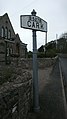 Cark Fingerpost opposite station - panoramio.jpg 1,728 × 3,072; 1.66 MB
-
 Cark p o box .jpg 2,448 × 3,264; 2.81 MB
-
 Entrance to Holker Hall - geograph.org.uk - 1751900.jpg 640 × 480; 173 KB
-
 Former Holker School.jpg 1,024 × 768; 215 KB
-
 Holker hall entrance.jpg 3,264 × 2,448; 3.1 MB
-
 Holker hall sign.jpg 3,264 × 2,448; 3.35 MB
-
 Houses near Shorthorn Farm - geograph.org.uk - 1751901.jpg 640 × 480; 128 KB
-
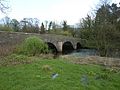 Low Wood Bridge, Haverthwaite.jpg 640 × 480; 172 KB
-
 Rose and Crown, Cark - geograph.org.uk - 1751904 (cropped).jpg 396 × 223; 49 KB
-
 Rose and Crown, Cark - geograph.org.uk - 1751904.jpg 578 × 434; 89 KB
-
 Bridge at Haverthwaite - geograph.org.uk - 98196.jpg 640 × 480; 164 KB
-
 The Road to Holker, Cark - geograph.org.uk - 447498.jpg 640 × 480; 140 KB


.jpg)


