Category:B5112 road (Wales)
Jump to navigation
Jump to search

road in Wales | |||||
| Upload media | |||||
| Instance of |
| ||||
|---|---|---|---|---|---|
| Location | Wales | ||||
| Transport network |
| ||||
| |||||
Media in category "B5112 road (Wales)"
The following 43 files are in this category, out of 43 total.
-

-

-

-
 Bends in the B 5112 near Brynclyd - geograph.org.uk - 1012178.jpg 640 × 359; 43 KB
-
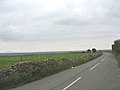
 Farmland SE of the B 5112 at Carmel - geograph.org.uk - 1012028.jpg 640 × 364; 35 KB
-

-

-
 Minor road running past Treriffri - geograph.org.uk - 995795.jpg 640 × 390; 41 KB
-

-

-

-

-

-

-

-

-

-
 The B 5112 north of Rhydydefaid Farm - geograph.org.uk - 1008680.jpg 640 × 470; 45 KB
-

-

-
 The B 5112 south of Treferwydd - geograph.org.uk - 1008435.jpg 640 × 480; 49 KB
-
 The B 5112 south of Y Werthyr Farm - geograph.org.uk - 1008772.jpg 640 × 480; 44 KB
-
 The B 5112 southwards towards Trefor - geograph.org.uk - 1008173.jpg 640 × 480; 39 KB
-

-

-
 The Ceirchiog Crossroads - geograph.org.uk - 1009198.jpg 640 × 480; 44 KB
-

-
 The junction with the B 5112 - geograph.org.uk - 1011905.jpg 640 × 396; 55 KB
-

-

-
 Treban Crossroads on the A 5. - geograph.org.uk - 976898.jpg 640 × 403; 44 KB
-

-
 Treban Meurig Farm from the A5 - geograph.org.uk - 998822.jpg 640 × 480; 49 KB
-

-
 Trefor Crossroads - geograph.org.uk - 997881.jpg 640 × 480; 60 KB
-
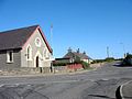
 Trefor, Anglesey. - geograph.org.uk - 114206.jpg 640 × 480; 63 KB
-
 Treriffri from the B 5112 - geograph.org.uk - 995667.jpg 640 × 480; 43 KB
-
 Ty'n Cae cottage on the B 5112 - geograph.org.uk - 1012249.jpg 640 × 423; 48 KB
-

-

-
 View north across the Caradog Valley - geograph.org.uk - 1008781.jpg 640 × 480; 43 KB
-
 Farm Buildings at Tafarn y Botel - geograph.org.uk - 152483.jpg 640 × 480; 120 KB
-
 Roadside Scene at Pont Rhydydefaid - geograph.org.uk - 200362.jpg 640 × 480; 88 KB


_-_geograph.org.uk_-_882988.jpg)


