Category:B5111 road (Wales)
Jump to navigation
Jump to search

road in Wales | |||||
| Upload media | |||||
| Instance of |
| ||||
|---|---|---|---|---|---|
| Location | Wales | ||||
| Transport network |
| ||||
| |||||
Media in category "B5111 road (Wales)"
The following 86 files are in this category, out of 86 total.
-

-
 Abandoned section of the B5111 - geograph.org.uk - 1399229.jpg 640 × 480; 75 KB
-
 Abandoned section of the B5111 - geograph.org.uk - 1400208.jpg 640 × 480; 69 KB
-

-

-

-

-
 B5111 Approaching Amlwch - geograph.org.uk - 1436658.jpg 640 × 480; 146 KB
-
-
 B5111 In Rhosybol - geograph.org.uk - 1437504.jpg 640 × 480; 227 KB
-
 B5111 Near Ty-Hen Newydd - geograph.org.uk - 1437523.jpg 640 × 480; 166 KB
-
 B5111 South Of Cae Mawr - geograph.org.uk - 1437516.jpg 640 × 480; 240 KB
-
 B5111 Starts The Descent To Rhosybol - geograph.org.uk - 1437494.jpg 638 × 423; 149 KB
-

-
 Bend in the B5111 by Llaethdy Chapel - geograph.org.uk - 1279439.jpg 640 × 480; 70 KB
-

-

-

-
 Cottages along the B5111 - geograph.org.uk - 1312613.jpg 640 × 423; 45 KB
-

-

-
 Entering Llanerch-y-medd - geograph.org.uk - 231550.jpg 640 × 480; 99 KB
-

-
 Houses alongside the B5111 - geograph.org.uk - 1312467.jpg 640 × 480; 49 KB
-
 Houses at Pen-lon on the B5111 - geograph.org.uk - 1279540.jpg 640 × 549; 45 KB
-

-

-

-

-
 Milestone alongside the B5111 - geograph.org.uk - 1402349.jpg 480 × 640; 143 KB
-
 Minor Road Joins The B5111 - geograph.org.uk - 1437515.jpg 544 × 479; 251 KB
-
 New bungalows alongside the B5111 - geograph.org.uk - 1402282.jpg 640 × 480; 63 KB
-

-

-
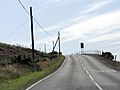
 Power Lines Across The B5111 - geograph.org.uk - 1437509.jpg 640 × 480; 242 KB
-

-
 Rhosgoch Junction, B5111 - geograph.org.uk - 1437513.jpg 640 × 480; 179 KB
-

-
 Sharp bend in the B5111 - geograph.org.uk - 1400168.jpg 640 × 482; 59 KB
-

-

-
 The B5111 at Pont Glan-rhyd - geograph.org.uk - 1399211.jpg 640 × 480; 49 KB
-
 The B5111 at Pont Uffernol - geograph.org.uk - 1360773.jpg 640 × 480; 73 KB
-
 The B5111 at Rhosmeirch - geograph.org.uk - 961831.jpg 640 × 480; 41 KB
-

-

-
 The B5111 near Bryn Mair - geograph.org.uk - 1312622.jpg 640 × 480; 74 KB
-
 The B5111 near Gorslwyd Chapel - geograph.org.uk - 1402269.jpg 640 × 422; 52 KB
-

-
 The B5111 north of Pont Uffernol - geograph.org.uk - 1360810.jpg 640 × 436; 71 KB
-

-
 The B5111 northwards towards Amlwch - geograph.org.uk - 1279556.jpg 640 × 460; 40 KB
-

-

-
 The B5111 over Mynydd Parys - geograph.org.uk - 1278575.jpg 640 × 480; 51 KB
-
 The B5111 south of Capel Peniel - geograph.org.uk - 1399419.jpg 640 × 333; 53 KB
-

-

-
 The B5111 southwards to Llangefni - geograph.org.uk - 1323893.jpg 640 × 480; 45 KB
-

-

-

-

-

-

-
 The Old Police Station, Llanerchymedd - geograph.org.uk - 864016.jpg 640 × 480; 130 KB
-

-

-

-
 View south along Amlwch Road (B5111) - geograph.org.uk - 1402402.jpg 640 × 340; 45 KB
-

-

-

-

-
 B5111 At Pentrefelin Crossroads - geograph.org.uk - 1436666.jpg 640 × 480; 166 KB
-
 B5111 At Pont Glan-rhyd - geograph.org.uk - 1437526.jpg 640 × 480; 154 KB
-
 B5111 Near Llyn Llaethdy - geograph.org.uk - 1436672.jpg 640 × 480; 152 KB
-
 B5111 Near Ysgoldy - geograph.org.uk - 1437524.jpg 640 × 480; 164 KB
-
 B5111 South Of Pont Glan-rhyd - geograph.org.uk - 1437527.jpg 640 × 480; 158 KB
-
 Passing Cae Mawr - geograph.org.uk - 231714.jpg 640 × 480; 110 KB
-
 Road junction north of Llangefni - geograph.org.uk - 152503.jpg 640 × 480; 134 KB
-
 Sharp bend - geograph.org.uk - 152508.jpg 640 × 480; 97 KB
-
 The B5111 - geograph.org.uk - 236385.jpg 640 × 480; 105 KB
-
 The B5111 - geograph.org.uk - 236599.jpg 640 × 480; 100 KB
-
 The B5111 - geograph.org.uk - 246464.jpg 640 × 480; 100 KB
-
 The B5111 - geograph.org.uk - 246466.jpg 640 × 480; 101 KB


,_Rhosybol_-_geograph.org.uk_-_1402342.jpg)


_approaching_Hen_Siop_-_geograph.org.uk_-_1299116.jpg)


_-_geograph.org.uk_-_1402402.jpg)


