Category:B4368 road (Great Britain)
Jump to navigation
Jump to search

road in Great Britain | |||||
| Upload media | |||||
| Instance of |
| ||||
|---|---|---|---|---|---|
| Location |
| ||||
| Transport network |
| ||||
| |||||
Subcategories
This category has the following 2 subcategories, out of 2 total.
M
T
- The Swan, Aston Munslow (6 F)
Media in category "B4368 road (Great Britain)"
The following 54 files are in this category, out of 54 total.
-
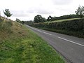
 Approaching Clun on the B4368 - geograph.org.uk - 1540938.jpg 640 × 494; 89 KB
-
 Approaching Clun on the B4368 - geograph.org.uk - 1540951.jpg 640 × 480; 75 KB
-
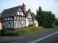 Aston Munslow - geograph.org.uk - 200741.jpg 640 × 480; 109 KB
-
 B4368 at Clunton - geograph.org.uk - 1540881.jpg 640 × 480; 75 KB
-
 B4368 at Clunton - geograph.org.uk - 1540909.jpg 640 × 480; 73 KB
-
 B4368 at Hungerford - geograph.org.uk - 1073432.jpg 640 × 480; 78 KB
-
-
 B4368 near Hall of the Forest - geograph.org.uk - 1596763.jpg 640 × 426; 210 KB
-
 B4368 on a miserable day in December - geograph.org.uk - 1073356.jpg 640 × 480; 49 KB
-
 B4368 passed the Kangaroo Inn - geograph.org.uk - 2703687.jpg 640 × 480; 58 KB
-
 B4368 passing The Kangaroo Inn - geograph.org.uk - 3835349.jpg 1,500 × 1,125; 1.58 MB
-

-

-
 B4368 road to Clun - geograph.org.uk - 872993.jpg 640 × 474; 109 KB
-
 B4368 road to Newcastle - geograph.org.uk - 1014527.jpg 480 × 640; 67 KB
-
 B4368 road to Newcastle and Clun - geograph.org.uk - 1017185.jpg 640 × 480; 104 KB
-
 B4368 road to Newcastle near Weals Farm - geograph.org.uk - 1017248.jpg 640 × 480; 103 KB
-
 B4368 through Clunton - geograph.org.uk - 3673051.jpg 640 × 514; 62 KB
-
 B4368 to Anchor - geograph.org.uk - 1013163.jpg 489 × 640; 92 KB
-
 B4368 to Clunton - geograph.org.uk - 705605.jpg 640 × 480; 81 KB
-
 B4368 to Purslow - geograph.org.uk - 705602.jpg 640 × 480; 76 KB
-
 B4368 west of Clunton - geograph.org.uk - 1540924.jpg 640 × 480; 121 KB
-
 B4368, Munslow (geograph 2126945).jpg 640 × 480; 127 KB
-
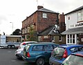
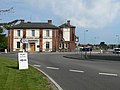 Craven Arms Hotel - geograph.org.uk - 834330.jpg 640 × 480; 65 KB
-
 Farm buildings by the B4368 - geograph.org.uk - 1013150.jpg 640 × 448; 84 KB
-
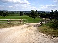 Farm track off the B4368 - geograph.org.uk - 522666.jpg 630 × 472; 108 KB
-

-

-
 Hall of the Forest Farm - geograph.org.uk - 1014538.jpg 640 × 459; 74 KB
-
 Hodley village - geograph.org.uk - 426262.jpg 640 × 480; 108 KB
-

-
 Kangaroo Inn Aston-on-Clun - geograph.org.uk - 2702890.jpg 640 × 465; 79 KB
-
 Lane junction with B4368 - geograph.org.uk - 1242323.jpg 600 × 450; 230 KB
-
 Lower slopes of Curney Bank - geograph.org.uk - 1017166.jpg 480 × 640; 81 KB
-
 Public Art, Craven Arms - geograph.org.uk - 736629.jpg 480 × 640; 58 KB
-
 Road junction of B4368 and B4369 - geograph.org.uk - 872986.jpg 640 × 447; 113 KB
-

-
 Signpost at crossroads near Weals Farm - geograph.org.uk - 1017275.jpg 480 × 640; 164 KB
-

-
 The B4368 at Weston - geograph.org.uk - 1036243.jpg 640 × 480; 66 KB
-
 The B4368 in Aston Eyre, Shropshire - geograph.org.uk - 489596.jpg 640 × 480; 181 KB
-
 The Craven Arms pub - geograph.org.uk - 1537087.jpg 640 × 499; 77 KB
-
 The Crown at Munslow (geograph 3195032).jpg 640 × 480; 71 KB
-
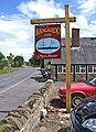 The Kangaroo Inn pub sign - geograph.org.uk - 872738.jpg 465 × 640; 115 KB
-
 The Kangaroo Inn, Aston on Clun - geograph.org.uk - 2720286.jpg 640 × 480; 47 KB
-
 The Round House, Aston on Clun - geograph.org.uk - 2720293.jpg 640 × 480; 53 KB
-
 Turn right for Ludlow - geograph.org.uk - 1242325.jpg 600 × 398; 187 KB
-
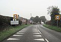
 Welcome to Clun - geograph.org.uk - 1594403.jpg 640 × 428; 187 KB
-
 B4368, the road to Craven Arms - geograph.org.uk - 767913.jpg 640 × 480; 85 KB
-
 Cruising the B4368 - geograph.org.uk - 767926.jpg 640 × 480; 87 KB
-
 Down to Corfton - geograph.org.uk - 245570.jpg 640 × 480; 89 KB
-
 House beside the B4368 - geograph.org.uk - 706021.jpg 640 × 480; 81 KB
-

-
 The B4368 approaching Munslow - geograph.org.uk - 200744.jpg 640 × 480; 131 KB


.jpg)


_-_geograph.org.uk_-_1443608.jpg)


.jpg)


