Category:B4361 road (England)
Jump to navigation
Jump to search

road in England | |||||
| Upload media | |||||
| Instance of |
| ||||
|---|---|---|---|---|---|
| Location | England | ||||
| Transport network |
| ||||
| |||||
Media in category "B4361 road (England)"
The following 33 files are in this category, out of 33 total.
-
 A49 bridge over the B4361 - geograph.org.uk - 1498082.jpg 640 × 480; 94 KB
-
 B4361 At Batchcott Crossroads - geograph.org.uk - 1759125.jpg 640 × 480; 205 KB
-
 B4361 bridge over the river Lugg - geograph.org.uk - 641572.jpg 640 × 480; 100 KB
-
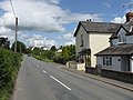
 B4361 Old Street - geograph.org.uk - 984885.jpg 640 × 426; 81 KB
-
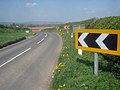 Bend on the B4361 at Nordan - geograph.org.uk - 1290854.jpg 640 × 480; 93 KB
-
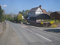 Black and White house at Luston - geograph.org.uk - 1286627.jpg 640 × 477; 56 KB
-
 Broadward Hall - geograph.org.uk - 1764881.jpg 3,456 × 2,592; 3.73 MB
-
 Gravel driveway off the B4361 - geograph.org.uk - 219478.jpg 640 × 480; 132 KB
-
 Junction with the B4361 at The Broad - geograph.org.uk - 1289653.jpg 640 × 472; 124 KB
-

-
 Luston - Old Building By The B4361 - geograph.org.uk - 1401281.jpg 640 × 480; 201 KB
-
 Luston, Herefordshire, by the B4361.jpg 640 × 369; 84 KB
-
 Old Milepost by the B4361, Portway, Orleton parish (geograph 6050990).jpg 851 × 1,276; 244 KB
-

-
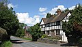
 Richard's Castle - geograph.org.uk - 206153.jpg 640 × 480; 76 KB
-
 Shell Petrol Station - geograph.org.uk - 984828.jpg 640 × 423; 78 KB
-
 Springfield Farm - geograph.org.uk - 1290846.jpg 640 × 480; 113 KB
-
 The B4361 at The Broad - geograph.org.uk - 1290837.jpg 640 × 480; 107 KB
-
 The Old Road - geograph.org.uk - 1200615.jpg 640 × 480; 168 KB
-
 The Rolling English Road - geograph.org.uk - 1746141.jpg 640 × 480; 160 KB
-
 The Windy Roads Of Herefordshire - geograph.org.uk - 743058.jpg 640 × 424; 48 KB
-
 Welcome To Shropshire - geograph.org.uk - 1746128.jpg 640 × 480; 145 KB
-
 B4361 Approaching Quarry Farm - geograph.org.uk - 1401275.jpg 640 × 480; 203 KB
-
 B4361 At Eyton Turning - geograph.org.uk - 1401254.jpg 640 × 480; 191 KB
-
 B4361 At Nordan Hall - geograph.org.uk - 1401274.jpg 640 × 480; 191 KB
-
 B4361 In Luston - geograph.org.uk - 1401278.jpg 640 × 480; 186 KB
-
 B4361 Near Lady Meadow - geograph.org.uk - 1401304.jpg 640 × 480; 199 KB
-
 B4361 Near Rosebank Farm - geograph.org.uk - 1401292.jpg 640 × 480; 207 KB
-
 Cottage By The B4361 - geograph.org.uk - 1401283.jpg 640 × 480; 170 KB
-
 Cottages By The B4361 - geograph.org.uk - 1401272.jpg 640 × 480; 166 KB
-
 Road junction near Orleton on the B4361 - geograph.org.uk - 219480.jpg 640 × 480; 125 KB
-
-
 The Maidenhead. - geograph.org.uk - 53104.jpg 639 × 457; 48 KB


.jpg)


