Category:B3354 road (England)
Jump to navigation
Jump to search

road in England | |||||
| Upload media | |||||
| Instance of |
| ||||
|---|---|---|---|---|---|
| Location | England | ||||
| Transport network |
| ||||
| |||||
Subcategories
This category has only the following subcategory.
C
Media in category "B3354 road (England)"
The following 17 files are in this category, out of 17 total.
-

-

-
-
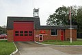 Botley fire station - geograph.org.uk - 279875.jpg 640 × 426; 205 KB
-

-

-
 St Thomas' Church, Fair Oak - geograph.org.uk - 1182762.jpg 640 × 393; 134 KB
-
 Fisher's Pond Road junction - geograph.org.uk - 89923.jpg 640 × 480; 50 KB
-
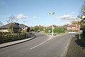
 Principal crossroads in Horton Heath - geograph.org.uk - 747598.jpg 640 × 427; 110 KB
-
 The Pear Tree Pub, Boorley Green - geograph.org.uk - 66118.jpg 640 × 480; 104 KB
-
 Tudor Barn, Winchester Road, Fair Oak - geograph.org.uk - 1162741.jpg 640 × 427; 168 KB
-
 B3354 between Horton Heath and Fairoak - geograph.org.uk - 747657.jpg 640 × 427; 110 KB
-
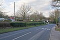
 B3354 through Horton Heath - geograph.org.uk - 747788.jpg 640 × 427; 111 KB
-

-

-
-
 The Lapstone - geograph.org.uk - 147193.jpg 640 × 480; 66 KB


