Category:B2028 road (England)
Jump to navigation
Jump to search

road in England | |||||
| Upload media | |||||
| Instance of |
| ||||
|---|---|---|---|---|---|
| Location | England | ||||
| Transport network |
| ||||
| |||||
Subcategories
This category has the following 4 subcategories, out of 4 total.
Media in category "B2028 road (England)"
The following 24 files are in this category, out of 24 total.
-

-
 Ardings Close - geograph.org.uk - 859648.jpg 479 × 640; 86 KB
-
 B2028 leaving Crawley Down - geograph.org.uk - 1658584.jpg 640 × 428; 126 KB
-

-

-

-

-
 St Richard's Church, Haywards Heath.jpg 2,048 × 1,024; 995 KB
-
 High Street - geograph.org.uk - 859658.jpg 479 × 640; 96 KB
-

-

-

-
 Moor Cottages, on B2028, Surrey - geograph.org.uk - 195593.jpg 640 × 480; 108 KB
-
 Newchapel Road (B2028), Surrey - geograph.org.uk - 210168.jpg 640 × 480; 135 KB
-

-
 Road junction at Stone Cross - geograph.org.uk - 1780610.jpg 1,600 × 1,200; 637 KB
-

-

-
 Selsfield Road - geograph.org.uk - 1260537.jpg 640 × 480; 70 KB
-
 Stubpond Lane - geograph.org.uk - 643091.jpg 640 × 480; 112 KB
-
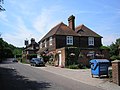 The 'Wheatsheaf', Marsh Green, Kent - geograph.org.uk - 195597.jpg 640 × 480; 90 KB
-
 The B2028 towards Lindfield - geograph.org.uk - 1438861.jpg 640 × 480; 131 KB
-
 The Lodge, Down Park - geograph.org.uk - 225878.jpg 640 × 476; 97 KB
-
 View north on the B2028 - geograph.org.uk - 1780621.jpg 1,600 × 1,200; 555 KB


,_Surrey_-_geograph.org.uk_-_195587.jpg)

,_Surrey_-_geograph.org.uk_-_210168.jpg)
,_Surrey_-_geograph.org.uk_-_211264.jpg)


