Category:B1108 road (England)
Jump to navigation
Jump to search

road in England | |||||
| Upload media | |||||
| Instance of |
| ||||
|---|---|---|---|---|---|
| Location | Norfolk, East of England, England | ||||
| Transport network |
| ||||
| Has part(s) | |||||
 | |||||
Media in category "B1108 road (England)"
The following 49 files are in this category, out of 49 total.
-
 Bond Street - geograph.org.uk - 696589.jpg 480 × 640; 81 KB
-
 Cross Road On The A1065 - geograph.org.uk - 299393.jpg 640 × 480; 68 KB
-
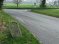
 Old Milestone - geograph.org.uk - 1230365.jpg 480 × 640; 140 KB
-
 Old Milestone - geograph.org.uk - 1230388.jpg 480 × 640; 142 KB
-
 Old Milestone - geograph.org.uk - 1230407.jpg 480 × 640; 127 KB
-
 Old Milestone - geograph.org.uk - 1230446.jpg 480 × 640; 103 KB
-
 Old Milestone - geograph.org.uk - 1230562.jpg 480 × 640; 141 KB
-
 Old Milestone - geograph.org.uk - 1231788.jpg 480 × 640; 99 KB
-
 Old Milestone - geograph.org.uk - 1231816.jpg 480 × 640; 144 KB
-
 Old Milestone - geograph.org.uk - 1231829.jpg 480 × 640; 134 KB
-
 Old Milestone - geograph.org.uk - 1231901.jpg 480 × 640; 120 KB
-
 Old Milestone - geograph.org.uk - 1233065.jpg 480 × 640; 148 KB
-
 Old Milestone - geograph.org.uk - 1233087.jpg 480 × 640; 107 KB
-
 Old Milestone - geograph.org.uk - 1233100.jpg 480 × 640; 130 KB
-
 Old Milestone - geograph.org.uk - 1233125.jpg 480 × 640; 150 KB
-
 Old Milestone - geograph.org.uk - 1779507.jpg 1,200 × 1,600; 500 KB
-
 Steel Water Tower - geograph.org.uk - 1361492.jpg 640 × 480; 66 KB
-
 The B1108 - geograph.org.uk - 278747.jpg 640 × 480; 96 KB
-
 The Road To Hingham - geograph.org.uk - 278298.jpg 640 × 480; 98 KB
-
 Water Tower - geograph.org.uk - 1389560.jpg 480 × 640; 84 KB
-
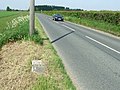
 Watton 0.5 - geograph.org.uk - 1231774.jpg 640 × 480; 77 KB
-
 Watton 1 - geograph.org.uk - 1230354.jpg 640 × 480; 102 KB
-
 Watton 10 - geograph.org.uk - 1231825.jpg 640 × 480; 134 KB
-
 Watton 12 - geograph.org.uk - 1231897.jpg 640 × 480; 96 KB
-
 Watton 14 - geograph.org.uk - 1233119.jpg 640 × 480; 123 KB
-
 Watton 15 - geograph.org.uk - 1779502.jpg 1,600 × 1,200; 898 KB
-
 Watton 17 - geograph.org.uk - 1233095.jpg 640 × 480; 109 KB
-
 Watton 18 - geograph.org.uk - 1233083.jpg 640 × 480; 93 KB
-
 Watton 19 - geograph.org.uk - 1233072.jpg 640 × 480; 114 KB
-
 Watton 2 - geograph.org.uk - 1230380.jpg 640 × 480; 134 KB
-
 Watton 4 - geograph.org.uk - 1230403.jpg 640 × 480; 88 KB
-
 Watton 5 - geograph.org.uk - 1230557.jpg 640 × 480; 131 KB
-
 Watton 6 - geograph.org.uk - 1230442.jpg 640 × 480; 119 KB
-
 Watton 7 - geograph.org.uk - 1231813.jpg 640 × 480; 89 KB
-
 Watton 8 - geograph.org.uk - 1290478.jpg 640 × 480; 111 KB
-
 B1108 junction - geograph.org.uk - 782343.jpg 640 × 480; 71 KB
-
 B1108 through Kimberley - geograph.org.uk - 668396.jpg 480 × 640; 153 KB
-
 Entering Hingham. - geograph.org.uk - 295768.jpg 640 × 480; 70 KB
-
 Entering Watton - geograph.org.uk - 293195.jpg 640 × 480; 112 KB
-
 Gated track - geograph.org.uk - 668345.jpg 480 × 640; 182 KB
-
 Heading south on Church Street - geograph.org.uk - 696577.jpg 640 × 480; 87 KB
-
 Junction With The B1108 - geograph.org.uk - 295716.jpg 640 × 480; 99 KB
-
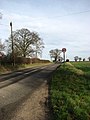
 On The Way To Watton - geograph.org.uk - 293951.jpg 640 × 480; 104 KB
-
 Road, Field, Plantation - geograph.org.uk - 295766.jpg 640 × 480; 89 KB
-
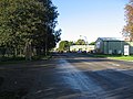
 Suburban Watton. - geograph.org.uk - 293193.jpg 640 × 480; 105 KB
-
 The B1108 - geograph.org.uk - 277393.jpg 640 × 480; 97 KB
-
 The B1108 to Watton - geograph.org.uk - 295969.jpg 640 × 480; 101 KB
-
 The Road To Watton - geograph.org.uk - 278009.jpg 640 × 480; 98 KB
-
 Turn-off to Little Cressingham - geograph.org.uk - 696956.jpg 640 × 480; 78 KB


