Category:Březiněves
Jump to navigation
Jump to search
English: Březiněves is a district in Prague, located north of city centre
neighborhood of Prague 8     | |||||
| Upload media | |||||
| Instance of |
| ||||
|---|---|---|---|---|---|
| Location | Prague 8, Prague, Czechia | ||||
| Head of government |
| ||||
| Headquarters location | |||||
| Legal form | |||||
| Inception |
| ||||
| Population |
| ||||
| Area |
| ||||
 | |||||
Subcategories
This category has the following 6 subcategories, out of 6 total.
Media in category "Březiněves"
The following 17 files are in this category, out of 17 total.
-
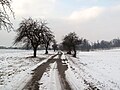
 Březiněves, budova v polích na východě.jpg 5,042 × 3,751; 3.47 MB
-
 Březiněves, zákaz ukládání jakéhokoliv materiálu kromě dřeva pod pokutou.jpg 5,184 × 3,888; 5.38 MB
-
 Cesta mezi Ďáblickou skládkou a Zdibami (2).jpg 4,416 × 3,312; 3.88 MB
-
 Cesta mezi Ďáblickou skládkou a Zdibami.jpg 4,416 × 3,312; 2.97 MB
-
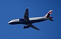 G-EUUE, směr Praha.jpg 3,496 × 2,225; 784 KB
-
 I-ADJK, směr Praha.jpg 3,414 × 2,114; 545 KB
-
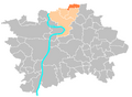 Location map municipal district Prague - Breziněves.PNG 544 × 399; 17 KB
-
 Mezi Ďáblickou skládkou a Zdibami (2).jpg 4,416 × 3,312; 4.04 MB
-
 Mezi Ďáblickou skládkou a Zdibami (5).jpg 4,416 × 3,312; 2.95 MB
-
 Mezi Ďáblickou skládkou a Zdibami (6).jpg 4,416 × 3,312; 2.41 MB
-
 Municipal district Prague Březiněves.png 544 × 399; 14 KB
-
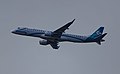
 OK-GFR, směr Praha (01).jpg 4,052 × 2,939; 753 KB
-
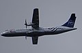 OK-GFR, směr Praha.jpg 3,852 × 2,500; 597 KB
-
 Prague municipal district Březiněves.svg 1,407 × 1,095; 1.42 MB
-
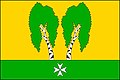 Praha-Březiněves vlajka.jpg 600 × 400; 31 KB
-
 Praha-Březiněves znak.jpg 1,914 × 1,899; 190 KB
-
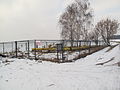
 Soocer Pitch, Prague Březiněves.jpg 2,200 × 1,579; 1.23 MB


.jpg)


.jpg)
.jpg)
.jpg)
.jpg)


