Category:Axholme Joint Railway
Jump to navigation
Jump to search
English:
Main Wikipedia article: Axholme Joint Railway.
section of railway line in the UK  | |||||
| Upload media | |||||
| Instance of |
| ||||
|---|---|---|---|---|---|
| Location |
| ||||
| Terminus |
| ||||
| |||||
Subcategories
This category has the following 3 subcategories, out of 3 total.
F
- Folly Drain Viaduct (10 F)
R
Media in category "Axholme Joint Railway"
The following 57 files are in this category, out of 57 total.
-

-
 Access to the Axholme Line Trail - geograph.org.uk - 1990908.jpg 1,024 × 768; 356 KB
-
 Axholme - Geograph-6261687-by-Marathon.jpg 4,000 × 3,000; 4.94 MB
-

-
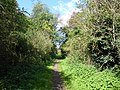
 Axholme Line Trail - geograph.org.uk - 1990901.jpg 1,024 × 768; 359 KB
-
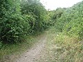
 Axholme Trail looking North - geograph.org.uk - 1987972.jpg 1,024 × 768; 295 KB
-
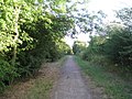
 Axholme Trail looking south - geograph.org.uk - 1987970.jpg 1,024 × 768; 330 KB
-
 Bridge abutment on Akeferry Road - geograph.org.uk - 1990969.jpg 1,024 × 768; 241 KB
-
 Bridge of the former Axholme Joint Railway - geograph.org.uk - 2208846.jpg 1,024 × 768; 201 KB
-
 Bridge over Lordsfolds Lane - geograph.org.uk - 1990962.jpg 1,024 × 768; 335 KB
-
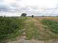
 Bridleway leading to A161 - geograph.org.uk - 1983462.jpg 1,024 × 768; 320 KB
-
 Bridleway on a former railway trackbed - geograph.org.uk - 5606932.jpg 800 × 600; 219 KB
-
 Buried Level Crossing - geograph.org.uk - 334617.jpg 640 × 480; 98 KB
-
 Course of the Axholme Joint Railway - geograph.org.uk - 2533079.jpg 1,024 × 768; 179 KB
-
 Course of the Axholme Light Railway (2) - geograph.org.uk - 1965124.jpg 1,024 × 768; 205 KB
-
 Course of the Axholme Light Railway - geograph.org.uk - 1965118.jpg 1,024 × 768; 205 KB
-
 Crowle Borrow Pits SSSI - geograph.org.uk - 1725202.jpg 640 × 480; 95 KB
-
 DANGER Deep water No swimming - geograph.org.uk - 1164503.jpg 640 × 480; 192 KB
-
 Decorative railing - geograph.org.uk - 1990885.jpg 1,024 × 768; 270 KB
-
 Dismantled railway bridge abutment - geograph.org.uk - 4684703.jpg 800 × 533; 138 KB
-
 Disused Railway Embankment - geograph.org.uk - 170818.jpg 640 × 480; 74 KB
-
 Disused Railway line - geograph.org.uk - 1212973.jpg 640 × 480; 89 KB
-
 Embankment of the Axholme Joint Railway - geograph.org.uk - 2289288.jpg 1,024 × 768; 183 KB
-
 Entrance to bridleway on Jeffrey Lane - geograph.org.uk - 1983457.jpg 1,024 × 768; 141 KB
-
 Farm road, once the route of a railway - geograph.org.uk - 2852187.jpg 1,500 × 843; 1.01 MB
-
 Footpath and Temple Drain - geograph.org.uk - 4668483.jpg 800 × 600; 197 KB
-
 Footpath to Belton - geograph.org.uk - 4783376.jpg 3,776 × 2,520; 3.89 MB
-
 Former Railway Line - geograph.org.uk - 644166.jpg 640 × 480; 83 KB
-
 Haxey Parish Nature Trail - geograph.org.uk - 4780498.jpg 3,776 × 2,520; 3.27 MB
-
 Heading south on the old railway (geograph 6717824).jpg 1,024 × 756; 205 KB
-

-
 Old bridge 28, Akeferry Road, Graizelound - geograph.org.uk - 4681364.jpg 2,971 × 1,725; 4.56 MB
-
 Old rail route, now a farm road - geograph.org.uk - 2851452.jpg 1,500 × 843; 1.26 MB
-
 Railway and Berries - geograph.org.uk - 293551.jpg 640 × 480; 162 KB
-
 Remains of old brick railway arch - geograph.org.uk - 4590645.jpg 2,831 × 1,715; 3.65 MB
-
 Remains of old Isle of Axholme Light Railway embankment - geograph.org.uk - 4681369.jpg 3,072 × 1,728; 3.43 MB
-
 Remains of railway bridge east of Curlews Farm - geograph.org.uk - 4453953.jpg 1,600 × 1,200; 706 KB
-
 Remains of railway bridge, Graizelound - geograph.org.uk - 2310491.jpg 1,280 × 959; 642 KB
-
 Site of a viaduct - geograph.org.uk - 2289371.jpg 1,024 × 768; 163 KB
-
 Temple Drain looking North - geograph.org.uk - 2289246.jpg 1,024 × 768; 253 KB
-
 Temple Drain looking South - geograph.org.uk - 2289242.jpg 1,024 × 768; 267 KB
-
 The Axeholme trail - geograph.org.uk - 2262604.jpg 640 × 467; 154 KB
-
 The Axholme line. - geograph.org.uk - 4114891.jpg 640 × 480; 135 KB
-
 The Axholme line. - geograph.org.uk - 4114896.jpg 640 × 480; 145 KB
-
 The Course of the Axholme Joint Railway - geograph.org.uk - 2208835.jpg 1,024 × 768; 157 KB
-
 The Course of the Axholme Joint Railway - geograph.org.uk - 2289602.jpg 1,024 × 768; 279 KB
-
 The course of the Axholme Joint Railway - geograph.org.uk - 3290277.jpg 1,024 × 768; 207 KB
-
 The Course of the former Axholme Joint Railway - geograph.org.uk - 2217017.jpg 1,024 × 768; 177 KB
-

-
 The last remains of the Crowle 12 Arches - geograph.org.uk - 2289586.jpg 1,024 × 768; 386 KB
-
 The Peatlands Way heading south from Belton - geograph.org.uk - 4455461.jpg 1,600 × 1,200; 738 KB
-
 The remains of the Axholme Joint Railway - geograph.org.uk - 2533112.jpg 1,024 × 768; 206 KB
-
-
 The Trent Valley Way (northern extension) past Church Town - geograph.org.uk - 4783387.jpg 3,776 × 2,520; 4.13 MB
-
 Walking the old tracks - geograph.org.uk - 5613147.jpg 5,376 × 3,024; 4.19 MB
-

-
 Wheat field beside Swinefleet Warping Drain - geograph.org.uk - 3025581.jpg 1,500 × 1,125; 1.26 MB


_-_geograph.org.uk_-_1965124.jpg)


.jpg)


_past_Church_Town_-_geograph.org.uk_-_4783387.jpg)


