Category:Avon Valley Path
Jump to navigation
Jump to search
long-distance footpath in England, UK  | |||||
| Upload media | |||||
| Instance of |
| ||||
|---|---|---|---|---|---|
| Location |
| ||||
| Connects with | |||||
| Length |
| ||||
| Terminus | |||||
 | |||||
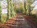
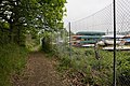
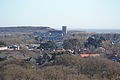
The Avon Valley Path is a long-distance path in the English counties of Wiltshire, Hampshire and (for about 2½ miles) Dorset. At one end is Salisbury Cathedral and at the other is Wimborne Priory.
Media in category "Avon Valley Path"
The following 53 files are in this category, out of 53 total.
-
 Avon Valley Path - geograph.org.uk - 1148562.jpg 640 × 427; 82 KB
-
 Avon Valley Path - geograph.org.uk - 1148576.jpg 640 × 427; 134 KB
-
 Avon Valley Path - geograph.org.uk - 1148873.jpg 640 × 427; 70 KB
-
 Avon Valley Path - geograph.org.uk - 1524324.jpg 640 × 427; 195 KB
-
 Avon Valley Path - geograph.org.uk - 21815.jpg 640 × 481; 158 KB
-
 Avon Valley Path - geograph.org.uk - 75312.jpg 640 × 481; 118 KB
-
 Avon Valley Path - geograph.org.uk - 75313.jpg 640 × 481; 89 KB
-

-
 Avon Valley Path approaching Downton - geograph.org.uk - 1524317.jpg 640 × 427; 181 KB
-
 Avon Valley Path approaching Downton - geograph.org.uk - 630767.jpg 559 × 640; 55 KB
-
 Avon Valley Path at Ibsley Bridge - geograph.org.uk - 1654907.jpg 426 × 640; 78 KB
-
 Avon Valley Path Map.png 600 × 3,108; 370 KB
-
 Avon Valley Path near Avon - geograph.org.uk - 1190645.jpg 640 × 481; 172 KB
-
 Avon Valley Path near Avon - geograph.org.uk - 1190657.jpg 640 × 480; 140 KB
-
-
 Avon Valley Path near Harnham - geograph.org.uk - 403958.jpg 640 × 480; 118 KB
-
 Avon Valley Path near Nunton - geograph.org.uk - 1170212.jpg 640 × 480; 228 KB
-
-
 Avon Valley Path, Avon - geograph.org.uk - 1188567.jpg 640 × 480; 204 KB
-
 Avon Valley Path, Avon - geograph.org.uk - 1188572.jpg 640 × 481; 168 KB
-
 Avon Valley Path, Bisterne - geograph.org.uk - 1188231.jpg 640 × 481; 179 KB
-
 Avon Valley Path, Bisterne - geograph.org.uk - 1188242.jpg 640 × 480; 237 KB
-
 Avon Valley Path, Downton - geograph.org.uk - 871426.jpg 640 × 464; 102 KB
-
 Avon Valley Path, north of Downton - geograph.org.uk - 312560.jpg 640 × 480; 104 KB
-
 Avon Valley Path, Sopley - geograph.org.uk - 1354577.jpg 480 × 640; 199 KB
-
 Avon Valley Path, Sopley - geograph.org.uk - 1354662.jpg 640 × 481; 172 KB
-
 Avon Valley Path, Woodgreen - geograph.org.uk - 1014546.jpg 640 × 480; 73 KB
-
 Avon Valley Path, Woodgreen - geograph.org.uk - 1014575.jpg 640 × 480; 81 KB
-
 Bluebells on the Avon Valley Path - geograph.org.uk - 1524358.jpg 640 × 427; 216 KB
-
 Burton, Avon Valley Path - geograph.org.uk - 1214232.jpg 480 × 640; 112 KB
-
 Burton, Avon Valley Path - geograph.org.uk - 1214261.jpg 640 × 480; 145 KB
-
 Christchurch Priory from St Catherine's Hill.JPG 4,608 × 3,072; 5.07 MB
-
 Dogdean Farm - geograph.org.uk - 1148600.jpg 640 × 427; 112 KB
-
 Ebble floodplain - geograph.org.uk - 1075378.jpg 640 × 427; 117 KB
-
 House on Whitesbury Road - geograph.org.uk - 1148609.jpg 640 × 427; 100 KB
-
 Isle of Wight seen from St Catherine's Hill.JPG 4,608 × 3,072; 5.01 MB
-
 Kissing gate near Charlton all Saints - geograph.org.uk - 871458.jpg 640 × 480; 132 KB
-
 Kissing gate near Charlton all Saints - geograph.org.uk - 871620.jpg 640 × 480; 113 KB
-
 Mind where you walk - geograph.org.uk - 1525674.jpg 640 × 426; 210 KB
-
 Pasture on the Avon Valley Path - geograph.org.uk - 1524338.jpg 640 × 427; 184 KB
-

-
 Seat, Harnham - geograph.org.uk - 1170186.jpg 640 × 480; 183 KB
-
 Sign for the Avon Valley Path - geograph.org.uk - 403962.jpg 640 × 480; 118 KB
-
 St Catherine's Hill, Dorset, seen from the Avon Valley..JPG 4,608 × 3,072; 6.28 MB
-
 Steps and gate, Downton - geograph.org.uk - 1281464.jpg 480 × 640; 253 KB
-
 Stile near Nunton - geograph.org.uk - 1170209.jpg 640 × 480; 167 KB
-

-

-
 Avon Valley Path at Ibsley - geograph.org.uk - 320262.jpg 640 × 480; 101 KB
-
 Avon Valley Path east of Downton - geograph.org.uk - 630776.jpg 427 × 640; 47 KB
-
 Avon Valley Path near Harbridge - geograph.org.uk - 320250.jpg 640 × 480; 170 KB
-
 Avon Valley Path towards Charlton - geograph.org.uk - 177738.jpg 480 × 640; 176 KB
-
 The Avon Valley Path at Rockford - geograph.org.uk - 705251.jpg 480 × 640; 134 KB


