Category:Avervoorde, De Vecht
Jump to navigation
Jump to search
| Object location | | View all coordinates using: OpenStreetMap |
|---|
 | |||||
| Upload media | |||||
| Instance of | |||||
|---|---|---|---|---|---|
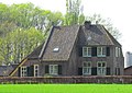
| Location | Terwolde, Voorst, Gelderland, Netherlands | ||||
| Street address |
| ||||
| Heritage designation |
| ||||
 | |||||
|
This is a category about rijksmonument number 38097
|
| Address |
|
Media in category "Avervoorde, De Vecht"
The following 3 files are in this category, out of 3 total.
-
 Avervoorde, aanzicht - Vecht, De - 20238719 - RCE.jpg 1,200 × 807; 207 KB
-
 Avervoorde.jpg 2,221 × 1,564; 935 KB
-
 Exterieur OVERZICHT VOORGEVELS, RECHTER ZIJGEVEL - De Vecht - 20339788 - RCE.jpg 1,190 × 1,200; 365 KB

