Category:Auvergne-Rhône-Alpes photographs taken on 2022-01-04
Jump to navigation
Jump to search
Administrative regions and territorial collectivity of Metropolitan France (‡ since start of 2016):
Auvergne-Rhône-Alpes‡ · Île-de-France
Auvergne-Rhône-Alpes‡ · Île-de-France
| 28 | · | 29 | · | 30 | · | 31 | · | 1 | · | 2 | · | 3 | · | 4 | · | 5 | · | 6 | · | 7 | · | 8 | · | 9 | · | 10 | · | 11 |

Auvergne-Rhône-Alpes photographs taken on January 4, 2022.
Files or subcategories can be added here using a direct categorization tag. Image files can be categorized here also automatically using {{Taken on}} template.
Media in category "Auvergne-Rhône-Alpes photographs taken on 2022-01-04"
The following 35 files are in this category, out of 35 total.
-
 Allée d'accès au Château de Vernange en janvier 2022 (2).jpg 2,906 × 3,875; 7.36 MB
-
 Allée d'accès au Château de Vernange en janvier 2022.jpg 1,291 × 2,159; 2.51 MB
-
 Boîte à livres à la salle polyvalente d'Ambérieux-en-Dombes.jpg 2,736 × 3,360; 5.61 MB
-
 Champs à Savigneux (Ain) en janvier 2022 (2).jpg 4,032 × 3,024; 7.11 MB
-
 Champs à Savigneux (Ain) en janvier 2022 (3).jpg 4,032 × 3,024; 7.18 MB
-
 Champs à Savigneux (Ain) en janvier 2022.jpg 4,032 × 3,024; 8.76 MB
-
 Chantier Nenupharia à Ambérieux-en-Dombes en janvier 2022 (2).jpg 1,872 × 4,000; 3.53 MB
-
 Chantier Nenupharia à Ambérieux-en-Dombes en janvier 2022.jpg 2,888 × 2,661; 3.44 MB
-
 Château de Vernange - janvier 2022.jpg 3,558 × 2,833; 5.2 MB
-
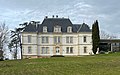 Château de Vernange en janvier 2022.jpg 3,366 × 2,112; 4.08 MB
-
 Château de Vernange à Saint-André-de-Corcy en janvier 2022.jpg 3,581 × 2,508; 7.07 MB
-
 Cime de Caron signpost.jpg 3,791 × 5,702; 7.36 MB
-
 Downhill view of Plan de l'eau, Les Menuires.jpg 5,229 × 3,476; 11.28 MB
-
 Entering Val Thorens on the Traversée de Montaulever slope.jpg 6,016 × 4,000; 9.79 MB
-
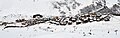 Grand Reberty and Les Bruyères from the Paturages slope at 2300 m, Les Menuires.jpg 5,400 × 1,721; 4.67 MB
-
 Lac du Lou from the terrace of the refuge.jpg 5,858 × 3,895; 10.04 MB
-
 Lac du Lou outlet.jpg 6,016 × 4,000; 8.95 MB
-
 Les Bruyères from Mellifera, Les Menuires.jpg 5,918 × 3,935; 7.43 MB
-
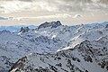 Mont Thabor and Pic de Thabor seen from Cime de Caron.jpg 6,016 × 4,000; 11.7 MB
-
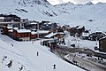
 Overview of Les Menuires from above Plan de l'eau.jpg 5,452 × 3,625; 12.12 MB
-
 Plan Bouchet, Orelle.jpg 5,427 × 3,609; 7.91 MB
-
 Plan de l'eau des Bruyères, Les Belleville 1.jpg 6,016 × 4,000; 9.95 MB
-
 Plan de l'eau des Bruyères, Les Belleville 2.jpg 6,016 × 4,000; 10.5 MB
-
 Refuge du Lac du Lou façade.jpg 6,016 × 4,000; 13.22 MB
-
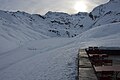
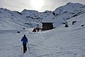 Refuge du Lac du Lou on the ascent.jpg 5,670 × 3,770; 9.24 MB
-
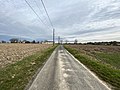 Route de campagne à Savigneux (Ain) en janvier 2022.jpg 4,032 × 3,024; 7.01 MB
-
 Salle polyvalente d'Ambérieux-en-Dombes en janvier 2022 (2).jpg 4,032 × 3,024; 7.27 MB
-
 Salle polyvalente d'Ambérieux-en-Dombes en janvier 2022 (3).jpg 3,024 × 4,032; 7.64 MB
-
 Salle polyvalente d'Ambérieux-en-Dombes en janvier 2022.jpg 4,032 × 3,024; 7.39 MB
-
 Tarte aux myrtilles, Refuge du Lac du Lou, Les Belleville.jpg 5,332 × 3,545; 9.06 MB
-
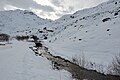
 Torrent du Lou, Les Belleville, in winter.jpg 6,016 × 4,000; 11.23 MB
-
 Val Thorens ski resort map.jpg 5,677 × 3,774; 8.83 MB
-
 Val Thorens welcome sign.jpg 5,919 × 3,935; 8.68 MB
-
 View of Val Thorens from Cime de Caron.jpg 5,796 × 3,854; 9.94 MB
-
 Vue lointaine du Château de Vernange.jpg 3,344 × 2,558; 7.83 MB
.jpg)


_en_janvier_2022_(2).jpg)
_en_janvier_2022_(3).jpg)
_en_janvier_2022.jpg)
.jpg)


_en_janvier_2022.jpg)
.jpg)
.jpg)


