Category:Auvergne-Rhône-Alpes photographs taken on 2018-04-30
Jump to navigation
Jump to search
Administrative regions and territorial collectivity of Metropolitan France (‡ since start of 2016):
Auvergne-Rhône-Alpes‡ · Occitania‡
Auvergne-Rhône-Alpes‡ · Occitania‡
| 23 | · | 24 | · | 25 | · | 26 | · | 27 | · | 28 | · | 29 | · | 30 | · | 1 | · | 2 | · | 3 | · | 4 | · | 5 | · | 6 | · | 7 |

Auvergne-Rhône-Alpes photographs taken on April 30, 2018.
Files or subcategories can be added here using a direct categorization tag. Image files can be categorized here also automatically using {{Taken on}} template.
Media in category "Auvergne-Rhône-Alpes photographs taken on 2018-04-30"
The following 37 files are in this category, out of 37 total.
-
 Clos Champs St Cyr Menthon 5.jpg 5,184 × 3,456; 7.3 MB
-
 Clos Champs St Cyr Menthon 6.jpg 5,184 × 3,456; 6.38 MB
-
 Clos Champs St Cyr Menthon 7.jpg 5,184 × 3,456; 7.63 MB
-
 Clos Champs St Cyr Menthon 8.jpg 5,184 × 3,456; 8.74 MB
-
 Lamberet St Cyr Menthon 5.jpg 5,184 × 3,456; 7.13 MB
-
 Lamberet St Cyr Menthon 6.jpg 5,184 × 3,456; 6.94 MB
-
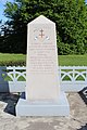
 Monument résistants Teppes St Cyr Menthon 10.jpg 3,456 × 5,184; 7.53 MB
-
 Monument résistants Teppes St Cyr Menthon 11.jpg 5,184 × 3,456; 7.86 MB
-
 Monument résistants Teppes St Cyr Menthon 12.jpg 3,456 × 5,184; 8.28 MB
-
 Monument résistants Teppes St Cyr Menthon 13.jpg 5,184 × 3,456; 6.25 MB
-
 Monument résistants Teppes St Cyr Menthon 14.jpg 5,184 × 3,456; 5.9 MB
-
 Monument résistants Teppes St Cyr Menthon 9.jpg 3,456 × 5,184; 7.35 MB
-
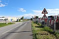
 Panneau A13a Route Vonnas St Cyr Menthon 1.jpg 5,184 × 3,456; 5.48 MB
-
 Panneau A13a Route Vonnas St Cyr Menthon 2.jpg 5,184 × 3,456; 8.45 MB
-
 Panneau A13a Route Vonnas St Cyr Menthon 3.jpg 3,456 × 5,184; 9.2 MB
-
 Panneau A13a Route Vonnas St Cyr Menthon 4.jpg 5,184 × 3,456; 5.46 MB
-
 Panneau A13a Route Vonnas St Cyr Menthon 5.jpg 5,184 × 3,456; 8.66 MB
-
 Panneaux A13a A14 AB2 Route Vonnas St Cyr Menthon 1.jpg 5,184 × 3,456; 6.76 MB
-
 Panneaux A13a A14 AB2 Route Vonnas St Cyr Menthon 2.jpg 5,184 × 3,456; 8.2 MB
-
 Plaque clos Champs St Cyr Menthon 4.jpg 5,184 × 3,456; 4.92 MB
-
 Plaque clos Champs St Cyr Menthon 5.jpg 5,184 × 3,456; 4.9 MB
-
 Plaque clos Champs St Cyr Menthon 6.jpg 5,184 × 3,456; 6.06 MB
-
 Pré près Route Gambys St Cyr Menthon 1.jpg 5,184 × 3,456; 9.46 MB
-
 Pré près Route Gambys St Cyr Menthon 2.jpg 5,184 × 3,456; 10.33 MB
-
 Pré près Route Gambys St Cyr Menthon 3.jpg 5,184 × 3,456; 8.06 MB
-
 Radar pédagogique Route Vonnas St Cyr Menthon 1.jpg 3,456 × 5,184; 6.18 MB
-
 Radar pédagogique Route Vonnas St Cyr Menthon 2.jpg 5,184 × 3,456; 8.25 MB
-
 Radar pédagogique Route Vonnas St Cyr Menthon 3.jpg 5,184 × 3,456; 4.2 MB
-
 Radar pédagogique Route Vonnas St Cyr Menthon 4.jpg 5,184 × 3,456; 5.13 MB
-
 Radar pédagogique Route Vonnas St Cyr Menthon 5.jpg 5,184 × 3,456; 7.81 MB
-
 Radar pédagogique Route Vonnas St Cyr Menthon 6.jpg 3,456 × 5,184; 5.98 MB
-
 Route D80 Vonnas St Cyr Menthon 10.jpg 5,184 × 3,456; 9.55 MB
-
 Route D80 Vonnas St Cyr Menthon 12.jpg 5,184 × 3,456; 8.63 MB
-
 Route D80 Vonnas St Cyr Menthon 13.jpg 5,184 × 3,456; 10.08 MB
-
 Route D80 Vonnas St Cyr Menthon 14.jpg 5,184 × 3,456; 6.78 MB
-
 Route D80 Vonnas St Cyr Menthon 15.jpg 5,184 × 3,456; 7.65 MB
-
 Route D80 Vonnas St Cyr Menthon 16.jpg 5,184 × 3,456; 9.85 MB


