Category:Auvergne-Rhône-Alpes photographs taken on 2011-11-23
Jump to navigation
Jump to search
Administrative regions and territorial collectivity of Metropolitan France (‡ since start of 2016):
Auvergne-Rhône-Alpes‡
Auvergne-Rhône-Alpes‡
| 16 | · | 17 | · | 18 | · | 19 | · | 20 | · | 21 | · | 22 | · | 23 | · | 24 | · | 25 | · | 26 | · | 27 | · | 28 | · | 29 | · | 30 |

Auvergne-Rhône-Alpes photographs taken on November 23, 2011.
Files or subcategories can be added here using a direct categorization tag. Image files can be categorized here also automatically using {{Taken on}} template.
Media in category "Auvergne-Rhône-Alpes photographs taken on 2011-11-23"
The following 60 files are in this category, out of 60 total.
-
 Plaque Allée Belin St Cyr Menthon 2011-11-23.jpg 2,048 × 1,536; 913 KB
-
 Plaque Allée Bois St Cyr Menthon 2011-11-23.jpg 2,048 × 1,536; 1.69 MB
-
 Plaque Allée Buchet St Cyr Menthon 2011-11-23.jpg 2,048 × 1,536; 568 KB
-
 Plaque Allée Chevaudières St Cyr Menthon 2011-11-23.jpg 2,048 × 1,536; 1.06 MB
-
 Plaque Allée Cours St Cyr Menthon 2011-11-23.jpg 2,048 × 1,536; 909 KB
-
 Plaque Allée Feuilles St Cyr Menthon 2011-11-23.jpg 2,048 × 1,536; 1.65 MB
-
 Plaque Allée Lamartine St Cyr Menthon 2011-11-23.jpg 2,048 × 1,536; 1.39 MB
-
 Plaque Allée Milandes St Cyr Menthon 2011-11-23.jpg 2,048 × 1,536; 884 KB
-
 Plaque Allée Moiroud St Cyr Menthon 2011-11-23.jpg 2,048 × 1,536; 1.06 MB
-
 Plaque Allée Pelou St Cyr Menthon 2011-11-23.jpg 2,048 × 1,536; 594 KB
-
 Plaque Allée Poype St Cyr Menthon 2011-11-23.jpg 2,048 × 1,536; 1.36 MB
-
 Plaque Allée Pré Molard St Cyr Menthon 2011-11-23.jpg 2,048 × 1,536; 1.02 MB
-
 Plaque Allée Rimbaud St Cyr Menthon 2011-11-23.jpg 2,048 × 1,536; 1.04 MB
-
 Plaque Allée Ronjon St Cyr Menthon 2011-11-23.jpg 2,048 × 1,536; 1.12 MB
-
 Plaque Allée Serve St Vincent St Cyr Menthon 2011-11-23.jpg 2,048 × 1,536; 1.02 MB
-
 Plaque Allée Trois Poiriers St Cyr Menthon 2011-11-23.jpg 2,048 × 1,536; 825 KB
-
 Plaque Allée Verdet St Cyr Menthon 2011-11-23.jpg 2,048 × 1,536; 410 KB
-
 Plaque Chemin Chapelle St Cyr Menthon 2011-11-23.jpg 2,048 × 1,536; 672 KB
-
 Plaque Chemin Montépin St Cyr Menthon 2011-11-23.jpg 2,048 × 1,536; 1.99 MB
-
 Plaque Chemin Pré Mort St Cyr Menthon 2011-11-23.jpg 2,048 × 1,536; 297 KB
-
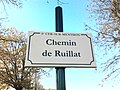 Plaque Chemin Ruillat St Cyr Menthon 2011-11-23.jpg 2,048 × 1,536; 1.64 MB
-
 Plaque Clos Boutaron St Cyr Menthon 2011-11-23.jpg 2,048 × 1,536; 1.04 MB
-
 Plaque Clos Champs St Cyr Menthon 2011-11-23.jpg 2,048 × 1,536; 915 KB
-
 Plaque Clos Lavoir St Cyr Menthon 2011-11-23.jpg 2,048 × 1,536; 1.1 MB
-
 Plaque Clos Moulin St Cyr Menthon 2011-11-23.jpg 2,048 × 1,536; 754 KB
-
 Plaque Clos Village St Cyr Menthon 2011-11-23.jpg 2,048 × 1,536; 1.07 MB
-
 Plaque Passage Tennis St Cyr Menthon 2011-11-23.jpg 2,048 × 1,536; 293 KB
-
 Plaque Passage Écoles St Cyr Menthon 2011-11-23.jpg 2,048 × 1,536; 1.35 MB
-
 Plaque Place Cimetière St Cyr Menthon 2011-11-23.jpg 2,048 × 1,536; 578 KB
-
 Plaque Place Mairie St Cyr Menthon 2011-11-23.jpg 2,048 × 1,536; 466 KB
-
 Plaque Place Église St Cyr Menthon 2011-11-23.jpg 2,048 × 1,536; 916 KB
-
 Plaque Route Bourbouillon St Cyr Menthon 2011-11-23.jpg 2,048 × 1,536; 1.01 MB
-
 Plaque Route Bourg St Cyr Menthon 2011-11-23.jpg 2,048 × 1,536; 1.43 MB
-
 Plaque Route Château Eau St Cyr Menthon 2011-11-23.jpg 2,048 × 1,536; 1.45 MB
-
 Plaque Route Cordonnier St Cyr Menthon 2011-11-23.jpg 2,048 × 1,536; 874 KB
-
 Plaque Route Gréziat St Cyr Menthon 2011-11-23.jpg 2,048 × 1,536; 1.19 MB
-
 Plaque Route Guillemières St Cyr Menthon 2011-11-23.jpg 2,048 × 1,536; 1.35 MB
-
 Plaque Route Lingent St Cyr Menthon 2011-11-23.jpg 2,048 × 1,536; 1.8 MB
-
 Plaque Route Mulatière St Cyr Menthon 2011-11-23.jpg 2,048 × 1,536; 1.37 MB
-
 Plaque Route Mâcon St Cyr Menthon 2011-11-23.jpg 2,048 × 1,536; 373 KB
-
 Plaque Route Tuilerie St Cyr Menthon 2011-11-23.jpg 2,048 × 1,536; 1.21 MB
-
 Plaque Rue Centre St Cyr Menthon 2011-11-23.jpg 2,048 × 1,536; 585 KB
-
 Plaque Sentier Branguemouille St Cyr Menthon 2011-11-23.jpg 2,048 × 1,536; 747 KB
-
 Plaque Sentier Naiman St Cyr Menthon 2011-11-23.jpg 2,048 × 1,536; 1.05 MB
-
 Plaque Sentier Étang Turche St Cyr Menthon 2011-11-23.jpg 2,048 × 1,536; 1.07 MB
-
 Plaques Route Bourbouillon Route Gréziat St Cyr Menthon 2011-11-23.jpg 2,048 × 1,536; 443 KB
-
 Plaques Route Bâgé Chemin Pavillon St Cyr Menthon 2011-11-23.jpg 2,048 × 1,536; 2.12 MB
-
 Plaques Route Bâgé Route Gréziat St Cyr Menthon 2011-11-23.jpg 2,048 × 1,536; 1.96 MB
-
 Plaques Route Bâgé Sentier Branguemouille St Cyr Menthon 2011-11-23.jpg 2,048 × 1,536; 1.83 MB
-
 Plaques Route Château Eau Route Lévrières St Cyr Menthon 2011-11-23.jpg 2,048 × 1,536; 1.65 MB
-
 Plaques Route Château Eau Route Teppe Nayet St Cyr Menthon 2011-11-23.jpg 2,048 × 1,536; 1.09 MB
-
 Plaques Route Chêne Route Deschamps St Cyr Menthon 2011-11-23.jpg 2,048 × 1,536; 382 KB
-
 Plaques Route Communaux Route Lys St Cyr Menthon 2011-11-23.jpg 2,048 × 1,536; 602 KB
-
 Plaques Route Cormorey Route Verchères St Cyr Menthon 2011-11-23.jpg 2,048 × 1,536; 1.22 MB
-
 Plaques Route Couardes Route Ripettes St Cyr Menthon 2011-11-23.jpg 2,048 × 1,536; 2.08 MB
-
 Plaques Route Croix Clos Colline St Cyr Menthon 2011-11-23.jpg 2,048 × 1,536; 533 KB
-
 Plaques Route Lingent Route Couardes St Cyr Menthon 2011-11-23.jpg 2,048 × 1,536; 783 KB
-
 Plaques Route Motte Castrale Route Bécalet St Cyr Menthon 2011-11-23.jpg 2,048 × 1,536; 1.1 MB
-
 Plaques Route Mâcon Route Bâgé St Cyr Menthon 2011-11-23.jpg 2,048 × 1,536; 558 KB
-
 Plaques Route Petit Meumain Route Thibaudes St Cyr Menthon 2011-11-23.jpg 2,048 × 1,536; 820 KB


