Category:Australia photographs taken on 2018-05-01
Jump to navigation
Jump to search

Media in category "Australia photographs taken on 2018-05-01"
The following 178 files are in this category, out of 178 total.
-
 Alley Family Graves, 2018.jpg 1,920 × 1,080; 478 KB
-
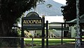
 Aloomba State School, Aloomba, 2018 01.jpg 1,920 × 1,080; 475 KB
-
 Aloomba State School, Aloomba, 2018 02.jpg 1,920 × 1,080; 483 KB
-
 Babinda Public Library, 2018.jpg 1,920 × 1,080; 485 KB
-
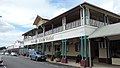 Babinda State Hotel, 2018.jpg 1,920 × 1,080; 488 KB
-
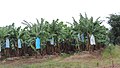
 Banana farming along Woopen Creek Road, Woopen Creek, 2018.jpg 1,920 × 1,080; 481 KB
-
 Banana farming, Waugh Pocket, 2018.jpg 1,920 × 1,080; 488 KB
-
 Banana farming, Woopen Creek Road, Woopen Creek, 2018.jpg 1,920 × 1,080; 484 KB
-
 Banana farming, Woopen Creek, 2018.jpg 1,920 × 1,080; 490 KB
-
 Bananas growing, Woopen Creek Road, Woopen Creek, 2108.jpg 1,080 × 1,920; 493 KB
-
 Bellenden Ker Memorial Hall (opened 1936), 2018.jpg 1,920 × 1,080; 483 KB
-
 Bellenden Ker State School, 2018.jpg 1,920 × 1,080; 486 KB
-
 Boat ramp at Russell River, Bellenden Ker, 2018 01.jpg 1,920 × 1,080; 487 KB
-
 Boat ramp at Russell River, Bellenden Ker, 2018 02.jpg 1,920 × 1,080; 478 KB
-
 Boat ramp into the Russell River, Ross Road, Deeral, 2018.jpg 1,920 × 1,080; 488 KB
-
 Brim, Victoria, Australia.jpg 4,032 × 3,024; 2.58 MB
-
 Bruce Highway crosses a bridge over Fishery Creek, Fishery Falls, 2018 01.jpg 1,920 × 1,080; 484 KB
-
 Bruce Highway crosses a bridge over Fishery Creek, Fishery Falls, 2018 02.jpg 1,920 × 1,080; 470 KB
-
 Bruce Highway passing through Mirriwinni, 2018.jpg 1,920 × 1,080; 482 KB
-
 Canal Creek, flowing through Ngatjan to Waugh Pocket, 2018.jpg 1,920 × 1,080; 468 KB
-

-
 Corner of Mill and Munro Stret with low cloud overhead, Babinda, 2018.jpg 1,920 × 1,080; 492 KB
-
 Creek at Bramston Beach, 2018.jpg 1,920 × 1,080; 488 KB
-
 Creek mouth at Rocky Point on Bramston Beach, 2018.jpg 1,920 × 1,080; 485 KB
-
 Creek mouth at Rocky Point, Bramston Beach, 2018.jpg 1,920 × 1,080; 486 KB
-
 Crocodile warning sign, Bramston Beach, 2018.jpg 1,920 × 1,080; 488 KB
-
 Crocodile warning sign, Russell River at Bellenden Ker, 2018.jpg 1,920 × 1,080; 477 KB
-
 Crossing the Russell River (Babinda foreground, East Russell background), 2018.jpg 1,920 × 1,080; 466 KB
-
 Dense residential garden, Fishery Falls township, 2018.jpg 1,920 × 1,080; 470 KB
-
 Driving the Gillies Highway through Lamb Range, 2018 01.jpg 1,920 × 1,080; 482 KB
-
 Driving the Gillies Highway through Lamb Range, 2018 02.jpg 1,920 × 1,080; 475 KB
-
 Driving the Gillies Highway through Lamb Range, 2018 03.jpg 1,920 × 1,080; 450 KB
-
 Electrical tower, Stewart Road, Fishery Falls, 2018 01.jpg 1,920 × 1,080; 489 KB
-
 Electrical tower, Stewart Road, Fishery Falls, 2018 02.jpg 1,920 × 1,080; 488 KB
-

-
 Eubenangee Swamp National Park, 2018.jpg 1,920 × 1,080; 475 KB
-
 Farm buildings, Waugh Pocket, 2018.jpg 1,920 × 1,080; 484 KB
-
 Farm machinery, Fishery Falls, 2018.jpg 1,920 × 1,080; 468 KB
-
 Farm on Little Mulgrave Road, Little Mulgrave, 2018 01.jpg 1,920 × 1,080; 495 KB
-
 Farm on Little Mulgrave Road, Little Mulgrave, 2018 02.jpg 1,920 × 1,080; 480 KB
-
 Farm with Bellenden Ker Range in the background, Deeral, 2018.jpg 1,920 × 1,080; 476 KB
-
 Farming, Deeral, 2018.jpg 1,920 × 1,080; 480 KB
-
 Fences and paddocks on Kruckow Road, East Russell, 2018.jpg 1,920 × 1,080; 477 KB
-
 Fences and paddocks, Kuckow Road, East Russell, 2018.jpg 1,920 × 1,080; 486 KB
-
 Fishery Falls Hotel, Bruce Highway, Fishery Falls, 2018.jpg 1,920 × 1,080; 487 KB
-
 Fishery Falls township along the Bruce Highway, 2018.jpg 1,920 × 1,080; 486 KB
-
 Foreshore park at Bramston Beach, 2018.jpg 1,920 × 1,080; 479 KB
-
 Foreshore park, Bramston Beach, 2018.jpg 1,080 × 1,920; 467 KB
-
 Gillies Range Road (aka Gillies Highway) in Lamb Range, 2018 01.jpg 1,920 × 1,080; 474 KB
-
 Gillies Range Road (aka Gillies Highway) in Lamb Range, 2018 02.jpg 1,080 × 1,920; 478 KB
-
 Gillies Range Road (aka Gillies Highway), Lamb Range, 2018.jpg 1,920 × 1,080; 481 KB
-

-
 Grazing land and banana fields, Waugh Pocket, 2018.jpg 1,920 × 1,080; 491 KB
-
 Harvey Creek Road crossing of the North Coast line, Bellenden Ker, 2018.jpg 1,920 × 1,080; 485 KB
-

-

-
 Headstone for Mary Ellen Alley, Alley Family Graves, 2018.jpg 1,080 × 1,920; 482 KB
-
 Headstone for Mary Ellen Alley, Alley Family Graves, Gordonvale, 2018.jpg 1,080 × 1,920; 483 KB
-
 Headstone for Sarah Blackwell and George Gorham Alley, Alley Family Graves, 2018 01.jpg 1,080 × 1,920; 485 KB
-
 Headstone for Sarah Blackwell and George Gorham Alley, Alley Family Graves, 2018 02.jpg 1,080 × 1,920; 495 KB
-
 Headstone for Sarah Blackwell and George Gorham Alley, Alley Family Graves, 2018 03.jpg 1,920 × 1,080; 488 KB
-
 Houses, Ingot Close, Goldsborough, 2018.jpg 1,920 × 1,080; 472 KB
-
 Josephine Falls carpark, Wooroonooran National Park, Wooroonooran, 2018.jpg 1,080 × 1,920; 459 KB
-
 Landscape from the Gillies Highway, Lamb Range, 2018.jpg 1,920 × 1,080; 478 KB
-
 Landscape, Woopen Creek, 2018.jpg 1,080 × 1,920; 493 KB
-
 Looking across farmland from Little Mulgrave Road, Little Mulgrave, 2018 01.jpg 1,920 × 1,080; 498 KB
-
 Looking across farmland from Little Mulgrave Road, Little Mulgrave, 2018 02.jpg 1,920 × 1,080; 479 KB
-
 Looking across farmland from Little Mulgrave Road, Little Mulgrave, 2018 03.jpg 1,920 × 1,080; 486 KB
-
 Looking across sugarcane fields towards cloudy mountains, Little Mulgrave, 2018.jpg 1,920 × 1,080; 496 KB
-
 Looking back along Bellenden Ker Road from the school, Bellenden Ker, 2018.jpg 1,920 × 1,080; 481 KB
-

-

-

-
 Looking east along Bennett Road, Aloomba, 2018 01.jpg 1,920 × 1,080; 481 KB
-
 Looking east along Bennett Road, Aloomba, 2018 02.jpg 1,920 × 1,080; 486 KB
-
 Looking east along Cartwright Road, Eubenangee, 2018.jpg 1,920 × 1,080; 486 KB
-
 Looking east from Ingot Close, Goldsborough, 2018.jpg 1,920 × 1,080; 479 KB
-
 Looking east on Ghidella Road, Mirriwinni, 2018.jpg 1,920 × 1,080; 475 KB
-
 Looking east on Greer Road, Mirriwinni, 2018.jpg 1,920 × 1,080; 493 KB
-
 Looking north along Bramston Beach Road, Bramston Beach, 2018.jpg 1,920 × 1,080; 484 KB
-
 Looking north along the Alice River, Eubenangee, 2018 01.jpg 1,920 × 1,080; 477 KB
-
 Looking north along the Alice River, Eubenangee, 2018 02.jpg 1,080 × 1,920; 453 KB
-
 Looking north along the beach at Bramston Beach, 2018.jpg 1,920 × 1,080; 490 KB
-
 Looking north along the beach, Bramston Beach, 2018.jpg 1,920 × 1,080; 486 KB
-

-
 Looking north over fields from Cartwright Road, Eubenangee, 2018.jpg 1,920 × 1,080; 488 KB
-
 Looking north-east along Buckland Road, Mirriwinni, 2018.jpg 1,920 × 1,080; 494 KB
-

-
 Looking south along Bramston Beach Road, Bramston Beach, 2018.jpg 1,920 × 1,080; 479 KB
-
 Looking south along the beach from the esplanade, Bramston Beach, 2018 01.jpg 1,920 × 1,080; 485 KB
-
 Looking south along the beach from the esplanade, Bramston Beach, 2018 02.jpg 1,920 × 1,080; 486 KB
-
 Looking south along the beach from the esplanade, Bramston Beach, 2018 03.jpg 1,920 × 1,080; 485 KB
-
 Looking south down Evans Road, Bramston Beach, 2018.jpg 1,920 × 1,080; 487 KB
-
 Looking south down Petersen Street, Aloomba, 2018.jpg 1,920 × 1,080; 476 KB
-
 Looking south over fields from Bramston Beach Road, Bramston Beach, 2018.jpg 1,920 × 1,080; 477 KB
-
 Looking south-east from Kruckow Road over sugar cane fields, East Russell, 2018.jpg 1,920 × 1,080; 490 KB
-
 Looking south-west along Buckland Road, Mirriwinni, 2018.jpg 1,920 × 1,080; 488 KB
-
 Looking to the east down Bennett Road, Aloomba, 2018 01.jpg 1,920 × 1,080; 489 KB
-
 Looking to the east down Bennett Road, Aloomba, 2018 02.jpg 1,080 × 1,920; 485 KB
-
 Looking west across fields from Bramston Beach Road, Bramston Beach, 2018.jpg 1,920 × 1,080; 478 KB
-
 Looking west along Bramston Beach Road from the beach, Bramston Beach, 2018.jpg 1,920 × 1,080; 480 KB
-
 Looking west along Greer Road into the rain on the mountain, Mirriwinni, 2018.jpg 1,920 × 1,080; 480 KB
-
 Looking west along Hesp Road across the North Coast railway line, Aloomba, 2018 01.jpg 1,920 × 1,080; 489 KB
-
 Looking west along Hesp Road across the North Coast railway line, Aloomba, 2018 02.jpg 1,920 × 1,080; 483 KB
-
 Looking west along Kruckow Road, East Russell, 2018.jpg 1,920 × 1,080; 484 KB
-
 Looking west along Munro Street (the main street), Babinda, 2018 01.jpg 1,920 × 1,080; 488 KB
-
 Looking west along Munro Street (the main street), Babinda, 2018 02.jpg 1,920 × 1,080; 492 KB
-
 Looking west down Thiele Road, Bartle Frere, 2018 01.jpg 1,920 × 1,080; 483 KB
-
 Looking west down Thiele Road, Bartle Frere, 2018 02.jpg 1,080 × 1,920; 496 KB
-
 Looking west on Moss Street, Alloomba, 2018 01.jpg 1,920 × 1,080; 482 KB
-
 Looking west on Moss Street, Alloomba, 2018 02.jpg 1,920 × 1,080; 442 KB
-
 Looking west on Moss Street, Alloomba, 2018 03.jpg 1,920 × 1,080; 484 KB
-

-

-
 Mangroves in the Russell River, Bellenden Ker, 2018.jpg 1,080 × 1,920; 477 KB
-
 Memorial for Edith Sarah Lancaster (nee Williams), Alley Family Graves, 2018.jpg 1,920 × 1,080; 482 KB
-
 Memorial for Ronwyn Margaret Corcoran, Alley Family Graves, 2018.jpg 1,920 × 1,080; 492 KB
-
 Memorial for Thomas John Corcoran, Alley Family Graves, 2018.jpg 1,920 × 1,080; 476 KB
-
 Memorial for William Blackwell, Alley Family Graves, 2018.jpg 1,920 × 1,080; 491 KB
-
 Memorial for William Saunders Alley, Alley Family Graves, 2018.jpg 1,920 × 1,080; 480 KB
-
 Memorial to James Healy and Bridget Hill, Alley Family Graves, 2018.jpg 1,920 × 1,080; 496 KB
-

-
 Mulgrave River on bridge to Wooroonooran National Park, Goldsborough, 2018 01.jpg 1,920 × 1,080; 487 KB
-
 Mulgrave River on bridge to Wooroonooran National Park, Goldsborough, 2018 02.jpg 1,920 × 1,080; 485 KB
-

-

-

-
 North Coast railway line, at Harvey Creek Road, Bellenden Ker, 2018 01.jpg 1,920 × 1,080; 478 KB
-
 North Coast railway line, at Harvey Creek Road, Bellenden Ker, 2018 02.jpg 1,920 × 1,080; 477 KB
-
 North Coast railway line, at Harvey Creek Road, Bellenden Ker, 2018 03.jpg 1,080 × 1,920; 468 KB
-
 North Coast railway line, at Harvey Creek Road, Bellenden Ker, 2018 04.jpg 1,080 × 1,920; 465 KB
-
 Queenslander house, Fishery Falls, 2018.jpg 1,920 × 1,080; 456 KB
-
 Road to Josephine Falls, Wooroonooran National Park, Wooroonooran, 2018 01.jpg 1,920 × 1,080; 475 KB
-
 Road to Josephine Falls, Wooroonooran National Park, Wooroonooran, 2018 02.jpg 1,920 × 1,080; 481 KB
-
 Rocks on the beach, Bramston Beach, 2018.jpg 1,920 × 1,080; 480 KB
-
 Rotary Lookout Point, Mt. Tamborine.jpg 4,032 × 3,024; 2.49 MB
-
 Rotary lookout, mt. Tamborine.jpg 3,024 × 4,032; 6.46 MB
-
 Russell River (Babinda in the foreground, East Russell in the background), 2018.jpg 1,920 × 1,080; 480 KB
-
 Russell River between Babinda (foreground) and East Russell (background), 2018.jpg 1,920 × 1,080; 465 KB
-

-

-

-

-
 Scaveola taccada growing at the beach, Bramston Beach, 2018 01.jpg 1,920 × 1,080; 481 KB
-
 Scaveola taccada growing at the beach, Bramston Beach, 2018 02.jpg 1,920 × 1,080; 482 KB
-
 Sign, Josephine Falls carpark, Wooroonooran National Park, Wooroonooran, 2018.jpg 1,920 × 1,080; 470 KB
-

-
 Solenotichus circuliferus.jpg 1,024 × 1,024; 486 KB
-
 Streetscape, Alloomba, 2018.jpg 1,920 × 1,080; 485 KB
-
 Streetscape, Fishery Falls, 2018.jpg 1,920 × 1,080; 481 KB
-
 Sugar cane farming, Bellenden Ker Road, Bellenden Ker, 2018.jpg 1,920 × 1,080; 487 KB
-
 Sugar cane farming, Ghidella Road, Mirriwinni, 2018.jpg 1,920 × 1,080; 455 KB
-
 Sugar cane farming, Ross Road, Deeral, 2018.jpg 1,920 × 1,080; 480 KB
-
 Sugar cane field near Bruce Highway, Mirriwinni, 2018.jpg 1,920 × 1,080; 484 KB
-
 Sugar cane fields, Bartle Frere, 2018.jpg 1,920 × 1,080; 485 KB
-

-
 Sugar cane, looking east on Kruckow Road, East Russell, 2018.jpg 1,920 × 1,080; 485 KB
-
 Sugarcane farming along Woopen Creek Road, Woopen Creek, 2018.jpg 1,920 × 1,080; 486 KB
-
 Sugarcane growing on Greer Road, Mirriwinni, 2018.jpg 1,920 × 1,080; 480 KB
-

-

-
 Town of Mirriwinni on the Bruce Highway, 2018 01.jpg 1,920 × 1,080; 491 KB
-
 Town of Mirriwinni on the Bruce Highway, 2018 02.jpg 1,920 × 1,080; 481 KB
-
 Town of Mirriwinni on the Bruce Highway, 2018 03.jpg 1,920 × 1,080; 485 KB
-
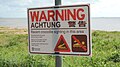
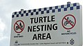 Turtle Nesting Area advisory sign, Bramston Beach, 2018.jpg 1,920 × 1,080; 468 KB
-
 Vegetation beside the Gillies Highway, Lamb Range, 2018.jpg 1,080 × 1,920; 467 KB
-
 View from Goldsborough Road across the residential area, Goldsborough, 2018 01.jpg 1,920 × 1,080; 484 KB
-
 View from Goldsborough Road across the residential area, Goldsborough, 2018 02.jpg 1,920 × 1,080; 476 KB
-
 View from Goldsborough Road across the residential area, Goldsborough, 2018 03.jpg 1,920 × 1,080; 478 KB
-
 View from Ingot Close, Goldsborough, 2018.jpg 1,920 × 1,080; 480 KB
-
 View from junction of Goldsborough Road and Downing Road, Goldsborough, 2018.jpg 1,920 × 1,080; 495 KB
-
 View from the Gillies Highway, en route through Lamb Range, 2018.jpg 1,080 × 1,920; 489 KB
-

-

-

-
 Warning sign at Bramston Beach, 2018.jpg 1,080 × 1,920; 487 KB
-
 Woopen Creek Road, Woopen Creek, 2018.jpg 1,920 × 1,080; 472 KB
-
 Yacht in the Russell River, East Russell int the background, 2018.jpg 1,920 × 1,080; 466 KB


,_2018.jpg)


,_Babinda,_2018.jpg)


,_2018.jpg)


_in_Lamb_Range,_2018_01.jpg)
_in_Lamb_Range,_2018_02.jpg)
,_Lamb_Range,_2018.jpg)


,_Babinda,_2018_01.jpg)
,_Babinda,_2018_02.jpg)


,_Alley_Family_Graves,_2018.jpg)


,_2018.jpg)
_and_East_Russell_(background),_2018.jpg)


_and_Bartle_Frere_(background),_2018_01.jpg)
_and_Bartle_Frere_(background),_2018_02.jpg)


_and_East_Russell_(background),_2018.jpg)


