Category:Ault Hucknall
Jump to navigation
Jump to search
English: Ault Hucknall is a small village, which gives its name to the surrounding civil parish, in the Bolsover district of Derbyshire, England.
village and civil parish in the Bolsover District of Derbyshire, England  | |||||
| Upload media | |||||
| Instance of | |||||
|---|---|---|---|---|---|
| Location | Bolsover, Derbyshire, East Midlands, England | ||||
| Population |
| ||||
 | |||||
Subcategories
This category has the following 10 subcategories, out of 10 total.
A
- Astwith (17 F)
- Ault Hucknall War Memorial (1 F)
B
- Bramley Vale (11 F)
C
- Common End, Derbyshire (1 F)
D
- Doe Lea, Derbyshire (7 F)
H
- Hardstoft (140 F)
R
- Rowthorne, Derbyshire (26 F)
S
- Stainsby, Derbyshire (27 F)
Media in category "Ault Hucknall"
The following 200 files are in this category, out of 873 total.
(previous page) (next page)-
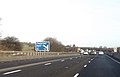 1 mile to junction 29 - geograph.org.uk - 4324302.jpg 640 × 413; 39 KB
-
 19th century cast-iron range - geograph.org.uk - 5066402.jpg 3,648 × 2,432; 3.14 MB
-
 A Front View of Hardwick Hall - geograph.org.uk - 5115543.jpg 640 × 480; 409 KB
-
 A patchwork of fields, plus the M1 - geograph.org.uk - 2418737.jpg 950 × 577; 257 KB
-
 A view towards Hardstoft - geograph.org.uk - 2325872.jpg 3,648 × 2,736; 5.35 MB
-

-
 A617, Mansfield Road, Glapwell - geograph.org.uk - 4206588.jpg 640 × 480; 261 KB
-
 Access road to Hardwick Hall - geograph.org.uk - 4068079.jpg 800 × 531; 109 KB
-
 Across the field at Hardwick Park - geograph.org.uk - 5065192.jpg 3,648 × 2,432; 5.36 MB
-

-
 Ajar by Gavin Turk - geograph.org.uk - 4110169.jpg 5,184 × 3,456; 4.41 MB
-
 Alliums in the gardens at Hardwick Hall - geograph.org.uk - 6175206.jpg 480 × 640; 137 KB
-
 An Autumnal Stroll - geograph.org.uk - 335020.jpg 640 × 360; 95 KB
-
 An Autumnal Stroll - geograph.org.uk - 335132.jpg 640 × 360; 91 KB
-
 An Autumnal Stroll - geograph.org.uk - 336431.jpg 640 × 360; 135 KB
-
 An Autumnal Stroll - geograph.org.uk - 336446.jpg 640 × 360; 68 KB
-
 Approaching Ault Hucknall - geograph.org.uk - 2838640.jpg 1,024 × 683; 170 KB
-
 Approaching Locko Lane Farm - geograph.org.uk - 3729993.jpg 4,000 × 2,248; 4.95 MB
-
 Arable field near Hardstoft - geograph.org.uk - 4068217.jpg 1,024 × 680; 319 KB
-
 Arable land near Pleasley - geograph.org.uk - 2326967.jpg 3,648 × 2,736; 4.55 MB
-
 Arable land to the west of Pleasley Pit Country Park - geograph.org.uk - 2494106.jpg 3,648 × 2,736; 4.41 MB
-
 Astwith Lane - geograph.org.uk - 4123138.jpg 4,000 × 3,000; 2.79 MB
-
 Astwith Lane, looking across the M1 to Hardwick Hall - geograph.org.uk - 3729835.jpg 4,000 × 2,248; 4.42 MB
-
 At Dale Lane Corner - geograph.org.uk - 3864223.jpg 3,888 × 5,184; 6.31 MB
-
 At last signs of a used footpath - geograph.org.uk - 4830998.jpg 1,024 × 768; 188 KB
-
 Ault Hucknall , M1 Motorway - geograph.org.uk - 6627190.jpg 6,000 × 4,000; 6.89 MB
-
 Ault Hucknall - Barn - geograph.org.uk - 2283978.jpg 800 × 531; 121 KB
-
 Ault Hucknall - cottage - geograph.org.uk - 2264567.jpg 1,600 × 1,200; 561 KB
-
 Ault Hucknall - geograph.org.uk - 2284162.jpg 800 × 531; 146 KB
-
 Ault Hucknall - St John the Baptist Church - geograph.org.uk - 6681242.jpg 5,184 × 2,912; 4.03 MB
-

-
 Ault Hucknall Farm - geograph.org.uk - 4113241.jpg 640 × 480; 80 KB
-
 Ault Hucknall in the distance - geograph.org.uk - 2283934.jpg 800 × 531; 71 KB
-
 Ault Hucknall Lane - 2 - geograph.org.uk - 1592287.jpg 640 × 480; 105 KB
-
 Ault Hucknall Lane - geograph.org.uk - 4113248.jpg 640 × 480; 90 KB
-
 Ault Hucknall Lane, Ault Hucknall - geograph.org.uk - 5149309.jpg 1,600 × 1,065; 671 KB
-
 Ault Hucknall War Memorial - geograph.org.uk - 1629418.jpg 640 × 468; 106 KB
-

-
 Ault Hucknall War Memorial, North Face - geograph.org.uk - 5115635.jpg 481 × 640; 638 KB
-
 Ault Hucknall War Memorial, South Face - geograph.org.uk - 5115621.jpg 481 × 640; 547 KB
-
 Ault Hucknall, Nr Glapwell, Derbyshire - geograph.org.uk - 5215244.jpg 2,325 × 3,100; 2.88 MB
-
 Ault Hucknall, Nr Glapwell, Derbyshire - geograph.org.uk - 5215315.jpg 3,067 × 1,922; 1.91 MB
-
 Ault Hucknall, Nr Glapwell, Derbyshire - geograph.org.uk - 5215339.jpg 3,124 × 2,343; 2.37 MB
-
 Ault Hucknall, Nr Glapwell, Derbyshire - geograph.org.uk - 5215372.jpg 2,727 × 2,341; 2.06 MB
-
 Ault Hucknall, Nr Glapwell, Derbyshire - geograph.org.uk - 5215407.jpg 2,517 × 1,713; 1.68 MB
-
 Ault Hucknall, Nr Glapwell, Derbyshire - geograph.org.uk - 5215445.jpg 2,327 × 1,707; 1.5 MB
-
 Ault Hucknall, Nr Glapwell, Derbyshire - geograph.org.uk - 5215465.jpg 1,895 × 1,338; 944 KB
-
 Ault Hucknall, Nr Glapwell, Derbyshire - geograph.org.uk - 5215478.jpg 2,261 × 2,028; 1.16 MB
-
 Ault Hucknall, Nr Glapwell, Derbyshiret - geograph.org.uk - 5215260.jpg 3,036 × 2,238; 3.83 MB
-
 Ault Hucknall, St. John the Baptist Church, Gargoyle 1 - geograph.org.uk - 6290558.jpg 6,172 × 4,115; 5.47 MB
-
 Ault Hucknall, St. John the Baptist Church, Gargoyle 2 - geograph.org.uk - 6290559.jpg 6,344 × 4,230; 6.75 MB
-

-
 Ault Hucknall, St. John the Baptist Church, Western aspect - geograph.org.uk - 6290550.jpg 6,158 × 4,105; 5.01 MB
-
 Ault Hucknall, St. John the Baptist Church, Western aspect - geograph.org.uk - 6290554.jpg 6,219 × 4,146; 5.28 MB
-
 Ault Hucknall, The War Memorial - geograph.org.uk - 2060710.jpg 640 × 480; 121 KB
-
 Ault Hucknall, UK - panoramio.jpg 1,600 × 899; 268 KB
-
 Avenue of Trees Hardwick Hall - geograph.org.uk - 2963145.jpg 1,024 × 768; 217 KB
-
 B6039 towards Tibshelf - geograph.org.uk - 2335585.jpg 1,600 × 1,200; 536 KB
-
 B6039, Chesterfield Road - geograph.org.uk - 3728350.jpg 4,000 × 2,248; 4.94 MB
-
 B6039, Stainsby Common - geograph.org.uk - 2453533.jpg 950 × 677; 263 KB
-
 Barley and wheat, hedges and woods - geograph.org.uk - 2451848.jpg 950 × 713; 312 KB
-
 Barley field by Ault Hucknall Lane - geograph.org.uk - 2418408.jpg 950 × 602; 268 KB
-
 Barn at Pear Tree Farm, Rowthorne - geograph.org.uk - 5149334.jpg 1,600 × 1,065; 690 KB
-
 Barn with VR postbox - geograph.org.uk - 2324037.jpg 3,648 × 2,736; 5.8 MB
-
 Barns at Hall Farm - geograph.org.uk - 1591505.jpg 640 × 480; 117 KB
-
 Barrier and original car park - geograph.org.uk - 2236290.jpg 3,216 × 1,809; 3.95 MB
-
 Batley Farm Viewed from Longhedge Lane - geograph.org.uk - 2690081.jpg 3,296 × 2,472; 1.04 MB
-
 Batley Lane - geograph.org.uk - 4113175.jpg 640 × 480; 49 KB
-
 Batley Lane rail bridges - geograph.org.uk - 2326957.jpg 3,648 × 2,736; 5.89 MB
-
 Below stairs in the kitchen - geograph.org.uk - 5066399.jpg 3,648 × 2,432; 3.64 MB
-
 Bess of Hardwick - geograph.org.uk - 5065277.jpg 3,648 × 2,432; 3.22 MB
-
 Bess of Hardwick - geograph.org.uk - 5838181.jpg 472 × 640; 65 KB
-
 Bolsover , Stainsby Mill - geograph.org.uk - 5931711.jpg 3,264 × 1,836; 1.46 MB
-
 Bolsover District , Ault Hucknall War Memorial - geograph.org.uk - 5976301.jpg 4,000 × 6,000; 7.67 MB
-
 Bolsover District , Countryside Scenery - geograph.org.uk - 5976264.jpg 6,000 × 4,000; 6.36 MB
-
 Bolsover District , Grassy Field - geograph.org.uk - 5976250.jpg 6,000 × 4,000; 5.71 MB
-
 Bolsover District , Hardwick Hall - Bedroom - geograph.org.uk - 5976274.jpg 6,000 × 4,000; 5.73 MB
-
 Bolsover District , Hardwick Hall - Bedroom - geograph.org.uk - 5976277.jpg 6,000 × 4,000; 5.92 MB
-
 Bolsover District , Hardwick Hall - Bedroom - geograph.org.uk - 5976280.jpg 6,000 × 4,000; 6.57 MB
-
 Bolsover District , Hardwick Hall - Butler's Room - geograph.org.uk - 5976278.jpg 6,000 × 4,000; 6.03 MB
-
 Bolsover District , Hardwick Hall - Chapel - geograph.org.uk - 5976276.jpg 6,000 × 4,000; 5.49 MB
-
 Bolsover District , Hardwick Hall - Corridor - geograph.org.uk - 5976275.jpg 6,000 × 4,000; 5.77 MB
-
 Bolsover District , Hardwick Hall - Cottages - geograph.org.uk - 5976259.jpg 6,000 × 4,000; 7.29 MB
-
 Bolsover District , Hardwick Hall - Documents - geograph.org.uk - 5976267.jpg 6,000 × 4,000; 7.71 MB
-
 Bolsover District , Hardwick Hall - Documents - geograph.org.uk - 5976268.jpg 6,000 × 4,000; 6.25 MB
-
 Bolsover District , Hardwick Hall - East Court - geograph.org.uk - 5976289.jpg 6,000 × 4,000; 6.6 MB
-
 Bolsover District , Hardwick Hall - Garden - geograph.org.uk - 5976282.jpg 6,000 × 4,000; 6.2 MB
-
 Bolsover District , Hardwick Hall - Garden - geograph.org.uk - 5976283.jpg 6,000 × 4,000; 5.79 MB
-
 Bolsover District , Hardwick Hall - Garden - geograph.org.uk - 5976284.jpg 4,000 × 6,000; 6.28 MB
-
 Bolsover District , Hardwick Hall - Garden - geograph.org.uk - 5976286.jpg 6,000 × 4,000; 7.35 MB
-
 Bolsover District , Hardwick Hall - Garden - geograph.org.uk - 5976288.jpg 6,000 × 4,000; 7.88 MB
-
 Bolsover District , Hardwick Hall - Garden - geograph.org.uk - 5976291.jpg 6,000 × 4,000; 7.48 MB
-
 Bolsover District , Hardwick Hall - geograph.org.uk - 5976257.jpg 6,000 × 4,000; 7.59 MB
-
 Bolsover District , Hardwick Hall - geograph.org.uk - 5976265.jpg 6,000 × 4,000; 5.79 MB
-
 Bolsover District , Hardwick Hall - geograph.org.uk - 5976266.jpg 4,000 × 6,000; 5.7 MB
-
 Bolsover District , Hardwick Hall - geograph.org.uk - 5976272.jpg 4,000 × 6,000; 7.87 MB
-
 Bolsover District , Hardwick Hall - geograph.org.uk - 5976285.jpg 6,000 × 4,000; 5.61 MB
-
 Bolsover District , Hardwick Hall - geograph.org.uk - 5976287.jpg 6,000 × 4,000; 6.52 MB
-
 Bolsover District , Hardwick Hall - Hardwick Old Hall - geograph.org.uk - 5976260.jpg 4,000 × 6,000; 7.32 MB
-
 Bolsover District , Hardwick Hall - Hardwick Old Hall - geograph.org.uk - 5976261.jpg 6,000 × 4,000; 5.72 MB
-
 Bolsover District , Hardwick Hall - Hardwick Old Hall - geograph.org.uk - 5976262.jpg 4,000 × 6,000; 6.74 MB
-
 Bolsover District , Hardwick Hall - Hardwick Old Hall - geograph.org.uk - 5976263.jpg 6,000 × 4,000; 6.21 MB
-
 Bolsover District , Hardwick Hall - Hardwick Old Hall - geograph.org.uk - 5976292.jpg 6,000 × 4,000; 7.35 MB
-
 Bolsover District , Hardwick Hall - Kitchen - geograph.org.uk - 5976281.jpg 6,000 × 4,000; 7.63 MB
-
 Bolsover District , Hardwick Hall - Living Area - geograph.org.uk - 5976279.jpg 6,000 × 4,000; 5.43 MB
-
 Bolsover District , Hardwick Hall - Long Gallery - geograph.org.uk - 5976273.jpg 6,000 × 4,000; 5.61 MB
-
 Bolsover District , Hardwick Hall - Sea Dogs Table - geograph.org.uk - 5976269.jpg 6,000 × 4,000; 5.5 MB
-
 Bolsover District , Hardwick Hall - Stables Yard - geograph.org.uk - 5976255.jpg 6,000 × 4,000; 6.1 MB
-
 Bolsover District , Hardwick Hall - Stairs - geograph.org.uk - 5976271.jpg 6,000 × 4,000; 6.36 MB
-
 Bolsover District , Hardwick Hall - Tapestry - geograph.org.uk - 5976270.jpg 6,000 × 4,000; 6.52 MB
-
 Bolsover District , Hardwick Hall - The Great Barn - geograph.org.uk - 5976258.jpg 6,000 × 4,000; 6.24 MB
-
 Bolsover District , Hardwick Hall - Visitor Centre - geograph.org.uk - 5976254.jpg 6,000 × 4,000; 5.95 MB
-
 Bolsover District , Hardwick Park - geograph.org.uk - 5976251.jpg 6,000 × 4,000; 6.03 MB
-
 Bolsover District , Hardwick Park - geograph.org.uk - 5976252.jpg 6,000 × 4,000; 5.51 MB
-
 Bolsover District , Hardwick Park - geograph.org.uk - 5976290.jpg 6,000 × 4,000; 6 MB
-
 Bolsover District , M1 Motorway - geograph.org.uk - 5951693.jpg 6,000 × 4,000; 7.06 MB
-
 Bolsover District , M1 Motorway - geograph.org.uk - 5951694.jpg 6,000 × 4,000; 7.56 MB
-
 Bolsover District , M1 Motorway - geograph.org.uk - 5951695.jpg 6,000 × 4,000; 7.2 MB
-
 Bolsover District , M1 Motorway - geograph.org.uk - 5952824.jpg 6,000 × 4,000; 6.14 MB
-
 Bolsover District , M1 Motorway - geograph.org.uk - 5952825.jpg 6,000 × 4,000; 6.69 MB
-
 Bolsover District , M1 Motorway - geograph.org.uk - 5952826.jpg 6,000 × 4,000; 6.71 MB
-
 Bolsover District , Road - geograph.org.uk - 5952960.jpg 6,000 × 4,000; 6.09 MB
-
 Bolsover District , Road - geograph.org.uk - 5952961.jpg 6,000 × 4,000; 6.46 MB
-
 Bolsover District , Road ^ Memorial - geograph.org.uk - 5976293.jpg 6,000 × 4,000; 6.12 MB
-
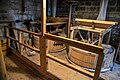 Bolsover District , Stainsby Mill - geograph.org.uk - 5976294.jpg 6,000 × 4,000; 5.71 MB
-
 Bolsover District , Stainsby Mill - geograph.org.uk - 5976295.jpg 6,000 × 4,000; 5.35 MB
-
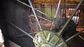 Bolsover District , Stainsby Mill - geograph.org.uk - 5976296.jpg 6,000 × 3,368; 7.12 MB
-
 Bolsover District , Stainsby Mill - geograph.org.uk - 5976297.jpg 6,000 × 4,000; 7.59 MB
-
 Bolsover District , Stainsby Mill - geograph.org.uk - 5976298.jpg 4,000 × 6,000; 6.65 MB
-
 Bolsover District , Stainsby Mill - geograph.org.uk - 5976299.jpg 6,000 × 4,000; 6.53 MB
-
 Bolsover District , Stainsby Mill - geograph.org.uk - 5976300.jpg 6,000 × 4,000; 6.19 MB
-
 Bowlers Plantation footpath - geograph.org.uk - 4831001.jpg 1,024 × 768; 182 KB
-
 Branch Lane - geograph.org.uk - 3736882.jpg 800 × 533; 150 KB
-
 Branch Lane junction with Astwith Lane - geograph.org.uk - 4592561.jpg 3,715 × 4,952; 4.83 MB
-
 Branch Lane towards Astwith - geograph.org.uk - 2335574.jpg 1,600 × 1,200; 573 KB
-
 Branch Lane towards the B6039 - geograph.org.uk - 2453530.jpg 950 × 713; 304 KB
-
 Bridge and driveway to Hardwick Hall - geograph.org.uk - 2838629.jpg 1,024 × 683; 259 KB
-
 Bridges on former colliery railway - geograph.org.uk - 3562242.jpg 800 × 533; 164 KB
-
 Bridleway - geograph.org.uk - 451725.jpg 640 × 360; 90 KB
-

-
 Broadoak hill, the one way road to Hardwick Hall - geograph.org.uk - 2421751.jpg 1,024 × 721; 117 KB
-
 Bus shelter by Tibshelf Road - geograph.org.uk - 2418774.jpg 950 × 713; 297 KB
-
 By Astwith Lane - geograph.org.uk - 2453526.jpg 950 × 713; 309 KB
-
 Car Park - geograph.org.uk - 464347.jpg 640 × 360; 78 KB
-
 Car Park at Hardwick Hall - geograph.org.uk - 4110154.jpg 4,180 × 2,787; 2.2 MB
-
 Car Park for Five Pits Trail - geograph.org.uk - 3728348.jpg 4,000 × 2,248; 7.5 MB
-
 Cart shed, Hardwick Hall - geograph.org.uk - 4068069.jpg 800 × 531; 150 KB
-
 Cattle by Stainsby Plantation - geograph.org.uk - 4592387.jpg 5,118 × 3,768; 5.5 MB
-
 Cattle grid - geograph.org.uk - 4113212.jpg 640 × 480; 90 KB
-
 Cattle Grid on Driveway to Hardwick Hall - geograph.org.uk - 5115538.jpg 640 × 481; 591 KB
-
 Cavendish Coat of Arms, Hardwick Hall - geograph.org.uk - 4066776.jpg 680 × 1,024; 225 KB
-
 Cemetery, Ault Hucknall - geograph.org.uk - 5149307.jpg 1,600 × 1,065; 682 KB
-
 Ceramic rose sculpture - geograph.org.uk - 3562262.jpg 533 × 800; 134 KB
-
 Church water spout - Ault Hucknall - geograph.org.uk - 3864038.jpg 2,901 × 3,626; 2.56 MB
-
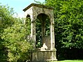 Conduit House - geograph.org.uk - 3047945.jpg 2,048 × 1,536; 1.55 MB
-
 Cosy small drawing room at Hardwick Hall - geograph.org.uk - 4539024.jpg 1,000 × 750; 177 KB
-
 Cottage and bungalow at Stainsbybrook - geograph.org.uk - 2325812.jpg 3,648 × 2,736; 5.38 MB
-
 Cottage in Ault Hucknall - geograph.org.uk - 2838653.jpg 1,024 × 683; 194 KB
-
 Cottages at Ault Hucknall - geograph.org.uk - 5149303.jpg 1,600 × 1,065; 724 KB
-
 Crop Boundary - geograph.org.uk - 465921.jpg 640 × 360; 65 KB
-

-

-
 Cut Mark Hall Farm Rowthorne - geograph.org.uk - 4490840.jpg 640 × 480; 85 KB
-
 Cut Mark Hardwick Hall Estate - geograph.org.uk - 4881495.jpg 640 × 480; 117 KB
-
 Cut Mark Old Hardwick Hall - geograph.org.uk - 4881457.jpg 640 × 480; 138 KB
-

-

-
 Cut Mark Toll Bar Cottage Hardstoft - geograph.org.uk - 4615945.jpg 640 × 480; 96 KB
-
 Dale Lane - geograph.org.uk - 1591595.jpg 640 × 480; 127 KB
-
 Dale Lane Corner near Rowthorne - geograph.org.uk - 3864219.jpg 3,604 × 1,080; 958 KB
-
 Dale Lane towards Mansfield Road - geograph.org.uk - 5149343.jpg 1,600 × 1,065; 715 KB
-
 Dale Lane towards Mansfield Road - geograph.org.uk - 5149346.jpg 1,600 × 1,065; 509 KB
-
 Dale Lane towards Mansfield Road - geograph.org.uk - 5149350.jpg 1,600 × 1,065; 722 KB
-
 Dead tree south of Astwith - geograph.org.uk - 4592556.jpg 3,888 × 5,184; 5.69 MB
-
 Deck chairs in the orchard - geograph.org.uk - 5429362.jpg 800 × 593; 234 KB
-
 Deckchair on the lawn at Hardwick Hall - geograph.org.uk - 6175202.jpg 480 × 640; 118 KB
-
 Deckchairs on the lawn - geograph.org.uk - 5099795.jpg 718 × 800; 159 KB
-
 Deeds-Records room - geograph.org.uk - 5065318.jpg 3,648 × 2,432; 3.78 MB
-
 Deep Lane bridge over M1 - geograph.org.uk - 4324292.jpg 640 × 375; 43 KB
-
 Deep Lane bridge over the M1 - geograph.org.uk - 5801167.jpg 2,000 × 1,187; 1.43 MB
-
 Deep Lane Bridge, M1 - geograph.org.uk - 4667520.jpg 640 × 385; 36 KB
-
 Deep Lane Road Bridge over M1 - geograph.org.uk - 5894611.jpg 1,024 × 614; 94 KB
-
 Deep Lane with view to Hardwick Hall - geograph.org.uk - 4592537.jpg 5,184 × 3,888; 6.5 MB
-
 Deep Lane, Hardstoft - geograph.org.uk - 2335768.jpg 1,600 × 1,200; 562 KB
-
 Derbyshire UK parish map highlighting Ault Hucknall.svg 888 × 1,308; 2.34 MB
-
 Dining Room, Hardwick Hall - geograph.org.uk - 4539789.jpg 1,000 × 750; 174 KB
-
 Disused Chapel near Hardstoft - geograph.org.uk - 2459118.jpg 640 × 480; 64 KB
-
 Disused farm cottage and stables at Astwith - geograph.org.uk - 4831004.jpg 1,024 × 768; 180 KB
-
 Disused Railway bridge over Batley Lane - geograph.org.uk - 4113163.jpg 640 × 480; 106 KB
-
 Doe Lea Miners Welfare Social Club, Doe Lea - geograph.org.uk - 5569939.jpg 5,094 × 3,472; 3.34 MB
-
 Down to Bramley Vale - geograph.org.uk - 2283952.jpg 800 × 531; 82 KB
-
 Driveway at Hardwick Hall - geograph.org.uk - 2838613.jpg 1,024 × 683; 143 KB
-
 Driveway near The Grange - geograph.org.uk - 1592711.jpg 640 × 480; 128 KB
-
 Driveway past The Grange - geograph.org.uk - 1592705.jpg 640 × 480; 149 KB
-
 Driveway to Hardwick Hall - geograph.org.uk - 5115529.jpg 640 × 480; 526 KB
-
 Dual carriageway up to the M1 - geograph.org.uk - 2045515.jpg 640 × 480; 45 KB
-
 Eastern Derbyshire - geograph.org.uk - 2284126.jpg 800 × 531; 95 KB
-
 Entering Hardwick Hall - geograph.org.uk - 5065174.jpg 3,648 × 2,432; 5.9 MB
-
 Entrance to Pleasley Pit Country Park - geograph.org.uk - 5149452.jpg 1,600 × 1,065; 665 KB
-
 Ex Great Northern Railway - geograph.org.uk - 2283483.jpg 800 × 531; 171 KB


_is_Hardwick_Hall_-_geograph.org.uk_-_4830995.jpg)


