Category:August 2017 in the East Riding of Yorkshire
Jump to navigation
Jump to search
Ceremonial counties of England: Bedfordshire · Berkshire · Buckinghamshire · Cambridgeshire · Cheshire · Cornwall · Derbyshire · Devon · Dorset · Durham · East Riding of Yorkshire · East Sussex · Essex · Gloucestershire · Greater London · Greater Manchester · Hampshire · Herefordshire · Hertfordshire · Isle of Wight · Kent · Lancashire · Leicestershire · Lincolnshire · Merseyside · Norfolk · North Yorkshire · Northamptonshire · Northumberland · Nottinghamshire · Oxfordshire · Shropshire · Somerset · South Yorkshire · Staffordshire · Suffolk · Surrey · Warwickshire · West Midlands · West Yorkshire · Wiltshire · Worcestershire
City-counties: Bristol ·
Former historic counties:
Other former counties:
City-counties: Bristol ·
Former historic counties:
Other former counties:
Deutsch: Bilder, die im August 2017 in the East Riding of Yorkshire aufgenommen worden sind. Bitte beachten Sie, dass dies weder das Datum des Uploads noch das Datum des Scannens eines Fotos ist.
English: Images/pictures taken in the East Riding of Yorkshire during August 2017. Note this is not the date of the upload, nor the date a photo was scanned.
Español: Fotografías o imágenes tomadas en the East Riding of Yorkshire durante agosto 2017. No es la fecha de subida ni escaneo, sino la fecha en que las fotografías o imágenes se crearon.
Esperanto: Bildoj faritaj en the East Riding of Yorkshire en aŭgusto 2017. Tio ne estas la dato, kiam la bildoj estis alŝutitaj aŭ skanitaj.
Français : Photographies ou images prises en the East Riding of Yorkshire durant août 2017. Ce n'est pas la date du téléchargement ou du scan.
Galego: Fotografías ou imaxes tomadas en the East Riding of Yorkshire durante agosto 2017. Non é a data de subida nin escaneamento, senón a data na que se crearon as fotografías ou imaxes.
Italiano: Fotografie o immagini scattate a the East Riding of Yorkshire nel agosto 2017. Nota bene: la data non si riferisce né a quella di upload né a quella in cui la foto è stata digitalizzata.
Norsk bokmål: Bilder tatt i the East Riding of Yorkshire i løpet av august 2017. Merk at dette ikke er datoen for opplasting, eller når et bilde har blitt skannet.
Norsk nynorsk: Bilete teke i the East Riding of Yorkshire i løpet av august 2017. Merk at dette ikkje er datoen for opplasting, eller når eit bilete har vorte skanna.
Русский: Изображения, сделанные в the East Riding of Yorkshire в течение август 2017 (не дата загрузки изображения).
Українська: Зображення, зроблені в the East Riding of Yorkshire протягом серпень 2017. Зауважте, що це не дата завантаження чи дата сканування фотографії.
| August 2016 | ← | August 2017 | → | August 2018 | |||||||
| Jan | Feb | Mar | Apr | May | Jun | Jul | Aug | Sep | Oct | Nov | Dec |
| 165 | 30 | 62 | 27 | 80 | 25 | 89 | 56 | 79 | 26 | 54 | 33 |
|---|---|---|---|---|---|---|---|---|---|---|---|
Subcategories
This category has only the following subcategory.
Media in category "August 2017 in the East Riding of Yorkshire"
The following 55 files are in this category, out of 55 total.
-
 Beach casting, Withernsea (geograph 5513279).jpg 640 × 536; 123 KB
-
 Beach landing, Withernsea (geograph 5513296).jpg 529 × 640; 138 KB
-
 Beverley & Barmston Drain (geograph 5503012).jpg 1,600 × 1,065; 707 KB
-
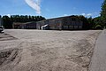
 Building at Brickyard Farm off Wood Lane (geograph 5486476).jpg 1,600 × 1,065; 930 KB
-
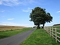
 By New Road, Owstwick (geograph 5511507).jpg 640 × 480; 324 KB
-
 Dane's Dyke beach, near Bridlington, East Yorkshire, England. (35970816433).jpg 3,744 × 2,499; 6.94 MB
-
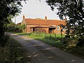
 Decoy House Farm (geograph 5501797).jpg 1,600 × 1,065; 623 KB
-
 Dry valley above Fordon (geograph 5519984).jpg 1,024 × 768; 153 KB
-
 Dry valley North-east of Fordon (geograph 5515455).jpg 1,024 × 768; 175 KB
-
 Easingwold Farm, Watton Carrs (geograph 5502948).jpg 1,600 × 1,044; 900 KB
-
 Farm road to Decoy House (geograph 5501799).jpg 1,600 × 1,065; 723 KB
-
 Featherbed Lane off Wood Lane (geograph 5486541).jpg 1,600 × 1,065; 941 KB
-
 Featherbed Lane off Wood Lane (geograph 5486550).jpg 1,600 × 1,065; 922 KB
-
 Featherbed Lane off Wood Lane (geograph 5486551).jpg 1,600 × 1,065; 895 KB
-
 Field with sheep near Danebury Manor (geograph 5519955).jpg 1,024 × 768; 184 KB
-
 Fingerpost on Wood Lane (geograph 5486538).jpg 1,600 × 1,065; 764 KB
-
 Footbridge over Barmston Drain (geograph 5501705).jpg 1,600 × 1,065; 947 KB
-
 Grass field by the Flixton to Fordon Road (geograph 5519977).jpg 1,024 × 768; 122 KB
-
 Groyne replacement, Withernsea (geograph 5513285).jpg 640 × 480; 185 KB
-
 Harvested field, High Fordon (geograph 5515401).jpg 1,024 × 768; 192 KB
-
 Hempholme Lock (geograph 5501460).jpg 1,600 × 1,065; 771 KB
-
 Hull Collegiate Sixth-Form Tie 2014.jpg 4,320 × 3,240; 5.52 MB
-
 Lane to Flixton near Danebury Manor (geograph 5515472).jpg 1,024 × 768; 156 KB
-
 One seal and lots of gulls, Redcliff Middle Sand (geograph 5618330).jpg 1,024 × 768; 117 KB
-
 Partially harvested field near North Fordon Farm (geograph 5515478).jpg 1,024 × 768; 168 KB
-
 Path leading to Easingwold Farm (geograph 5501806).jpg 1,600 × 1,065; 852 KB
-
 Path leading to Hempholme Lock (geograph 5501430).jpg 1,600 × 1,065; 807 KB
-
 Path leading towards Easingwold Plantation (geograph 5502950).jpg 1,600 × 1,065; 815 KB
-
 Path leading towards Easingwold Plantation (geograph 5502954).jpg 1,600 × 1,065; 976 KB
-
 Path leading towards Easingwold Plantation (geograph 5502960).jpg 1,600 × 1,065; 843 KB
-
 Path near Standingholme Farm (geograph 5501714).jpg 1,600 × 1,065; 832 KB
-
 Path near Standingholme Farm (geograph 5501719).jpg 1,600 × 1,065; 929 KB
-
 Path near Standingholme Farm (geograph 5501782).jpg 1,600 × 1,065; 986 KB
-
 Paull Holme Tower August 2017 (Front).jpg 4,320 × 3,240; 5.53 MB
-
 Paull Holme Tower August 2017 (Rear).jpg 4,320 × 3,240; 5.87 MB
-
 Power lines and potato field, High Fordon (geograph 5520275).jpg 1,024 × 768; 158 KB
-
 Public footpath at Easingwold Farm (geograph 5501816).jpg 1,600 × 1,065; 622 KB
-
 Public footpath at Easingwold Farm (geograph 5502901).jpg 1,600 × 1,065; 677 KB
-
 Public footpath at Easingwold Farm (geograph 5502904).jpg 1,600 × 1,065; 782 KB
-
 Public footpath at Easingwold Farm (geograph 5502906).jpg 1,600 × 1,065; 809 KB
-
 River Hull at Hempholme Lock (geograph 5501457).jpg 1,600 × 1,065; 506 KB
-
 Rusty railings, Withernsea (geograph 5513291).jpg 640 × 479; 193 KB
-
 Slurry Tank near Decoy Wood (geograph 5501791).jpg 1,600 × 1,065; 637 KB
-
 Smithy Garth, Owstwick (geograph 5511524).jpg 640 × 480; 192 KB
-
 South of Quaker Road, near Owstwick (geograph 5511629).jpg 640 × 444; 93 KB
-
 Spur between two dry valleys (geograph 5520266).jpg 1,024 × 768; 281 KB
-
 Standingholme Farm (geograph 5501707).jpg 1,600 × 1,065; 760 KB
-

-
 The former Ryehill and Burstwick Station (geograph 5508856).jpg 1,024 × 768; 244 KB
-
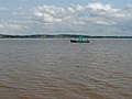 The River Humber at Redcliff, on a falling tide (geograph 5613601).jpg 1,024 × 768; 113 KB
-
 Three Jolly Tars Farm (geograph 5503016).jpg 1,600 × 1,065; 679 KB
-
 Verge grass cutting on Wood Lane, North Howden (geograph 5486472).jpg 1,600 × 1,065; 770 KB
-
 View over Fordon (geograph 5520270).jpg 1,024 × 768; 278 KB
-
 View over North Dale to North Fordon Farm (geograph 5515435).jpg 1,024 × 768; 245 KB
-
 Withernsea Pier Towers (geograph 5503323).jpg 640 × 427; 91 KB
.jpg)
.jpg)
.jpg)
.jpg)
.jpg)
.jpg)
.jpg)
.jpg)
.jpg)
.jpg)
.jpg)
.jpg)
.jpg)
.jpg)
.jpg)
.jpg)
.jpg)
.jpg)
.jpg)
.jpg)
.jpg)

.jpg)
.jpg)
.jpg)
.jpg)
.jpg)
.jpg)
.jpg)
.jpg)
.jpg)
.jpg)
.jpg)
.jpg)
.jpg)
.jpg)
.jpg)
.jpg)
.jpg)
.jpg)
.jpg)
.jpg)
.jpg)
.jpg)
.jpg)
.jpg)
.jpg)
.jpg)
.jpg)
.jpg)
.jpg)
.jpg)
.jpg)
.jpg)
.jpg)