Category:August 2014 in Leeds
Jump to navigation
Jump to search
Media in category "August 2014 in Leeds"
The following 45 files are in this category, out of 45 total.
-
'Cluster of Nuts', the Wetherby Lorry Park (28th August 2014).JPG 4,608 × 3,456; 6.42 MB
-
A64, Leeds - geograph.org.uk - 4899920.jpg 960 × 596; 213 KB
-
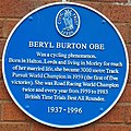
Beryl Burton OBE.jpg 2,267 × 2,269; 1.94 MB
-
Briggate-Commercial Street, Leeds (14859111043).jpg 3,383 × 2,255; 4.01 MB
-
Burley Park Station (geograph 4199647).jpg 640 × 409; 87 KB
-
Butcher's Row, Kirkgate Market - geograph.org.uk - 4107575.jpg 1,600 × 1,064; 606 KB
-
Car park, Thorp Arch retail park (geograph 5353759).jpg 1,024 × 768; 79 KB
-
Cookridge Hospital Lodge 2014 1.jpg 1,944 × 2,592; 1.89 MB
-
Cookridge Hospital Lodge 2014 2.jpg 1,944 × 2,592; 1.1 MB
-
DFS Warehouse (geograph 4130820).jpg 1,600 × 1,064; 334 KB
-
First Avenue, Wetherby (28th August 2014) 001.JPG 4,608 × 3,456; 6.36 MB
-
First Avenue, Wetherby (28th August 2014) 002.JPG 4,608 × 3,456; 6.38 MB
-
First Avenue, Wetherby (28th August 2014) 003.JPG 4,608 × 3,456; 6.35 MB
-
Flytipping on St. James' Street, Wetherby (31st August 2014) 001.JPG 4,608 × 3,456; 6.28 MB
-
Flytipping on St. James' Street, Wetherby (31st August 2014) 002.JPG 4,608 × 3,456; 6.39 MB
-
Fourth Avenue, Wetherby (28th August 2014) 001.JPG 4,608 × 3,456; 6.32 MB
-
Fourth Avenue, Wetherby (28th August 2014) 002.JPG 4,608 × 3,456; 6.39 MB
-
Grandstand at Wetherby Racecourse (geograph 4130262).jpg 1,600 × 1,064; 398 KB
-
Headingley Station (geograph 4199634).jpg 640 × 430; 82 KB
-
Headingley Station - geograph.org.uk - 4199636.jpg 640 × 430; 65 KB
-
Headingley Station - geograph.org.uk - 4199637.jpg 640 × 430; 62 KB
-
Hold the Front Page! The End of the Yorkshire Post Building!.jpg 1,895 × 1,065; 440 KB
-
In Leeds Station - geograph.org.uk - 4206080.jpg 640 × 430; 76 KB
-
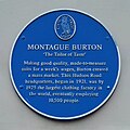
Montague Burton.jpg 1,404 × 1,404; 349 KB
-
Morley Station (geograph 4213807).jpg 640 × 430; 93 KB
-
New sidings north of Horsforth Station (geograph 4199528).jpg 640 × 430; 81 KB
-
New sidings north of Horsforth Station (geograph 4199531).jpg 640 × 430; 80 KB
-
New sidings north of Horsforth Station (geograph 4199533).jpg 640 × 430; 83 KB
-
Roundabout at Wetherby Racecourse (geograph 4130257).jpg 1,600 × 1,064; 431 KB
-
Second Avenue, Wetherby (28th August 2014) 001.JPG 4,608 × 3,456; 6.33 MB
-
Second Avenue, Wetherby (28th August 2014) 002.JPG 4,608 × 3,456; 6.33 MB
-
Second Avenue, Wetherby (28th August 2014) 003.JPG 4,608 × 3,456; 6.38 MB
-
Shelter, Horsforth Station (geograph 4199583).jpg 640 × 430; 68 KB
-
The Black Bull, Market Place, Wetherby (geograph 4113735).jpg 1,600 × 1,599; 1.02 MB
-
The Black Bull, Market Place, Wetherby (geograph 4113739).jpg 1,394 × 1,600; 621 KB
-
The Fox & Hounds on the High Street (geograph 4112352).jpg 1,600 × 1,600; 698 KB
-
The Pax Inn (geograph 4112157).jpg 1,600 × 1,296; 595 KB
-
The Pax Inn (geograph 4112159).jpg 1,336 × 1,600; 509 KB
-
The Windmill Inn on Main Street, Linton - geograph.org.uk - 4111710.jpg 1,600 × 1,156; 579 KB
-
Third Avenue, Wetherby (28th August 2014).JPG 4,608 × 3,456; 6.42 MB
-
Thorparch Bridge towards Boston Spa (geograph 4112176).jpg 1,600 × 1,064; 820 KB
-
TowerLeeds.PNG 353 × 627; 430 KB
-
Town Hall, Wetherby.jpg 2,397 × 2,777; 4.96 MB
-
Wetherby Fire Station (geograph 4113769).jpg 1,600 × 1,064; 514 KB
-
Wetherby High School (28th August 2014).JPG 4,608 × 3,456; 6.45 MB


