Category:August 2010 in Wales
Jump to navigation
Jump to search
English: Images taken in Wales in this month of 2010 (not the date of the upload).
| Jan | Feb | Mar | Apr | May | Jun | Jul | Aug | Sep | Oct | Nov | Dec | ||
| ← | 26 | 43 | 58 | 62 | 41 | 98 | 29 | 44 | 62 | 27 | 12 | 14 | → |
|---|
Subcategories
This category has the following 4 subcategories, out of 4 total.
Media in category "August 2010 in Wales"
The following 40 files are in this category, out of 40 total.
-
 " THE CAMBRIAN "DSC 6731c-Edit.jpg 1,500 × 1,013; 244 KB
-
 A Stormy Night in Capel Curig (19963421572).jpg 3,000 × 1,996; 3.48 MB
-
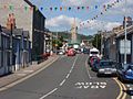
 Alma Street, Beaumaris - geograph.org.uk - 2021688.jpg 640 × 425; 135 KB
-
 Approaching Ta'r Bull village - geograph.org.uk - 1993684.jpg 640 × 480; 74 KB
-
 Arriva Wales open top Bristol VR 3992 Llandudno.jpg 1,216 × 952; 1.2 MB
-
 Arriva Wales open top Olympian ECW 3996.jpg 1,127 × 895; 1,016 KB
-
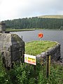 Beacons reservoir - geograph.org.uk - 2023577.jpg 1,704 × 2,272; 2.26 MB
-
 Blaen Taf Fawr - geograph.org.uk - 2023589.jpg 2,272 × 1,704; 2.49 MB
-
 Clywedog Dam - geograph.org.uk - 2040363.jpg 2,100 × 1,400; 366 KB
-
 Cottages and Church In Llanbedr - geograph.org.uk - 2026123.jpg 1,496 × 1,122; 687 KB
-
 Great Orme Tramway - geograph.org.uk - 2006418.jpg 3,296 × 2,472; 1.93 MB
-
 Hengoed - geograph-2036236-by-Jaggery.jpg 640 × 506; 116 KB
-
 Lane In Llanbedr - geograph.org.uk - 2026142.jpg 1,496 × 1,122; 535 KB
-
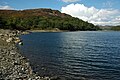
 LlangorseLake.JPG 4,000 × 3,000; 5.81 MB
-
 Llyn Cynwch - geograph.org.uk - 2041366.jpg 3,008 × 2,000; 1.48 MB
-
 Machynlleth Town Clock (8061983744).jpg 1,280 × 960; 958 KB
-
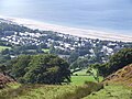
 Maesycwmmer - geograph-2036662-by-Jaggery.jpg 640 × 411; 69 KB
-

-
 Old tramway through the rocks at Cribarth - geograph.org.uk - 2020001.jpg 2,272 × 1,704; 2.09 MB
-
 Pantyrafon o'r Gwddw Glas.JPG 1,280 × 960; 268 KB
-
 Pengam Road houses, Ystrad Mynach - geograph.org.uk - 2036132.jpg 640 × 470; 81 KB
-
 Pentwynmawr Presbyterian Church - geograph.org.uk - 2017336.jpg 640 × 434; 77 KB
-

-
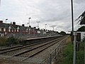 Rhoose up platform - geograph.org.uk - 2006661.jpg 640 × 480; 73 KB
-
 Rhyl Flats windfarm.jpg 1,280 × 960; 116 KB
-
 Sign informing of new supermarket, High Street, Saltney, Flintshire - DSC08081.JPG 3,648 × 2,736; 3.62 MB
-
 Site of Courtybella Junction, Newport (geograph 2042534).jpg 640 × 480; 85 KB
-
 Southern moat - geograph.org.uk - 2759869.jpg 1,024 × 769; 200 KB
-
 St Cadoc, Penrhos - geograph.org.uk - 2026147.jpg 1,496 × 1,122; 704 KB
-
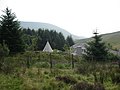 Teepee at the Storey Arms Mountain Centre - geograph.org.uk - 2023604.jpg 2,272 × 1,704; 1.83 MB
-
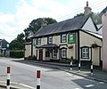
 The Tanners Arms - geograph.org.uk - 2020013.jpg 2,272 × 1,704; 1.88 MB
-

-
 Three Horseshoes, Pentwynmawr - geograph.org.uk - 2017369.jpg 640 × 534; 77 KB
-
 Tower at Plas Brondanw - geograph.org.uk - 2087110.jpg 1,728 × 2,304; 2.34 MB
-
 Track at Parc Slip Nature Park - geograph.org.uk - 2003260.jpg 640 × 633; 108 KB
-
 Tramway at Pen-cribarth - geograph.org.uk - 2019999.jpg 2,272 × 1,704; 2.57 MB
-
 White Hart, Pentwynmawr - geograph.org.uk - 2017216.jpg 640 × 458; 69 KB
-
 WHR NG87 Afon Glaslyn.jpg 2,592 × 1,936; 1.34 MB
-
 Wrecked ship on Sully Island - geograph.org.uk - 2001846.jpg 640 × 480; 75 KB
-
 Wrexham Central 1st railway station (site) (geograph 3440447).jpg 1,024 × 768; 141 KB

.jpg)


.jpg)

,_High_Street,_Saltney,_Flintshire_-_DSC08079.JPG)


.jpg)


_(geograph_3440447).jpg)