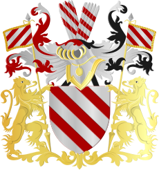
Category:Athus
Jump to navigation
Jump to search
Internationalization
Deutsch: Athem
Lëtzebuergesch: Attem
Walon : Atu
| Object location | | View all coordinates using: OpenStreetMap |
|---|
section of Aubange, Wallonia, Belgium | |||||
| Upload media | |||||
| Instance of |
| ||||
|---|---|---|---|---|---|
| Location | Aubange, Arrondissement of Arlon, Luxembourg, Walloon Region, Belgium | ||||
| Elevation above sea level |
| ||||
| official website | |||||
 | |||||
Subcategories
This category has the following 15 subcategories, out of 15 total.
C
E
M
- Messancy river in Athus (12 F)
P
S
- Schwarz building, Athus (3 F)
- Sports in Athus (1 F)
- Steel industry in Athus (14 F)
- Streets in Athus (40 F)
T
- Town hall in Athus (5 F)
- Athus train station (41 F)
V
- Views of Athus (2 F)
Media in category "Athus"
The following 10 files are in this category, out of 10 total.
-
Armoiries Athus.jpg 292 × 266; 23 KB
-
Blason Athus(BE).svg 655 × 616; 805 KB
-
Blason Athus.svg 600 × 660; 737 KB
-
Athus - Ancien Hotel de Ville, Grand Rue.JPG 4,320 × 3,240; 5.34 MB
-
Athus - Chapelle.JPG 4,320 × 3,240; 5.67 MB
-
Athus - L'école maternelle du centre.JPG 4,320 × 3,240; 5.31 MB
-
Athus - Étang de pêche.jpg 4,320 × 3,240; 5.27 MB
-
Athus.png 1,052 × 593; 935 KB
-
Monument Pierre Luttgens.jpg 1,628 × 2,570; 1.37 MB
-
Rond-point dit de Glaverbel (en 2013).JPG 4,320 × 3,240; 5.34 MB


