Category:Atherington, Devon
Jump to navigation
Jump to search
English: Atherington is a village and civil parish in the North Devon district of Devon, England, about 8 miles south of Barnstaple. According to the 2001 census the parish had a population of 391.
village and civil parish in North Devon, Devon, England  | |||||
| Upload media | |||||
| Instance of | |||||
|---|---|---|---|---|---|
| Location | North Devon, Devon, South West England, England | ||||
| Population |
| ||||
 | |||||
Subcategories
This category has the following 3 subcategories, out of 3 total.
Media in category "Atherington, Devon"
The following 200 files are in this category, out of 238 total.
(previous page) (next page)-
 A thatched cottage at Langridgeford - geograph.org.uk - 3510373.jpg 1,600 × 1,200; 533 KB
-

-
 A377 approaching Umberleigh House - geograph.org.uk - 6148268.jpg 3,268 × 2,260; 1.26 MB
-
 A377 near Umberleigh House - geograph.org.uk - 6141134.jpg 4,288 × 2,848; 2.49 MB
-

-
 Atherington , St Mary's Church - geograph.org.uk - 5994914.jpg 3,648 × 2,736; 6.46 MB
-
 Atherington , The B3227 - geograph.org.uk - 3594350.jpg 4,288 × 2,848; 4.77 MB
-
 Atherington , The B3227 - geograph.org.uk - 5994915.jpg 3,648 × 2,736; 5.2 MB
-
 Atherington , The B3227 - geograph.org.uk - 6349417.jpg 6,000 × 4,000; 6.32 MB
-
 Atherington Village and Post Office - geograph.org.uk - 338303.jpg 640 × 427; 48 KB
-
 Atherington village sign - geograph.org.uk - 6147575.jpg 4,233 × 2,774; 1.87 MB
-
 Atherington, footpath to the village - geograph.org.uk - 489185.jpg 640 × 427; 311 KB
-
 Atherington, Langley Cross - geograph.org.uk - 488442.jpg 640 × 427; 183 KB
-
 Atherington, on Boreat Moor - geograph.org.uk - 489183.jpg 640 × 427; 168 KB
-
 Autumn colours on the B3227 near Atherington - geograph.org.uk - 6317953.jpg 3,360 × 3,030; 5.41 MB
-

-
 AyreArms.png 927 × 1,066; 114 KB
-
 B3217 near Andrews Park - geograph.org.uk - 6147065.jpg 4,288 × 2,848; 1.89 MB
-
 B3217 on Cole's Moor - geograph.org.uk - 6141125.jpg 4,288 × 2,848; 2.78 MB
-
 B3217 on Cole's Moor - geograph.org.uk - 6147083.jpg 4,288 × 2,848; 1.5 MB
-
 BassetArms.jpg 207 × 260; 9 KB
-
 Beetfield near Atherington - geograph.org.uk - 668140.jpg 640 × 438; 122 KB
-
 Beside the lane to Wanhill - geograph.org.uk - 672581.jpg 640 × 427; 60 KB
-
 Black Bridge, Umberleigh - geograph.org.uk - 5825306.jpg 1,024 × 796; 236 KB
-
 Bonds Farmhouse, Atherington - geograph.org.uk - 6147551.jpg 4,279 × 2,648; 1.21 MB
-
 Bottom of Rock Hill - geograph.org.uk - 3664421.jpg 640 × 478; 195 KB
-
 Brown's Hill Head - geograph.org.uk - 668187.jpg 640 × 489; 88 KB
-
 Buildings, Atherington (geograph 6147416).jpg 3,474 × 2,378; 1.03 MB
-
 Buildings, Atherington - geograph.org.uk - 6147572.jpg 4,288 × 2,848; 2 MB
-
 Church path, Atherington - geograph.org.uk - 6147549.jpg 4,288 × 2,848; 1.25 MB
-
 Coffin or bier rest, Atherington (geograph 6147545).jpg 4,288 × 2,848; 1.61 MB
-
 Cottage near Atherington - geograph.org.uk - 668079.jpg 640 × 480; 78 KB
-
 Cottage, Atherington (geograph 6147571).jpg 4,204 × 2,529; 921 KB
-
 Cross roads at Langridgeford - geograph.org.uk - 3510377.jpg 1,600 × 1,200; 691 KB
-
 Drinking trough in field near Wanhill - geograph.org.uk - 672609.jpg 640 × 480; 117 KB
-
 Early Purple Orchid, Potem's Cross - geograph.org.uk - 6146610.jpg 2,848 × 4,288; 673 KB
-
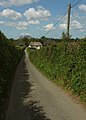
 Easter Hill (B3227), Atherington - geograph.org.uk - 6729585.jpg 2,000 × 1,521; 2.28 MB
-
 Entrance drive to Bremridge Farm (geograph 6147624).jpg 4,207 × 2,673; 1.81 MB
-
 Farmland at Wanhill - geograph.org.uk - 672682.jpg 640 × 281; 52 KB
-
 Fence near Greater Knowle Farm - geograph.org.uk - 6146927.jpg 4,245 × 2,545; 2.11 MB
-
 Field and lane near Atherington - geograph.org.uk - 6147361.jpg 4,138 × 2,802; 1.99 MB
-
 Field by Moor Copse - geograph.org.uk - 6141131.jpg 4,288 × 2,848; 2.16 MB
-
 Field near Atherington - geograph.org.uk - 6147344.jpg 4,288 × 2,848; 2.03 MB
-
 Field near Fishleigh Bridge - geograph.org.uk - 6148236.jpg 3,689 × 1,999; 860 KB
-
 Field near Fishleigh Bridge - geograph.org.uk - 6148243.jpg 4,215 × 1,951; 1.58 MB
-
 Field near Greater Knowle Farm - geograph.org.uk - 6146737.jpg 4,122 × 2,646; 1.53 MB
-
 Field near Greater Knowle Farm - geograph.org.uk - 6146738.jpg 3,814 × 2,492; 2.06 MB
-
 Field near Greater Knowle Farm - geograph.org.uk - 6146740.jpg 3,203 × 2,178; 1.23 MB
-
 Field near Potem's Cross - geograph.org.uk - 6141101.jpg 4,288 × 2,848; 2.54 MB
-
 Field near Wanhill - geograph.org.uk - 672855.jpg 640 × 480; 84 KB
-
 Field with a view near Eastacombe - geograph.org.uk - 671873.jpg 640 × 480; 107 KB
-
 Field, Boreat Moor - geograph.org.uk - 6147074.jpg 4,288 × 2,848; 2.27 MB
-
 Field, Cole's Moor - geograph.org.uk - 6147077.jpg 4,288 × 2,848; 2.04 MB
-
 Field, Cole's Moor - geograph.org.uk - 6147080.jpg 4,288 × 2,848; 2.26 MB
-
 Fields at Christmas Close - geograph.org.uk - 671717.jpg 640 × 440; 110 KB
-
 Fields near Rectory Cottage, Atherington - geograph.org.uk - 6147405.jpg 4,240 × 2,332; 1.44 MB
-
 Fields west of Atherington - geograph.org.uk - 671854.jpg 640 × 480; 78 KB
-
 Fishleigh Bridge - geograph.org.uk - 3441352.jpg 1,024 × 768; 158 KB
-
 Fishleigh Rock Garage - geograph.org.uk - 456104.jpg 640 × 427; 47 KB
-
 Ford at Fishleigh Barton - geograph.org.uk - 4189303.jpg 3,872 × 2,592; 4.18 MB
-
 From the lane to Eastacombe - geograph.org.uk - 671810.jpg 640 × 445; 91 KB
-
 Gated minor road at Little Weir - geograph.org.uk - 3664403.jpg 640 × 427; 196 KB
-
 Grass field, Boreat Moor - geograph.org.uk - 6141122.jpg 4,284 × 2,640; 1.8 MB
-
 Grass field, Boreat Moor - geograph.org.uk - 6146952.jpg 3,956 × 2,527; 2.16 MB
-
 Grass field, Boreat Moor - geograph.org.uk - 6146957.jpg 4,258 × 1,976; 1.59 MB
-
 Grass field, Lilcot Farm - geograph.org.uk - 6147939.jpg 3,891 × 2,586; 1.99 MB
-
 Grass field, Lilcot Farm - geograph.org.uk - 6147942.jpg 4,080 × 2,474; 2.61 MB
-
 Half-timbered garage in Fisherton Wood - geograph.org.uk - 3441334.jpg 1,024 × 1,024; 182 KB
-
 Houses on the B3227 at Langridgeford - geograph.org.uk - 6729575.jpg 2,000 × 1,094; 2.2 MB
-
 Junction at Fishleigh Rock - geograph.org.uk - 3441350.jpg 1,024 × 768; 82 KB
-
 Junction of B3227 with A377 - geograph.org.uk - 3441342.jpg 1,024 × 768; 125 KB
-
 Junction, Atherington - geograph.org.uk - 6147095.jpg 3,766 × 2,397; 1.22 MB
-
 Lane from Potem's Cross - geograph.org.uk - 6146584.jpg 4,288 × 2,848; 2.22 MB
-
 Lane from Potem's Cross - geograph.org.uk - 6146594.jpg 4,164 × 2,523; 1,010 KB
-
 Lane from Potem's Cross - geograph.org.uk - 6146615.jpg 4,288 × 2,848; 2.46 MB
-
 Lane near Greater Knowle Farm - geograph.org.uk - 6146630.jpg 4,288 × 2,848; 2.23 MB
-
 Lane near Greater Knowle Farm - geograph.org.uk - 6148256.jpg 4,288 × 2,848; 2.13 MB
-
 Lane near Rectory Cottage, Atherington - geograph.org.uk - 6147391.jpg 4,288 × 2,848; 2.13 MB
-
 Lane north at Atherington - geograph.org.uk - 5923218.jpg 640 × 480; 74 KB
-
 Lane to Atherington - geograph.org.uk - 668106.jpg 498 × 640; 75 KB
-
 Lane to Brown's Hill Head - geograph.org.uk - 672832.jpg 640 × 436; 62 KB
-
 Lane to Eastacombe - geograph.org.uk - 668165.jpg 640 × 528; 103 KB
-
 Lane to Fishleigh Bridge - geograph.org.uk - 6147577.jpg 4,282 × 2,640; 1.34 MB
-
 Lane to Fishleigh Bridge - geograph.org.uk - 6147618.jpg 4,158 × 2,676; 1.14 MB
-
 Lane to Fishleigh Bridge - geograph.org.uk - 671788.jpg 468 × 640; 93 KB
-
 Lane to High Bickington - geograph.org.uk - 6146963.jpg 4,288 × 2,848; 2.29 MB
-
 Lane to Langley Cross - geograph.org.uk - 668243.jpg 640 × 480; 72 KB
-
 Lane to Langridgeford - geograph.org.uk - 668204.jpg 577 × 640; 117 KB
-
 Lane to Potem's Cross - geograph.org.uk - 6146618.jpg 4,288 × 2,848; 2.26 MB
-
 Lane to Potem's Cross - geograph.org.uk - 6146943.jpg 4,288 × 2,848; 1.53 MB
-
 Lane to Wanhill - geograph.org.uk - 672599.jpg 499 × 640; 92 KB
-
 Lane, Boreat Moor - geograph.org.uk - 6146932.jpg 4,288 × 2,848; 2.22 MB
-
 Langdridge , Langridge Farm - geograph.org.uk - 6184473.jpg 6,000 × 4,000; 6.92 MB
-
 Langham Lake valley - geograph.org.uk - 672740.jpg 640 × 450; 83 KB
-
 Langridge , Crossways - geograph.org.uk - 6184472.jpg 6,000 × 4,000; 6.95 MB
-
 Langridge cross - geograph.org.uk - 4309337.jpg 640 × 480; 80 KB
-
 Langridgeford , The B3227 - geograph.org.uk - 4116036.jpg 4,288 × 2,848; 6.58 MB
-
 Langridgeford , The B3227 - geograph.org.uk - 6349410.jpg 6,000 × 4,000; 6.84 MB
-
 Langridgeford , The B3227 - geograph.org.uk - 6349415.jpg 6,000 × 4,000; 6.41 MB
-
 Little Knowle Farm, High Bickington - geograph.org.uk - 933395.jpg 640 × 480; 46 KB
-
 Little Weir - geograph.org.uk - 609909.jpg 640 × 428; 80 KB
-
 Little Weir - geograph.org.uk - 609988.jpg 640 × 428; 109 KB
-
 Little Weir Farm, Umberleigh - geograph.org.uk - 6730905.jpg 2,000 × 1,343; 2.42 MB
-

-

-
 Looking west on the B3227 at Langridgeford - geograph.org.uk - 3510381.jpg 1,600 × 1,200; 852 KB
-
 Meadows beside the Taw - August 2011 - panoramio.jpg 2,014 × 1,508; 793 KB
-

-
 Mobile phone pole at Fisherton - geograph.org.uk - 89416.jpg 450 × 600; 73 KB
-
 Modern Houses in Atherington - geograph.org.uk - 344367.jpg 537 × 295; 42 KB
-
 Moor Copse - geograph.org.uk - 671703.jpg 640 × 480; 80 KB
-
 Moor Copse from near Christmas Close - geograph.org.uk - 671732.jpg 640 × 480; 112 KB
-
 Moor Copse from near Christmas Close - geograph.org.uk - 671766.jpg 640 × 539; 116 KB
-
 North Devon , Brown's Hill Head - geograph.org.uk - 4116005.jpg 4,288 × 2,848; 6.29 MB
-
 North Devon , Brown's Hill Head - geograph.org.uk - 4116016.jpg 4,288 × 2,848; 5.38 MB
-
 North Devon , Brown's Hill Head - geograph.org.uk - 6184443.jpg 6,000 × 4,000; 6.55 MB
-
 North Devon , Country Gates - geograph.org.uk - 4116002.jpg 4,288 × 2,848; 6.74 MB
-
 North Devon , Country Lane - geograph.org.uk - 4115987.jpg 4,288 × 2,848; 6.09 MB
-
 North Devon , Country Lane - geograph.org.uk - 4115991.jpg 4,288 × 2,848; 7.55 MB
-
 North Devon , Country Lane - geograph.org.uk - 4115997.jpg 4,288 × 2,848; 6.38 MB
-
 North Devon , Country Lane - geograph.org.uk - 4116015.jpg 4,288 × 2,848; 5.32 MB
-
 North Devon , Country Lane - geograph.org.uk - 4116019.jpg 4,288 × 2,848; 6.59 MB
-
 North Devon , Country Lane - geograph.org.uk - 4116020.jpg 4,288 × 2,848; 6.7 MB
-
 North Devon , Country Lane - geograph.org.uk - 4116027.jpg 4,288 × 2,848; 5.99 MB
-
 North Devon , Country Lane - geograph.org.uk - 4116030.jpg 2,848 × 4,288; 6.18 MB
-
 North Devon , Country Lane - geograph.org.uk - 4116031.jpg 4,288 × 2,848; 6.21 MB
-
 North Devon , Country Lane - geograph.org.uk - 4116032.jpg 4,288 × 2,848; 6.31 MB
-
 North Devon , Country Lane - geograph.org.uk - 6147063.jpg 6,000 × 4,000; 6.16 MB
-
 North Devon , Country Lane - geograph.org.uk - 6147064.jpg 6,000 × 4,000; 7.18 MB
-
 North Devon , Country Lane - geograph.org.uk - 6147071.jpg 6,000 × 4,000; 7.14 MB
-
 North Devon , Country Lane - geograph.org.uk - 6184435.jpg 6,000 × 4,000; 5.77 MB
-
 North Devon , Country Lane - geograph.org.uk - 6184451.jpg 6,000 × 4,000; 6.46 MB
-
 North Devon , Country Lane - geograph.org.uk - 6184453.jpg 6,000 × 4,000; 6.43 MB
-
 North Devon , Country Lane - geograph.org.uk - 6184468.jpg 6,000 × 4,000; 7.1 MB
-
 North Devon , Country Lane - geograph.org.uk - 6184479.jpg 6,000 × 4,000; 7.5 MB
-
 North Devon , Country Lane - geograph.org.uk - 6184482.jpg 6,000 × 4,000; 6.48 MB
-
 North Devon , Country Lane - geograph.org.uk - 6184484.jpg 6,000 × 4,000; 7.72 MB
-
 North Devon , Country Lane - geograph.org.uk - 6184500.jpg 6,000 × 4,000; 6.81 MB
-
 North Devon , Country Lane - geograph.org.uk - 6184501.jpg 6,000 × 4,000; 6.66 MB
-
 North Devon , Country Lane - geograph.org.uk - 6184510.jpg 6,000 × 4,000; 6.51 MB
-
 North Devon , Countryside Scenery - geograph.org.uk - 3594351.jpg 4,288 × 2,848; 5.39 MB
-
 North Devon , Countryside Scenery - geograph.org.uk - 3594352.jpg 4,288 × 2,848; 5.89 MB
-
 North Devon , Countryside Scenery - geograph.org.uk - 6147067.jpg 6,000 × 4,000; 5.73 MB
-
 North Devon , Countryside Scenery - geograph.org.uk - 6147068.jpg 6,000 × 4,000; 5.86 MB
-
 North Devon , Countryside Scenery - geograph.org.uk - 6147069.jpg 6,000 × 4,000; 5.81 MB
-
 North Devon , Countryside Scenery - geograph.org.uk - 6147070.jpg 6,000 × 4,000; 6.54 MB
-
 North Devon , Countryside Scenery - geograph.org.uk - 6184446.jpg 6,000 × 4,000; 5.76 MB
-
 North Devon , Countryside Scenery - geograph.org.uk - 6184448.jpg 6,000 × 4,000; 6.43 MB
-
 North Devon , Countryside Scenery - geograph.org.uk - 6184449.jpg 6,000 × 4,000; 7.51 MB
-
 North Devon , Countryside Scenery - geograph.org.uk - 6184458.jpg 6,000 × 4,000; 6.97 MB
-
 North Devon , Countryside Scenery - geograph.org.uk - 6184462.jpg 6,000 × 4,000; 6.02 MB
-
 North Devon , Countryside Scenery - geograph.org.uk - 6184467.jpg 6,000 × 4,000; 7.18 MB
-
 North Devon , Countryside Scenery - geograph.org.uk - 6184475.jpg 6,000 × 4,000; 6.38 MB
-
 North Devon , Gate ^ Sheep - geograph.org.uk - 4116010.jpg 4,288 × 2,848; 5.35 MB
-
 North Devon , Grassy Field - geograph.org.uk - 4115994.jpg 4,288 × 2,848; 6 MB
-
 North Devon , Grassy Field - geograph.org.uk - 4115995.jpg 4,288 × 2,848; 4.83 MB
-
 North Devon , Grassy Field - geograph.org.uk - 4116013.jpg 4,288 × 2,848; 6.33 MB
-
 North Devon , Grassy Field - geograph.org.uk - 4116024.jpg 4,288 × 2,848; 6.33 MB
-
 North Devon , Grassy Field - geograph.org.uk - 4116026.jpg 4,288 × 2,848; 5.23 MB
-
 North Devon , Grassy Field ^ Bales - geograph.org.uk - 4116000.jpg 4,288 × 2,848; 5.21 MB
-
 North Devon , Grassy Field ^ Gate - geograph.org.uk - 6184455.jpg 6,000 × 4,000; 6.59 MB
-
 North Devon , Grassy Field ^ Gate - geograph.org.uk - 6184480.jpg 6,000 × 4,000; 6.11 MB
-
 North Devon , Grassy Field ^ Sheep - geograph.org.uk - 4116022.jpg 4,288 × 2,848; 6.43 MB
-
 North Devon , Grassy Field ^ Sheep - geograph.org.uk - 4116025.jpg 4,288 × 2,848; 6.29 MB
-
 North Devon , Grassy Field ^ Sheep - geograph.org.uk - 6184437.jpg 6,000 × 4,000; 6.21 MB
-
 North Devon , Grassy Field ^ Sheep - geograph.org.uk - 6184439.jpg 6,000 × 4,000; 6.76 MB
-
 North Devon , Grassy Field ^ Sheep - geograph.org.uk - 6184441.jpg 6,000 × 4,000; 6.66 MB
-
 North Devon , Grassy Track - geograph.org.uk - 6184488.jpg 6,000 × 4,000; 6.78 MB
-
 North Devon , Grassy Track - geograph.org.uk - 6184497.jpg 6,000 × 4,000; 6.18 MB
-
 North Devon , Langley Cross - geograph.org.uk - 4115983.jpg 4,288 × 2,848; 5.61 MB
-
 North Devon , Langley Cross - geograph.org.uk - 6147062.jpg 6,000 × 4,000; 6.63 MB
-
 North Devon , Lower Deer Park - geograph.org.uk - 6184492.jpg 6,000 × 4,000; 6.33 MB
-
 North Devon , Moor Park - geograph.org.uk - 6184507.jpg 6,000 × 4,000; 7.15 MB
-
 North Devon , Ploughed Field - geograph.org.uk - 6147073.jpg 6,000 × 4,000; 6.13 MB
-
 North Devon , Ploughed Field - geograph.org.uk - 6184436.jpg 6,000 × 4,000; 5.74 MB
-
 North Devon , Potem's Cross - geograph.org.uk - 6184478.jpg 6,000 × 4,000; 6.21 MB
-
 North Devon , The A377 - geograph.org.uk - 6184573.jpg 6,000 × 4,000; 6.67 MB
-
 North Devon , Track - geograph.org.uk - 6184489.jpg 6,000 × 4,000; 6.38 MB
-
 North Devon , Track - geograph.org.uk - 6184495.jpg 6,000 × 4,000; 7.01 MB
-
 North Devon , Track - geograph.org.uk - 6184575.jpg 6,000 × 4,000; 6.95 MB
-
 North Devon , Wanhill - geograph.org.uk - 6184450.jpg 6,000 × 4,000; 6.87 MB
-
 Orchids near Greater Knowle Farm - geograph.org.uk - 6146793.jpg 2,660 × 3,707; 807 KB
-
 Ordnance Survey Cut Mark - geograph.org.uk - 3862166.jpg 480 × 640; 115 KB
-
 Ordnance Survey Cut Mark - geograph.org.uk - 4741778.jpg 4,000 × 3,000; 3.91 MB
-
 Ordnance Survey Flush Bracket 1644 - geograph.org.uk - 4720195.jpg 4,000 × 3,000; 3.71 MB
-
 Ordnance Survey Flush Bracket 1648 - geograph.org.uk - 4734423.jpg 4,000 × 3,000; 4.07 MB
-
 Ordnance Survey Flush Bracket 1649 - geograph.org.uk - 4720192.jpg 4,000 × 3,000; 3.22 MB
-
 Ordnance Survey Flush Bracket 1652 - geograph.org.uk - 4741766.jpg 4,000 × 3,000; 4.28 MB
-
 Ordnance Survey Flush Bracket 1653 - geograph.org.uk - 4741753.jpg 4,000 × 3,000; 2.99 MB
-
 Pasture by Wessey Copse - geograph.org.uk - 6141102.jpg 4,288 × 2,848; 2.31 MB
-
 Potem's Cross - geograph.org.uk - 6146579.jpg 4,240 × 2,546; 1.61 MB
-
 Potem's Cross - geograph.org.uk - 6146606.jpg 4,288 × 2,848; 2.05 MB
-
 Rectory Cottage, Atherington (geograph 6147363).jpg 2,524 × 3,530; 877 KB
-
 River Taw at Black Bridge - geograph.org.uk - 5301100.jpg 1,565 × 922; 323 KB
-
 Road leaving Atherington - geograph.org.uk - 6147088.jpg 4,223 × 2,710; 1.3 MB
-
 Seat and gateway, Atherington - geograph.org.uk - 6147154.jpg 4,288 × 2,848; 2.5 MB
-

-
 St Mary's church, Atherington - geograph.org.uk - 6147430.jpg 2,736 × 1,578; 449 KB
-

-
 St. Mary's Church, Atherington - geograph.org.uk - 6729579.jpg 1,454 × 2,000; 2.29 MB


.jpg)


.jpg)

.jpg)


,_Atherington_-_geograph.org.uk_-_6729585.jpg)
.jpg)


.jpg)


_-_geograph.org.uk_-_3513357.jpg)


