Category:Athelney
Jump to navigation
Jump to search
Ænglisc: Æðelinga īeg is in Secgmōr wonge þe gēo wæs mersc, in Sumorsǣta scīre on Englume. Hit is lytel wīc nēah Norþperettūne and gēo wæs gesundorod in Sumorsǣtna efnlande. Man cnǣwþ hit mǣst for þǣm þe Ælfrēd se Grēata cyning behȳdde þǣr, þanon ēode hē tō oferdrīfenne þā Dene in þǣre Beadwe be Eðandūne.
English: Athelney is located between the villages of Burrowbridge and East Lyng in the Sedgemoor district of Somerset, England. The area is known as the Isle of Athelney, because it was once a very low isolated island in the 'very great swampy and impassable marshes' of the Somerset Levels. Much of the Levels are below sea level. They are now drained for agricultural use during the summer, but are regularly flooded in the winter.
Esperanto: Athelney situas en la regiono de Somerset, Anglio, nomata Sedgemoor. Antaŭ ĝi estis insulo ĉirkaŭita de marĉoj. Nuntempe oftas vintraj inundoj.
Español: Athelney está localizado entre las poblaciones de Burrowbridge y East Lyng, en Somerset, Inglaterra. Esta zona es conocida como "La Isla de Athelney" debido a que antiguamente hubo una isla aislada situada en los pantanos de los Llanos de Somerset. Gran parte de los llanos está por debajo del nivel del mar. Durante el verano son drenados para uso agrícola; en invierno permanecen inundados.
Polski: Athelney - historyczne miejsce w Anglii w dystrykcie Sedgemoor, w hrabstwie Somerset. Okoliczny teren znany był jako The Isle of Athelney (Wyspa Athelney) ponieważ był kiedyś izolowaną kępą na mokradłach Somerset Levels. Duża część terenu mokradeł leży poniżej poziomu morza. Obecnie osuszone, latem są użytkowane rolniczo, lecz zimą regularnie podtapiane.
village in the United Kingdom  L'« île » d'Athelney, surplombée par le monument au roi Alfred. | |||||
| Upload media | |||||
| Instance of | |||||
|---|---|---|---|---|---|
| Location | Sedgemoor, Somerset, South West England, England | ||||
 | |||||
Subcategories
This category has only the following subcategory.
K
- King Alfred's Monument, Athelney (13 F)
Media in category "Athelney"
The following 30 files are in this category, out of 30 total.
-
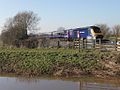 Athelney - FGW 43136.JPG 1,024 × 768; 502 KB
-
 Athelney - geograph.org.uk - 4437263.jpg 800 × 533; 139 KB
-

-
 Curload - geograph.org.uk - 460659.jpg 640 × 480; 102 KB
-
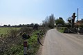
 Cuts Road, Athelney - geograph.org.uk - 2929139.jpg 3,888 × 2,592; 4.64 MB
-
 Cuts Road, Athelney - geograph.org.uk - 4437234.jpg 800 × 533; 189 KB
-
 Dredged River Tone at Athelney - geograph.org.uk - 4075166.jpg 1,024 × 615; 120 KB
-

-
 House at Athelney - geograph.org.uk - 2006549.jpg 640 × 480; 71 KB
-
 Houses and cyclist at Athelney - geograph.org.uk - 4546141.jpg 640 × 480; 134 KB
-
 Level crossing just south of Athelney - geograph.org.uk - 4546132.jpg 640 × 480; 122 KB
-
 River Tone at Athelney - geograph.org.uk - 4848608.jpg 1,024 × 836; 192 KB
-
 River Tone at Athelney - geograph.org.uk - 5496728.jpg 640 × 535; 132 KB
-
 River Tone, Athelney - geograph.org.uk - 4437250.jpg 800 × 533; 141 KB
-
 Riverside Cottages, Athelney - geograph.org.uk - 4848615.jpg 1,024 × 768; 193 KB
-
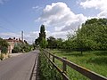
 Road at Athelney - geograph.org.uk - 2006565.jpg 640 × 480; 64 KB
-
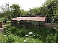 Shed by Stanmoor Road - geograph.org.uk - 442583.jpg 640 × 480; 149 KB
-
 The Tone at Athelney - geograph.org.uk - 2006286.jpg 640 × 480; 97 KB
-
 Aller Moor Pumping Station - geograph.org.uk - 1156045.jpg 640 × 405; 78 KB
-
 Barn and cottages at Curload - geograph.org.uk - 463680.jpg 640 × 480; 115 KB
-
 Burrow Bridge - geograph.org.uk - 196622.jpg 640 × 480; 99 KB
-
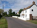
 Cottage on Stanmoor Road - geograph.org.uk - 442628.jpg 640 × 480; 114 KB
-
 Curload Farm - geograph.org.uk - 463652.jpg 640 × 480; 117 KB
-
 Field bindweed (Convolvulus arvensis) - geograph.org.uk - 196628.jpg 640 × 481; 62 KB
-
 Hurdles 4 sale - geograph.org.uk - 441758.jpg 640 × 480; 145 KB
-
-
 Orchard on edge of Stan Moor - geograph.org.uk - 442535.jpg 640 × 480; 129 KB
-
 Stanmoor Garage - geograph.org.uk - 442552.jpg 640 × 372; 74 KB
-
 Stanmoor Road - geograph.org.uk - 442560.jpg 640 × 480; 102 KB
-
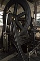
 Steam pumping engine Curry Moor - geograph.org.uk - 676927.jpg 422 × 640; 68 KB


_-_geograph.org.uk_-_196628.jpg)


