Category:Atateken Street
Jump to navigation
Jump to search
street in Montreal, Canada | |||||
| Upload media | |||||
| Instance of | |||||
|---|---|---|---|---|---|
| Location | Ville-Marie, Montreal, Urban agglomeration of Montreal, Montreal Region, Quebec, Canada | ||||
| Language of work or name | |||||
 | |||||
Français : La rue Atateken (prononcé a-de-dé-gan et signifie « fraternité » en mohawk), anciennement rue Amherst, est une rue de Montréal d'orientation nord-sud. Elle relie la rue Saint-Antoine à la rue Sherbrooke et traverse ainsi le Village gai.
English: Atateken Street (meaning "brotherhood" or "fraternity among nations" in Mohawk), formerly Amherst Street, is a north-south street in Montreal from Saint-Antoine Street to Sherbrooke Street.
Subcategories
This category has the following 6 subcategories, out of 6 total.
Media in category "Atateken Street"
The following 11 files are in this category, out of 11 total.
-
1050 Rene-Levesque Est.jpg 4,608 × 3,456; 3.96 MB
-
1100 Rene-Levesque Est.jpg 4,608 × 3,456; 3.65 MB
-
1101 rue Sainte-Catherine Est.jpg 4,608 × 3,456; 3.53 MB
-
Montréal, 11 avril 1906. Rue Amherst près de rue St-Catherine. (6440313257).jpg 2,592 × 2,016; 2.28 MB
-
Montréal, vers 1905-1910. Lancien Marché Saint-Jacques. (6435133319).jpg 3,140 × 1,458; 1.25 MB
-
Rue Amherst (extrémité sud), Tour de l'Horloge, Viaduc Notre-Dame.jpg 4,224 × 3,168; 5.37 MB
-
Rue Amherst en direction nord sous le viaduc Notre-Dame.jpg 3,168 × 4,224; 2.97 MB
-
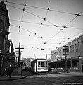
Rue Amherst vers 1937.jpg 1,031 × 1,050; 344 KB
-
Rue Amherst à l'angle de la rue de la Commune.jpg 4,224 × 3,168; 5.58 MB
-
Rue Amherst, coin Viger en direction sud, Tour de l'Horloge.jpg 3,168 × 4,224; 5.29 MB
-
Tour Horloge.JPG 2,112 × 2,816; 1.71 MB


