Category:Aston Sandford
Jump to navigation
Jump to search
English: Aston Sandford is a small village and civil parish within Aylesbury Valedistrict in Buckinghamshire, England, about a mile east of Haddenham. According to the 2001 census the parish had a population of 50.
Svenska: Aston Sandford är en by och civil parish i Aylesbury Vale-distriktet i Buckinghamshire i England. Byn ligger cirka 1,6 km öster om Haddenham. 1,5 km nordost om byn ligger Aston Mullins. Byn var 1086 känd som Cold Aston, under Manno the Breton ägo.
village in Buckinghamshire, United Kingdom  | |||||
| Upload media | |||||
| Instance of | |||||
|---|---|---|---|---|---|
| Location | Buckinghamshire, South East England, England | ||||
| Population |
| ||||
 | |||||
Subcategories
This category has only the following subcategory.
Media in category "Aston Sandford"
The following 21 files are in this category, out of 21 total.
-
 Aston Sandford's only road - geograph.org.uk - 4527239.jpg 3,544 × 2,664; 2.43 MB
-
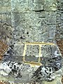 Benchmark on buttress of St Michael's Church - geograph.org.uk - 2065889.jpg 768 × 1,024; 299 KB
-
 Cows in the Meadow, Aston Sandford - geograph.org.uk - 4527246.jpg 3,724 × 2,520; 2.09 MB
-
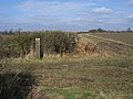 Footpath and Bridleway Junction - geograph.org.uk - 1229499.jpg 640 × 480; 89 KB
-
 Footpath Crossing - geograph.org.uk - 4527221.jpg 3,484 × 2,556; 2.44 MB
-
 Footpath near Aston Sandford - geograph.org.uk - 6062258.jpg 3,772 × 2,782; 1.56 MB
-
 Footpath through thistles - geograph.org.uk - 2068760.jpg 800 × 600; 149 KB
-
 Footpath to Aston Sandford - geograph.org.uk - 2068757.jpg 800 × 600; 164 KB
-
 Footpath to Walridge Manor - geograph.org.uk - 1186803.jpg 640 × 480; 77 KB
-
 Junction of public rights of way - geograph.org.uk - 2068769.jpg 800 × 600; 147 KB
-
 The life of the Rev. Thomas Scott, D. D., rector of Aston Sandford, Bucks- (IA lifeofrevthomass01scot).pdf 583 × 1,081, 430 pages; 49.38 MB
-
 Manor Farm and courtyard, Aston Sandford - geograph.org.uk - 43223.jpg 640 × 480; 116 KB
-
 New Entrance to Black Barn Farm - geograph.org.uk - 4527256.jpg 4,000 × 2,664; 2.61 MB
-
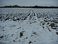
 No clear path visible - geograph.org.uk - 1229484.jpg 640 × 480; 79 KB
-
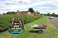 Penns Flowers - geograph.org.uk - 4528472.jpg 4,000 × 2,664; 2.61 MB
-
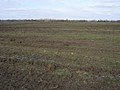
 Ploughed field near Aston Sandford - geograph.org.uk - 43329.jpg 640 × 480; 105 KB
-
 St Michael and All Angels, Aston Sandford - geograph.org.uk - 2842650.jpg 1,600 × 1,080; 318 KB
-
 St Michael's church Aston Sandford - geograph.org.uk - 3229534.jpg 2,560 × 1,920; 960 KB
-
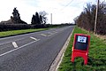 Thame Road by Little Acre Farm - geograph.org.uk - 3888672.jpg 1,500 × 999; 269 KB
-
 Thame Road to Kingsey - geograph.org.uk - 3888667.jpg 1,500 × 999; 257 KB
-
 Thame Road to Longwick - geograph.org.uk - 3890962.jpg 1,500 × 999; 203 KB


