Category:Astley, Warwickshire
Jump to navigation
Jump to search
village in Warwickshire, UK  | |||||
| Upload media | |||||
| Instance of | |||||
|---|---|---|---|---|---|
| Location | North Warwickshire, Warwickshire, West Midlands, England | ||||
| Population |
| ||||
| Area |
| ||||
| Said to be the same as | Astley (Wikimedia duplicated page, civil parish) | ||||
 | |||||
English: Astley is a village and parish within the North Warwickshire district of Warwickshire, England. In the 2001 census it had a population of 219.
Subcategories
This category has the following 3 subcategories, out of 3 total.
Media in category "Astley, Warwickshire"
The following 57 files are in this category, out of 57 total.
-
-

-
 Approaching Astley - geograph.org.uk - 5288389.jpg 4,128 × 2,322; 3.83 MB
-
 Arable land east of Astley Lane - geograph.org.uk - 5286197.jpg 1,600 × 901; 688 KB
-
 Astley Book Barn - geograph.org.uk - 4859807.jpg 1,500 × 1,125; 1.62 MB
-
 Astley Book Farm - geograph.org.uk - 2086513.jpg 1,600 × 1,200; 470 KB
-
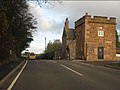
 Astley crossroads - geograph.org.uk - 2692994.jpg 640 × 480; 70 KB
-
 Astley Lane - geograph.org.uk - 4771559.jpg 640 × 480; 67 KB
-
 Astley Lane - geograph.org.uk - 5286192.jpg 1,600 × 901; 694 KB
-
 Astley Lane - geograph.org.uk - 5288374.jpg 4,128 × 2,322; 3.13 MB
-
 Astley Lane - geograph.org.uk - 5288382.jpg 4,128 × 2,322; 5.86 MB
-
 Astley Lane - geograph.org.uk - 5310944.jpg 640 × 480; 69 KB
-
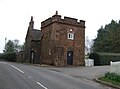 Astley Lodge - geograph.org.uk - 5311059.jpg 640 × 477; 58 KB
-
 Astley Lodge, Park Lane (geograph 6913530).jpg 2,592 × 1,936; 1.76 MB
-
 Astley Parish Trail Gate - geograph.org.uk - 6676644.jpg 1,536 × 2,048; 1.4 MB
-
 Astley Road at Astley Pool - geograph.org.uk - 2693013.jpg 640 × 480; 65 KB
-

-
 B4102 approaching Astley - geograph.org.uk - 2692989.jpg 640 × 480; 63 KB
-
 Barn on Nuthurst Lane, Astley - geograph.org.uk - 5311051.jpg 640 × 480; 50 KB
-
 Church of St. Mary the Virgin, Astley - geograph.org.uk - 5311049.jpg 2,848 × 2,136; 1.36 MB
-
 Close up, Elizabeth II postbox on Breach Oak Lane - geograph.org.uk - 5311412.jpg 1,352 × 2,610; 655 KB
-
 Close up, Elizabeth II postbox, Astley - geograph.org.uk - 5311501.jpg 1,615 × 2,192; 734 KB
-
 Corley Services on the M6 - geograph.org.uk - 5288397.jpg 4,128 × 2,322; 5.04 MB
-
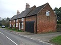 Cottages on Nuthurst Lane, Astley - geograph.org.uk - 5311057.jpg 640 × 480; 68 KB
-
 Cottages, Astley - geograph.org.uk - 5311502.jpg 2,848 × 2,136; 1.26 MB
-

-
 Elizabeth II postbox, Astley - geograph.org.uk - 5311500.jpg 640 × 480; 83 KB
-

-
 Entrance to Oak View Farm from Park Lane - geograph.org.uk - 2884626.jpg 640 × 425; 107 KB
-
 Farmland at Vauls Farm - geograph.org.uk - 5288378.jpg 4,128 × 2,322; 3.55 MB
-
 Farmland east of Corley - geograph.org.uk - 5288403.jpg 4,128 × 2,322; 4.8 MB
-
 Field entrance off Howe Green Lane - geograph.org.uk - 5311032.jpg 640 × 480; 104 KB
-
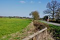
 Field south of Astley - geograph.org.uk - 5311044.jpg 640 × 480; 68 KB
-
 Gateway to Fitzroy Farming, Astley - geograph.org.uk - 2886415.jpg 640 × 425; 96 KB
-
 Grazing and hedgerow - geograph.org.uk - 5310958.jpg 640 × 480; 68 KB
-
 Grazing beside Smorrall Lane - geograph.org.uk - 5310966.jpg 640 × 480; 64 KB
-
 Grazing off Astley Lane - geograph.org.uk - 5310940.jpg 640 × 480; 57 KB
-
 Holly Bush Farm at Astley - geograph.org.uk - 2886292.jpg 640 × 425; 69 KB
-
 Howe Green Lane - geograph.org.uk - 5288395.jpg 4,128 × 2,322; 3.73 MB
-
 Howe Green Lane - geograph.org.uk - 5311036.jpg 640 × 480; 81 KB
-
 Lodge Farm, Astley, Warwickshire. - geograph.org.uk - 5723016.jpg 4,778 × 3,524; 7.55 MB
-
 Monument, Holly Bush Farm - geograph.org.uk - 2086498.jpg 768 × 1,024; 257 KB
-
 Nuthurst Lane, Astley - geograph.org.uk - 5311054.jpg 640 × 480; 42 KB
-
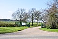
 Park Lane - geograph.org.uk - 5288392.jpg 4,128 × 2,322; 4.32 MB
-

-
 Park Lane in rolling countryside - geograph.org.uk - 2692976.jpg 640 × 480; 54 KB
-
 Road junction Smorral Lane and Hospital Lane - geograph.org.uk - 5237563.jpg 4,128 × 2,322; 5.41 MB
-
 Smorrall Lane - geograph.org.uk - 5310961.jpg 640 × 480; 104 KB
-
 Smorrall Lane - geograph.org.uk - 5311030.jpg 640 × 480; 59 KB
-

-
 South end of Birmingham Road, Ansley - geograph.org.uk - 3355169.jpg 1,024 × 768; 169 KB
-

-
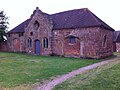 Stable block at Astley Castle, North Warwickshire (geograph 6940319).jpg 2,592 × 1,936; 2.01 MB
-
 The Coventry Way - geograph.org.uk - 5606456.jpg 1,600 × 900; 232 KB
-
 The Lantern of Arden - geograph.org.uk - 2087654.jpg 2,304 × 3,072; 2.64 MB
-
 Windmill Lane - geograph.org.uk - 5311046.jpg 640 × 480; 57 KB
-
 Windmill Lane near Oak Field Farm - geograph.org.uk - 5311045.jpg 640 × 480; 58 KB


.jpg)


.jpg)


