Category:Asterd
Jump to navigation
Jump to search
| Object location | | View all coordinates using: OpenStreetMap |
|---|
Nederlands: Afbeeldingen van de wijk de Asterd met de Asterdplas in het noordwesten van de gemeente Breda in de provincie Noord-Brabant in het zuiden van Nederland. De Asterd is nabij de wijken Heksenwiel, Kievitsloop en Overkroeten in het grote stadsdeel de Haagse Beemden. De Asterd is nabij het winkelcentrum Heksenwiel. De Asterd is onder meer bereikbaar vanaf de straten de Emerparklaan en de Westerhagelaan
neighborhood in Breda, the Netherlands   | |||||
| Upload media | |||||
| Instance of | |||||
|---|---|---|---|---|---|
| Location | Haagse Beemden, Breda, North Brabant, Netherlands | ||||
 | |||||
Nederlands: Asterd, Asterdplas, Haagse Beemden (wijk), Breda, Breda (gemeente), Noord-Brabant, Nederland
Subcategories
This category has the following 14 subcategories, out of 14 total.
Media in category "Asterd"
The following 11 files are in this category, out of 11 total.
-
 Afvalbakken Asterd P1150776.jpg 4,000 × 2,672; 6.19 MB
-
 Asterd DSCF9137.jpg 2,816 × 1,864; 2.56 MB
-
 Asterd P1150778.jpg 4,000 × 2,672; 6.14 MB
-
 Asterd P1150782.jpg 4,000 × 2,672; 5.85 MB
-
 Boom Asterd P1150781.jpg 2,672 × 4,000; 5.61 MB
-
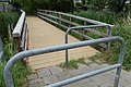
 Bruggetje Asterd P1150779.jpg 4,000 × 2,672; 6.05 MB
-
 BSV Boeimeer DSCF1031.JPG 4,000 × 2,664; 4.34 MB
-
 Emerparklaan DSCF4451.JPG 4,000 × 3,000; 4.83 MB
-
 Jupiterlaan DSCF1028.JPG 4,000 × 2,664; 4.29 MB
-
 Kerstboom Asterd DSCF9283.JPG 2,664 × 4,000; 4.17 MB
-
 P1030026Asterd.JPG 3,264 × 2,448; 3.72 MB


