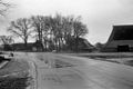
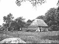
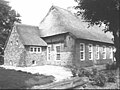
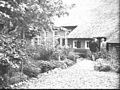
Category:Asserstraat 78 (Zuidvelde)
Jump to navigation
Jump to search
| Object location | | View all coordinates using: OpenStreetMap |
|---|
farmhouse in Noordenveld, Netherlands  | |||||
| Upload media | |||||
| Instance of | |||||
|---|---|---|---|---|---|
| Location | Zuidvelde, Noordenveld, Drenthe, Netherlands | ||||
| Street address |
| ||||
| Located on street |
| ||||
| Heritage designation |
| ||||
 | |||||
|
This is a category about rijksmonument number 30810
|
| Address |
|
Media in category "Asserstraat 78 (Zuidvelde)"
The following 100 files are in this category, out of 100 total.
-
 Achter- en zijgevel nr. F 331-31 - Zuidvelde - 20438497 - RCE.jpg 1,200 × 900; 104 KB
-
 Achter- en zijgevel nr. F 78-10 - Zuidvelde - 20438397 - RCE.jpg 1,200 × 900; 155 KB
-
 Achter- en zijgevel nr. F 78-9 - Zuidvelde - 20438396 - RCE.jpg 1,200 × 900; 116 KB
-
 Achter- en zijgevel nr. Norg 14 - Zuidvelde - 20438420 - RCE.jpg 1,200 × 900; 124 KB
-
 Achter- en zijgevel; bakhuis nr. F 331-30 - Zuidvelde - 20438413 - RCE.jpg 1,200 × 900; 131 KB
-
 Achterbaander nr. F 14-10 - Zuidvelde - 20438403 - RCE.jpg 1,200 × 900; 167 KB
-
 Achterbaander nr. F 172-35 - Zuidvelde - 20438422 - RCE.jpg 1,200 × 900; 145 KB
-
 Achterbaander nr. F 172-36 - Zuidvelde - 20438423 - RCE.jpg 1,200 × 900; 138 KB
-
 Achterbaander nr. F 79-23 - Zuidvelde - 20438410 - RCE.jpg 1,200 × 900; 167 KB
-
 Achtergevel - Zuidvelde - 20438485 - RCE.jpg 1,200 × 900; 198 KB
-
 Achtergevel nr. F 172-37 - Zuidvelde - 20438424 - RCE.jpg 1,200 × 900; 124 KB
-
 Achtergevel nr. F 429-17 - Zuidvelde - 20438473 - RCE.jpg 1,200 × 900; 166 KB
-
 Achtergevel nr. F 79-20 - Zuidvelde - 20438408 - RCE.jpg 1,200 × 900; 73 KB
-
 Asserstraat 78 (zuidzijde).jpg 4,608 × 3,456; 4.13 MB
-
 Bijschuur Asserstraat 78.jpg 4,608 × 3,456; 3.05 MB
-
 Boerderij - Zuidvelde - 20438488 - RCE.jpg 1,200 × 900; 181 KB
-
 Boerderij Asserstraat 78 Zuidvelde.jpg 5,333 × 3,000; 2.59 MB
-
 Boerderij met aangebouwde schuur nr. L 119 - Zuidvelde - 20464995 - RCE.jpg 1,200 × 900; 109 KB
-
 Boerderij, gezien naar de baander - Zuidvelde - 20438414 - RCE.jpg 1,200 × 884; 288 KB
-

-
 Brink 1 (oostzijde).jpg 4,608 × 3,456; 3.25 MB
-
 De boer bij de pomp en het emmerrek nr. F 14-15 - Zuidvelde - 20438391 - RCE.jpg 1,200 × 900; 164 KB
-
 Detail balk nr. F 14-7 - Zuidvelde - 20438439 - RCE.jpg 1,200 × 900; 178 KB
-
 Detail zijgevel nr. F 78-23 - Zuidvelde - 20438406 - RCE.jpg 1,200 × 900; 189 KB
-
 Erf met spoelplaats en emmerrek nr. F 14-14 - Zuidvelde - 20438390 - RCE.jpg 1,200 × 900; 180 KB
-
 Exterieur - Zuidvelde - 20225837 - RCE.jpg 1,190 × 1,200; 319 KB
-
 Exterieur - Zuidvelde - 20225838 - RCE.jpg 1,190 × 1,200; 344 KB
-
 Het gehele complex nr. F 78-22 - Zuidvelde - 20438405 - RCE.jpg 1,200 × 900; 105 KB
-
 Kelderraam met diefijzers nr. F 78-21 - Zuidvelde - 20438404 - RCE.jpg 1,200 × 900; 102 KB
-
 Kop- en zijgevel nr. F 225-33 - Zuidvelde - 20438431 - RCE.jpg 1,200 × 900; 143 KB
-
 Kop- en zijgevel nr. F 268-28 - Zuidvelde - 20438434 - RCE.jpg 1,200 × 900; 175 KB
-
 Kop- en zijgevel nr. F 78-17 - Zuidvelde - 20438392 - RCE.jpg 1,200 × 900; 187 KB
-
 Kopgevel - Zuidvelde - 20438480 - RCE.jpg 1,200 × 900; 122 KB
-
 Kopgevel - Zuidvelde - 20438483 - RCE.jpg 1,200 × 900; 173 KB
-
 Kopgevel - Zuidvelde - 20438484 - RCE.jpg 1,200 × 900; 175 KB
-
 Kopgevel geit nr. F 78-19 - Zuidvelde - 20438402 - RCE.jpg 1,200 × 900; 138 KB
-
 Kopgevel met aanbouw - Zuidvelde - 20438466 - RCE.jpg 1,200 × 900; 183 KB
-
 Kopgevel nr. F 14-8 - Zuidvelde - 20438440 - RCE.jpg 1,200 × 900; 170 KB
-
 Kopgevel nr. F 14-9 - Zuidvelde - 20438441 - RCE.jpg 1,200 × 900; 132 KB
-
 Kopgevel nr. F 225-34 - Zuidvelde - 20438432 - RCE.jpg 1,200 × 900; 131 KB
-
 Kopgevel nr. F 225-35 - Zuidvelde - 20438433 - RCE.jpg 1,200 × 900; 144 KB
-
 Kopgevel nr. F 429-22 - Zuidvelde - 20438478 - RCE.jpg 1,200 × 900; 85 KB
-
 Kopgevel nr. Norg 17 - Zuidvelde - 20438419 - RCE.jpg 1,200 × 900; 189 KB
-
 Muizentand en muuranker nr. F 225-32 - Zuidvelde - 20438430 - RCE.jpg 1,200 × 900; 149 KB
-
 Muuranker nr. F 225-30 - Zuidvelde - 20438428 - RCE.jpg 1,200 × 900; 134 KB
-
 Muuranker nr. F 78-20 - Zuidvelde - 20438388 - RCE.jpg 1,200 × 900; 145 KB
-
 Overzicht boerderij - Zuidvelde - 20438495 - RCE.jpg 1,200 × 904; 320 KB
-
 Overzicht boerderij met omgeving - Zuidvelde - 20438417 - RCE.jpg 1,200 × 914; 373 KB
-
 Overzicht boerderij met omgeving - Zuidvelde - 20438496 - RCE.jpg 1,200 × 917; 310 KB
-
 Overzicht rietgedekte boerderij - Zuidvelde - 20404485 - RCE.jpg 1,200 × 1,196; 369 KB
-
 Overzicht rietgedekte boerderij, erf - Zuidvelde - 20404486 - RCE.jpg 1,194 × 1,200; 359 KB
-
 Overzicht vanuit het noord-westen - Zuidvelde - 20225820 - RCE.jpg 1,200 × 800; 240 KB
-
 Overzicht vanuit het noorden - Zuidvelde - 20225818 - RCE.jpg 1,200 × 800; 191 KB
-
 Overzicht vanuit het westen - Zuidvelde - 20225821 - RCE.jpg 1,200 × 800; 197 KB
-
 Overzicht zuid-west zijde vanuit het noorden - Zuidvelde - 20225822 - RCE.jpg 1,200 × 797; 245 KB
-
 Raam nr. F 225-31 - Zuidvelde - 20438416 - RCE.jpg 1,200 × 900; 110 KB
-
 Schuur en (buur)boerderij nr. F 78-12 - Zuidvelde - 20438399 - RCE.jpg 1,200 × 900; 112 KB
-
 Schuur en (buur)boerderij nr. F 79-22 - Zuidvelde - 20438409 - RCE.jpg 1,200 × 900; 139 KB
-
 Schuur nr. F 193-1 - Zuidvelde - 20438425 - RCE.jpg 1,200 × 900; 105 KB
-
 Schuur nr. F 193-2 - Zuidvelde - 20438426 - RCE.jpg 1,200 × 900; 100 KB
-
 Schuurdak nr. F 193-3 - Zuidvelde - 20438443 - RCE.jpg 1,200 × 900; 140 KB
-
 Schuurtje nr. F 14-11 - Zuidvelde - 20438429 - RCE.jpg 1,200 × 900; 134 KB
-
 Schuurtje nr. F 79-24 - Zuidvelde - 20438411 - RCE.jpg 1,200 × 900; 153 KB
-
 Schuurtjes en konijnenhok nr. F 14-13 - Zuidvelde - 20438389 - RCE.jpg 1,200 × 900; 185 KB
-
 Voor- en rechterzijgevel nr. F 425-15 - Zuidvelde - 20438470 - RCE.jpg 1,200 × 900; 158 KB
-
 Voor- en zijgevel nr. F 331-33 - Zuidvelde - 20438401 - RCE.jpg 1,200 × 900; 129 KB
-
 Voor- en zijgevel PBK Van Leerij fotodrukkerij - Zuidvelde - 20438490 - RCE.jpg 1,200 × 900; 186 KB
-
 Voorgevel nr. F 331-32 - Zuidvelde - 20438454 - RCE.jpg 1,200 × 900; 165 KB
-
 Voorgevel nr. F 425-13 - Zuidvelde - 20438468 - RCE.jpg 1,200 × 900; 160 KB
-
 Voorgevel nr. F 425-14 - Zuidvelde - 20438469 - RCE.jpg 1,200 × 900; 146 KB
-
 Voorgevel nr. F 425-16 - Zuidvelde - 20438471 - RCE.jpg 1,200 × 900; 154 KB
-
 Zij- en achtergevel nr. F 429-18 - Zuidvelde - 20438474 - RCE.jpg 1,200 × 900; 124 KB
-
 Zij- en achtergevel nr. F 429-19 - Zuidvelde - 20438475 - RCE.jpg 1,200 × 900; 132 KB
-
 Zij- en achtergevel nr. F 78-5 - Zuidvelde - 20438394 - RCE.jpg 1,200 × 900; 138 KB
-
 Zij- en achtergevel nr. F 78-7 - Zuidvelde - 20438395 - RCE.jpg 1,200 × 900; 112 KB
-
 Zij- en achtergevel nr. Norg 15 - Zuidvelde - 20438421 - RCE.jpg 1,200 × 900; 132 KB
-

-
 Zijgevel - Zuidvelde - 20438482 - RCE.jpg 1,200 × 900; 193 KB
-
 Zijgevel - Zuidvelde - 20438486 - RCE.jpg 1,200 × 900; 166 KB
-
 Zijgevel - Zuidvelde - 20438487 - RCE.jpg 1,200 × 900; 209 KB
-
 Zijgevel - Zuidvelde - 20438493 - RCE.jpg 1,200 × 953; 89 KB
-
 Zijgevel nr. F 14-12 - Zuidvelde - 20438427 - RCE.jpg 1,200 × 900; 122 KB
-
 Zijgevel nr. F 14-3 - Zuidvelde - 20438436 - RCE.jpg 1,200 × 900; 145 KB
-
 Zijgevel nr. F 14-4 - Zuidvelde - 20438437 - RCE.jpg 1,200 × 900; 214 KB
-
 Zijgevel nr. F 14-5 - Zuidvelde - 20438438 - RCE.jpg 1,200 × 900; 200 KB
-
 Zijgevel nr. F 268-29 - Zuidvelde - 20438435 - RCE.jpg 1,200 × 900; 138 KB
-
 Zijgevel nr. F 331-34 - Zuidvelde - 20438442 - RCE.jpg 1,200 × 900; 114 KB
-
 Zijgevel nr. F 425-17 - Zuidvelde - 20438472 - RCE.jpg 1,200 × 900; 101 KB
-
 Zijgevel nr. F 429-21 - Zuidvelde - 20438477 - RCE.jpg 1,200 × 900; 148 KB
-
 Zijgevel nr. F 78-11 - Zuidvelde - 20438398 - RCE.jpg 1,200 × 900; 129 KB
-
 Zijgevel nr. F 78-13 - Zuidvelde - 20438400 - RCE.jpg 1,200 × 900; 133 KB
-
 Zijgevel nr. F 78-4 - Zuidvelde - 20438393 - RCE.jpg 1,200 × 900; 148 KB
-
 Zijgevel nr. F 79-19 - Zuidvelde - 20438407 - RCE.jpg 1,200 × 900; 147 KB
-
 Zijgevel nr. F 79-25 - Zuidvelde - 20438412 - RCE.jpg 1,200 × 900; 205 KB
-
 Zijgevel nr. F 79-26 - Zuidvelde - 20438492 - RCE.jpg 1,200 × 900; 155 KB
-
 Zijgevel nr. Norg 19 - Zuidvelde - 20438418 - RCE.jpg 1,200 × 900; 117 KB
-
 Zijgevel PBK Jos Pe, Arnhem - Zuidvelde - 20438489 - RCE.jpg 1,200 × 900; 140 KB
-
 Zijgevel woongedeelte nr. F 429-20 - Zuidvelde - 20438476 - RCE.jpg 1,200 × 900; 193 KB
-
 Zijgevel; schuur nr. F 331-35 - Zuidvelde - 20438467 - RCE.jpg 1,200 × 900; 121 KB
-
 Zijkant achterbaander nr. F 78-15 - Zuidvelde - 20438415 - RCE.jpg 1,200 × 900; 65 KB


.jpg)


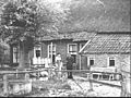
_en_bedrijfsgedeelte_met_baander_(rechts)_verbonden_door_een_kleine_sluis_-_Zuidvelde_-_20438494_-_RCE.jpg)
.jpg)


boerderij_nr._F_78-12_-_Zuidvelde_-_20438399_-_RCE.jpg)
boerderij_nr._F_79-22_-_Zuidvelde_-_20438409_-_RCE.jpg)


