Category:Asserstraat 10, Gieten
Jump to navigation
Jump to search
| Object location | | View all coordinates using: OpenStreetMap |
|---|
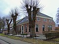
farmhouse in Aa en Hunze, Netherlands  | |||||
| Upload media | |||||
| Instance of | |||||
|---|---|---|---|---|---|
| Location | Gieten, Drenthe, Netherlands | ||||
| Street address |
| ||||
| Located on street |
| ||||
| Heritage designation |
| ||||
 | |||||
|
This is a category about rijksmonument number 510859
|
| Address |
|
Media in category "Asserstraat 10, Gieten"
The following 4 files are in this category, out of 4 total.
-
 Boerderij Story Gieten.jpg 1,296 × 972; 243 KB
-
 Bovenlicht nr. F 224-1 - Gieten - 20491043 - RCE.jpg 1,200 × 900; 130 KB
-
 Voor- en zijgevel nr. F 224-42 - Gieten - 20491042 - RCE.jpg 1,200 × 900; 128 KB
-
 Zij- en achtergevel nr. F 224-43 - Gieten - 20491044 - RCE.jpg 1,200 × 900; 121 KB


