Category:Ashwell, Rutland
Jump to navigation
Jump to search
village and civil parish in Rutland, UK .jpg) | |||||
| Upload media | |||||
| Instance of | |||||
|---|---|---|---|---|---|
| Location | Rutland, East Midlands, England | ||||
| Population |
| ||||
| Area |
| ||||
| Said to be the same as | Ashwell (Wikimedia duplicated page, civil parish) | ||||
 | |||||

English: Ashwell is a village and civil parish in the county of Rutland in the East Midlands of England. It is located about three miles (5 km) north of Oakham.
Subcategories
This category has the following 3 subcategories, out of 3 total.
A
- Ashwell railway station (2 F)
Media in category "Ashwell, Rutland"
The following 146 files are in this category, out of 146 total.
-
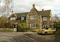
 1-5 Croft Lane - geograph.org.uk - 4811910.jpg 1,280 × 886; 564 KB
-
 4 ^ 6 Woodside, Ashwell - geograph.org.uk - 4811915.jpg 1,280 × 960; 386 KB
-
 5 -11 (odds) Water Lane - geograph.org.uk - 4811936.jpg 1,280 × 900; 425 KB
-
 5 Counties bus - geograph.org.uk - 4811954.jpg 1,280 × 960; 438 KB
-
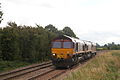 66061 hauling 66122 and 60010 Ashwell.jpg 3,456 × 2,304; 5.3 MB
-
 7 Cottesmore Road, Ashwell - geograph.org.uk - 4811897.jpg 1,280 × 960; 402 KB
-
 8 ^ 10 Woodside, Ashwell - geograph.org.uk - 4811921.jpg 1,280 × 968; 402 KB
-
 Approaching Langham Road Crossing, Ashwell - geograph.org.uk - 4953658.jpg 1,280 × 960; 525 KB
-
 Ashwell crossroads - geograph.org.uk - 3911894.jpg 1,280 × 936; 300 KB
-
-
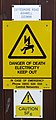
 Ashwell electricity sub-station. - geograph.org.uk - 158723.jpg 480 × 640; 101 KB
-
 Ashwell House - geograph.org.uk - 4811163.jpg 1,280 × 926; 323 KB
-
 Ashwell Junction - geograph.org.uk - 2351444.jpg 640 × 467; 63 KB
-
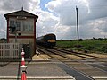
 Ashwell level crossing and signal box - geograph.org.uk - 4449942.jpg 4,320 × 3,240; 4.37 MB
-

-

-
 Ashwell Lodge - geograph.org.uk - 4811090.jpg 1,280 × 871; 463 KB
-
 Ashwell Old Hall - geograph.org.uk - 3911900.jpg 1,280 × 786; 336 KB
-
 Ashwell Old Hall - geograph.org.uk - 4811119.jpg 1,280 × 960; 448 KB
-
 Ashwell Road to Ashwell on a crisp autumn afternoon - geograph.org.uk - 4266731.jpg 3,776 × 2,520; 4.1 MB
-
 Ashwell signal box - geograph.org.uk - 4812463.jpg 640 × 465; 119 KB
-
 Ashwell signal box and crossing - geograph.org.uk - 2789679.jpg 640 × 438; 92 KB
-
 Ashwell Village Hall - geograph.org.uk - 4811094.jpg 1,280 × 960; 350 KB
-
 Ashwell village well - geograph.org.uk - 4811085.jpg 1,280 × 960; 537 KB
-
 Ashwell village well, inscription - geograph.org.uk - 4811089.jpg 1,280 × 960; 438 KB
-
 Ashwell, Rutland - geograph.org.uk - 41124.jpg 640 × 480; 126 KB
-
 Barn near Ashwell - geograph.org.uk - 4411775.jpg 640 × 376; 46 KB
-
 Belt and braces (or rather hedge and fence) - geograph.org.uk - 4953655.jpg 1,280 × 960; 627 KB
-
 Bench mark, Ashwell Village Hall - geograph.org.uk - 4811093.jpg 960 × 1,280; 420 KB
-
 Bench mark, Cottesmore Bridge - geograph.org.uk - 4811960.jpg 960 × 1,280; 516 KB
-
 Bench mark, Cottesmore Road - geograph.org.uk - 4811926.jpg 960 × 1,280; 614 KB
-
 Bench mark, St Mary's Church, Ashwell - geograph.org.uk - 4811104.jpg 960 × 1,280; 515 KB
-
 Bench mark, Teigh Road railway bridge - geograph.org.uk - 4824696.jpg 1,280 × 960; 544 KB
-
 Birmingham to Stansted Railway line - geograph.org.uk - 41121.jpg 640 × 480; 163 KB
-
-

-
 Church Close - geograph.org.uk - 2913799.jpg 1,024 × 724; 185 KB
-
 Church of St Mary, Ashwell - geograph.org.uk - 5198167.jpg 3,776 × 2,520; 4.25 MB
-
 Cottesmore bridge - geograph.org.uk - 2822053.jpg 640 × 440; 77 KB
-
 Cottesmore Bridge - geograph.org.uk - 4811957.jpg 1,280 × 960; 299 KB
-
 Cottesmore Bridge, near Ashwell - geograph.org.uk - 3101311.jpg 2,256 × 1,504; 1.22 MB
-
 Cottesmore Road over Cottesmore Bridge - geograph.org.uk - 5198076.jpg 3,776 × 2,520; 4.21 MB
-
 Cottesmore Road towards Ashwell - geograph.org.uk - 2822054.jpg 640 × 487; 106 KB
-
 Countryside near Ashwell - geograph.org.uk - 4411766.jpg 640 × 426; 41 KB
-

-
 Dismantled bridge on Teigh Road - geograph.org.uk - 5198183.jpg 3,776 × 2,520; 4.08 MB
-
 Eadys Bridge, near Ashwell Junction - geograph.org.uk - 5257380.jpg 3,776 × 2,520; 3.96 MB
-
 Eastfield Farm, Ashwell, Rutland - geograph.org.uk - 41122.jpg 640 × 480; 104 KB
-
 End of shift, Ashwell Signal Box - geograph.org.uk - 3911363.jpg 1,280 × 960; 329 KB
-
 Entrance to St. Mary's Church - geograph.org.uk - 2913801.jpg 1,024 × 768; 197 KB
-
 Farmland near Ashwell - geograph.org.uk - 4411770.jpg 640 × 426; 43 KB
-
 Fields by Whissendine Road - geograph.org.uk - 2351441.jpg 640 × 480; 61 KB
-
 Fields NE of Ashwell Road - geograph.org.uk - 4812458.jpg 640 × 399; 73 KB
-
 Fingerpost at Ashwell crossroads - geograph.org.uk - 3911892.jpg 1,280 × 1,280; 278 KB
-
 Footpath to Market Overton - geograph.org.uk - 5257386.jpg 3,776 × 2,520; 4.29 MB
-
 Former gap in the hedge - geograph.org.uk - 2351475.jpg 640 × 419; 97 KB
-
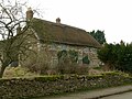
 Former Methodist Church Ashwell - geograph.org.uk - 158725.jpg 640 × 480; 73 KB
-
 Former Post Office - geograph.org.uk - 4811895.jpg 1,280 × 960; 307 KB
-

-
 Former Telephone Exchange, Ashwell - geograph.org.uk - 1974042.jpg 3,072 × 2,304; 1.77 MB
-
 Gateway - geograph.org.uk - 2351483.jpg 640 × 436; 68 KB
-
 Gateway - geograph.org.uk - 2825650.jpg 640 × 528; 94 KB
-
 Gateway - geograph.org.uk - 4434222.jpg 640 × 394; 80 KB
-
 Gateway in stone wall - geograph.org.uk - 2132576.jpg 640 × 349; 84 KB
-

-
 Harrier plane crash Ashwell, Rutland AB1.JPG 1,793 × 1,195; 1,014 KB
-
 Harrier plane crash Ashwell, Rutland AB2.JPG 2,228 × 1,485; 1.21 MB
-
 Harrier plane crash Ashwell, Rutland AB3.JPG 3,888 × 2,592; 3.9 MB
-
 Holy Well - geograph.org.uk - 3572566.jpg 640 × 427; 170 KB
-
 Holy Well - geograph.org.uk - 3572569.jpg 640 × 427; 158 KB
-
 Holy well at Ashwell - geograph.org.uk - 149918.jpg 640 × 427; 136 KB
-
 Holy Well inscription - geograph.org.uk - 3572572.jpg 640 × 427; 126 KB
-
 Home Farmhouse, Water Lane - geograph.org.uk - 4811942.jpg 1,280 × 932; 420 KB
-
 House at Ashwell - geograph.org.uk - 1008288.jpg 640 × 485; 90 KB
-
 Houses on Whissendine Rd - geograph.org.uk - 4411778.jpg 640 × 426; 46 KB
-
 Jubilee beech tree in winter - geograph.org.uk - 4811885.jpg 1,280 × 960; 371 KB
-
 Junction of Water Lane and Cottesmore Road - geograph.org.uk - 4811932.jpg 1,280 × 960; 428 KB
-
 K6 telephone kiosk, Cottesmore Road - geograph.org.uk - 4811889.jpg 1,280 × 960; 489 KB
-
 Keep out^ - geograph.org.uk - 2351426.jpg 640 × 480; 52 KB
-
 Knight effigy, St Mary's church, Ashwell - geograph.org.uk - 5759622.jpg 2,668 × 4,272; 5.52 MB
-

-
 Langham Rd - geograph.org.uk - 4411772.jpg 571 × 640; 56 KB
-
 Langham Road - geograph.org.uk - 3144121.jpg 640 × 394; 69 KB
-
 Langham Road from Langham to Ashwell - geograph.org.uk - 5363272.jpg 3,648 × 2,736; 4.14 MB
-
 Langham Road level crossing - geograph.org.uk - 4811083.jpg 1,280 × 960; 377 KB
-
 Langham Road level crossing, Ashwell - geograph.org.uk - 5363265.jpg 3,648 × 2,736; 4.08 MB
-
 Leaving the east flank of Thomas Hill - geograph.org.uk - 5257373.jpg 3,776 × 2,520; 3.34 MB
-

-

-
 New stone wall - geograph.org.uk - 2132574.jpg 640 × 361; 73 KB
-
 North of Ashwell - geograph.org.uk - 4824698.jpg 1,280 × 960; 328 KB
-

-

-
 Oakham Road at Water Lane - geograph.org.uk - 4811948.jpg 1,280 × 960; 366 KB
-

-
 Old School, Ashwell - geograph.org.uk - 4824700.jpg 1,280 × 960; 443 KB
-
 Old stone wall - geograph.org.uk - 2132575.jpg 640 × 480; 110 KB
-
 Passing Ashwell signal box - geograph.org.uk - 4811081.jpg 1,280 × 875; 271 KB
-
 Pillar of light – Church of St Mary, Ashwell - geograph.org.uk - 4811144.jpg 907 × 1,280; 177 KB
-
 Ploughed field obstacle on a footpath to Whissendine - geograph.org.uk - 5257368.jpg 3,776 × 2,520; 3.25 MB
-
 Railway embankment - geograph.org.uk - 2351486.jpg 640 × 463; 55 KB
-
 Re-built wall in Ashwell - geograph.org.uk - 4434224.jpg 640 × 518; 82 KB
-
 Remains of railway bridge - geograph.org.uk - 4824694.jpg 4,320 × 3,240; 4.2 MB
-
 Rivet bench mark, Oakham Road culvert - geograph.org.uk - 4811945.jpg 1,280 × 960; 289 KB
-
 Road Junction. Ashwell - geograph.org.uk - 3729656.jpg 640 × 480; 77 KB
-
 Rolling countryside - geograph.org.uk - 4411784.jpg 640 × 331; 33 KB
-
 Rutland landscape - geograph.org.uk - 4411761.jpg 640 × 426; 30 KB
-
 Rutland scenery - geograph.org.uk - 4411763.jpg 640 × 426; 40 KB
-
 Sewage pumping station, Ashwell - geograph.org.uk - 5257385.jpg 3,776 × 2,520; 4.05 MB
-
 Shallow valley - geograph.org.uk - 4411782.jpg 640 × 426; 42 KB
-
 Sign by Silver Jubilee Tree - geograph.org.uk - 2999880.jpg 640 × 607; 118 KB
-
-

-
 Squiggles in the rape - geograph.org.uk - 4953652.jpg 1,280 × 732; 448 KB
-
 Stable block adjoining Ashwell Lodge - geograph.org.uk - 4811091.jpg 1,280 × 960; 352 KB
-
 The Croft, Croft Lane - geograph.org.uk - 4811904.jpg 1,280 × 937; 525 KB
-
 The Oakham Canal - geograph.org.uk - 146257.jpg 640 × 427; 175 KB
-
 The Old School, Ashwell - geograph.org.uk - 4811095.jpg 1,280 × 943; 376 KB
-
 The village well, Ashwell - geograph.org.uk - 5198180.jpg 3,776 × 2,520; 4.06 MB
-
 To the church - geograph.org.uk - 4812464.jpg 640 × 523; 117 KB
-
 Towards Ashwell - geograph.org.uk - 2351442.jpg 640 × 480; 82 KB
-
 Towards Ashwell - geograph.org.uk - 2351481.jpg 640 × 537; 80 KB
-
 Towards Ashwell - geograph.org.uk - 2351484.jpg 640 × 447; 79 KB
-
 Towards Ashwell - geograph.org.uk - 2652908.jpg 640 × 460; 109 KB
-
 Towards Ashwell - geograph.org.uk - 4812459.jpg 640 × 471; 113 KB
-
 Towards Langham - geograph.org.uk - 2652909.jpg 640 × 469; 97 KB
-
 Towards Oakham - geograph.org.uk - 2351473.jpg 640 × 497; 125 KB
-
 Towards Oakham - geograph.org.uk - 2351482.jpg 640 × 429; 77 KB
-
 Towards Teigh - geograph.org.uk - 2351485.jpg 640 × 492; 139 KB
-
 Towards Whissendine - geograph.org.uk - 2351443.jpg 640 × 480; 73 KB
-
 Towards Whissendine - geograph.org.uk - 4434225.jpg 640 × 537; 81 KB
-
 Towards Whissendine - geograph.org.uk - 4812460.jpg 640 × 443; 84 KB
-
 Track along turnip field boundary south of Ashwell - geograph.org.uk - 4266768.jpg 3,776 × 2,520; 3.98 MB
-
 Track and fields - geograph.org.uk - 2351480.jpg 640 × 434; 64 KB
-

-
 View across the Vale - geograph.org.uk - 4811077.jpg 1,280 × 816; 286 KB
-
 View across the Vale - geograph.org.uk - 4811079.jpg 1,280 × 889; 451 KB
-
-
 Walking the hounds - geograph.org.uk - 2970786.jpg 640 × 475; 107 KB
-
 Wall renovations at Ashwell - geograph.org.uk - 1008289.jpg 640 × 434; 92 KB
-
 Wall repairs - geograph.org.uk - 4434227.jpg 640 × 439; 82 KB
-
 Wall restoration at Ashwell - geograph.org.uk - 1008290.jpg 640 × 446; 109 KB
-
 Whissendine Rd - geograph.org.uk - 4411779.jpg 572 × 640; 62 KB
-
 Whissendine Road approaching Ashwell - geograph.org.uk - 4266733.jpg 3,776 × 2,520; 4.3 MB
-
 Whissendine Road towards Ashwell - geograph.org.uk - 4812461.jpg 640 × 456; 82 KB
-
 Whissendine Road towards Whissendine - geograph.org.uk - 4812462.jpg 640 × 468; 101 KB


_Water_Lane_-_geograph.org.uk_-_4811936.jpg)


_-_geograph.org.uk_-_4953655.jpg)


