Category:Ashley, Gloucestershire
Jump to navigation
Jump to search
village in Gloucestershire, England | |||||
| Upload media | |||||
| Instance of | |||||
|---|---|---|---|---|---|
| Location | Cotswold, Gloucestershire, South West England, England | ||||
| Population |
| ||||
 | |||||
English: Ashley is a village and civil parish in the Cotswold district of Gloucestershire, England, about 8 miles south-west of Cirencester. According to the 2001 census it had a population of 142.
Subcategories
This category has the following 2 subcategories, out of 2 total.
C
- Culkerton, Gloucestershire (14 F)
S
Media in category "Ashley, Gloucestershire"
The following 87 files are in this category, out of 87 total.
-
-
 Arable farmland - geograph.org.uk - 4794525.jpg 1,024 × 680; 355 KB
-
 Ashley church - geograph.org.uk - 4797144.jpg 1,024 × 680; 269 KB
-
 Building in an arable field - geograph.org.uk - 4797049.jpg 1,024 × 680; 274 KB
-
 Communication centre - geograph.org.uk - 4798803.jpg 800 × 531; 140 KB
-
 Converted farm buildings - geograph.org.uk - 4797155.jpg 800 × 531; 136 KB
-
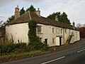
 Cottage in Ashley - geograph.org.uk - 4798801.jpg 800 × 531; 131 KB
-
 Cottages at Trull - geograph.org.uk - 337086.jpg 640 × 472; 102 KB
-
 Country road near Culkerton - geograph.org.uk - 4797527.jpg 1,024 × 680; 231 KB
-
 Country road west of Ashley - geograph.org.uk - 4799391.jpg 1,024 × 680; 399 KB
-
 Dismantled Railway Bridge - geograph.org.uk - 3011245.jpg 640 × 480; 112 KB
-
 Dismantled Railway Line - geograph.org.uk - 3009526.jpg 640 × 480; 77 KB
-
 Dutch barns - geograph.org.uk - 5907004.jpg 1,024 × 768; 266 KB
-
 Farm buildings in Ashley - geograph.org.uk - 4798805.jpg 800 × 531; 126 KB
-
 Farmland between Culkerton and Ashley - geograph.org.uk - 4794470.jpg 800 × 531; 137 KB
-
 Field and boundary near Ashley - geograph.org.uk - 3126419.jpg 640 × 480; 187 KB
-
 Field near Boldridge Farm - geograph.org.uk - 2841853.jpg 2,592 × 1,944; 1.67 MB
-
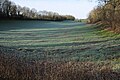 Field on a frosty January morning - geograph.org.uk - 4794464.jpg 800 × 531; 150 KB
-
 Fly tipping - geograph.org.uk - 337058.jpg 640 × 480; 132 KB
-
 Footpath to Long Newnton - geograph.org.uk - 4794582.jpg 800 × 531; 148 KB
-
 Former Trouble House Inn A433 near Tetbury - geograph.org.uk - 3790728.jpg 1,280 × 960; 824 KB
-
 Fosse Way at Fosse Gate - geograph.org.uk - 1747493.jpg 640 × 480; 141 KB
-
 Fosse Way north of Crudwell Lane - geograph.org.uk - 4797055.jpg 800 × 531; 116 KB
-
 Gate on Stonehill Lane - geograph.org.uk - 2479318.jpg 3,648 × 2,736; 4.24 MB
-
 Haresdown Hill, Rodmarton - geograph.org.uk - 6130585.jpg 1,808 × 1,080; 1.78 MB
-
 Houses on northern outskirts of Ashley - geograph.org.uk - 2379947.jpg 640 × 480; 125 KB
-

-
 Old Barn - geograph.org.uk - 2479340.jpg 3,648 × 2,736; 3.32 MB
-
 Pond on the outskirts of Ashley - geograph.org.uk - 2379950.jpg 640 × 480; 230 KB
-
 Pond on the outskirts of Ashley - geograph.org.uk - 2383629.jpg 640 × 480; 200 KB
-
 Pylons marching easterly - geograph.org.uk - 281160.jpg 640 × 480; 85 KB
-
 Railway bridge near Rodmarton Halt - geograph.org.uk - 3795000.jpg 1,280 × 960; 1.1 MB
-
 Railway bridge near Rodmarton Halt - geograph.org.uk - 3795010.jpg 1,280 × 960; 1.12 MB
-
 Right of way across a field - geograph.org.uk - 4797531.jpg 800 × 531; 89 KB
-
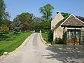
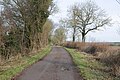
 Road in the village of Ashley - geograph.org.uk - 4798804.jpg 800 × 531; 115 KB
-
 Road into Culkerton - geograph.org.uk - 5907000.jpg 1,024 × 768; 240 KB
-
 Road to Chedglow - geograph.org.uk - 1747452.jpg 640 × 480; 62 KB
-
 Road to Culkerton - geograph.org.uk - 4794455.jpg 800 × 531; 127 KB
-
 Rolling arable land - geograph.org.uk - 4794554.jpg 1,024 × 680; 298 KB
-
 Rush hour in Ashley - geograph.org.uk - 4092206.jpg 640 × 480; 84 KB
-

-
 Snowdrops in Ashley churchyard - geograph.org.uk - 4803707.jpg 800 × 600; 151 KB
-

-
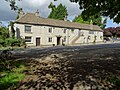
 Stable Flat, Ashley - geograph.org.uk - 2382757.jpg 640 × 480; 134 KB
-
 Stonehill Lane - geograph.org.uk - 6145447.jpg 1,024 × 683; 332 KB
-
 Stonehill Lane - looking north - geograph.org.uk - 2479347.jpg 3,648 × 2,736; 4.67 MB
-
 Stonehill Lane - looking south - geograph.org.uk - 2479309.jpg 3,648 × 2,736; 4.03 MB
-
 Stonehill Lane crosses some fields - geograph.org.uk - 2479323.jpg 3,648 × 2,736; 3.84 MB
-
 Stonehill Lane passes Stonehill Barn - geograph.org.uk - 2479331.jpg 3,648 × 2,736; 4.23 MB
-
 Stonehill Lane track - geograph.org.uk - 2479314.jpg 3,648 × 2,736; 4.4 MB
-
 Tetbury Branch Line Near Culkerton - geograph.org.uk - 276242.jpg 640 × 480; 78 KB
-
 The A433 passing Culkerton - geograph.org.uk - 4794438.jpg 1,024 × 680; 309 KB
-
 The former Tetbury branch line - geograph.org.uk - 5906982.jpg 1,024 × 768; 403 KB
-
 The Fosse Way - geograph.org.uk - 2841883.jpg 2,592 × 1,944; 1.67 MB
-
 The Fosse Way - geograph.org.uk - 337053.jpg 640 × 480; 101 KB
-
 The Fosse Way - geograph.org.uk - 342863.jpg 503 × 640; 128 KB
-
 The Fosse Way at Fosse Gate - geograph.org.uk - 4797123.jpg 800 × 531; 166 KB
-
 The Fosse Way Roman Road - geograph.org.uk - 4797093.jpg 800 × 531; 162 KB
-

-
 The road to Culkerton - geograph.org.uk - 2383624.jpg 640 × 480; 144 KB
-
 Track to Holt Farm - geograph.org.uk - 5906996.jpg 1,024 × 768; 298 KB
-
 Trouble House - geograph.org.uk - 6682717.jpg 3,860 × 2,898; 3.57 MB
-
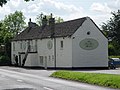
 Trouble House Inn - geograph.org.uk - 5905215.jpg 1,024 × 768; 286 KB
-
 Tympanum, Ashley church - geograph.org.uk - 4797151.jpg 800 × 531; 103 KB
-
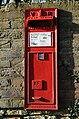 Victorian postbox - geograph.org.uk - 4794477.jpg 531 × 800; 161 KB
-
 View along Oxleaze Road - geograph.org.uk - 2379995.jpg 640 × 480; 110 KB
-
 View along the road to Ashley - geograph.org.uk - 2379943.jpg 640 × 480; 147 KB
-
 View along the road to Culkerton - geograph.org.uk - 2383615.jpg 640 × 480; 146 KB
-

-
 View of St James' church, Ashley - geograph.org.uk - 2379959.jpg 640 × 480; 137 KB
-
 View S along Monarch's Way path - geograph.org.uk - 3126404.jpg 640 × 480; 202 KB
-
 Woodlands by the A433, Culkerton - geograph.org.uk - 6130363.jpg 1,920 × 1,280; 1.59 MB
-
 Woods by the A433, Culkerton - geograph.org.uk - 6130157.jpg 1,629 × 1,019; 1.39 MB
-
 Ash tree, near Ashley Marsh - geograph.org.uk - 433725.jpg 480 × 640; 108 KB
-
 Dismantled railway bridge - geograph.org.uk - 337088.jpg 640 × 480; 126 KB
-
 Field from Withy Bed - geograph.org.uk - 281196.jpg 640 × 480; 91 KB
-
 Fodder crop - geograph.org.uk - 433726.jpg 640 × 456; 85 KB
-
 Fosse Gate - geograph.org.uk - 281181.jpg 640 × 480; 174 KB
-
 Great Larkhill Farm - geograph.org.uk - 281145.jpg 640 × 480; 107 KB
-
 Morgan's Tynings - geograph.org.uk - 337040.jpg 640 × 480; 81 KB
-
 New hedge on Crudwell Lane - geograph.org.uk - 342860.jpg 640 × 480; 105 KB
-
 Pasture Field near Ash Bed - geograph.org.uk - 281206.jpg 640 × 480; 66 KB
-
 Pond, near Ashley Marsh - geograph.org.uk - 433733.jpg 480 × 640; 146 KB
-
 Tetbury Branch Line Track Bed - geograph.org.uk - 276213.jpg 640 × 480; 95 KB
-
 Trouble House Inn - geograph.org.uk - 275438.jpg 640 × 480; 64 KB
-
 Trull farm - geograph.org.uk - 337098.jpg 640 × 480; 75 KB
-
 Venerable trees, near Chedglow - geograph.org.uk - 342858.jpg 640 × 480; 115 KB


