Category:Ashford Carbonel (civil parish)
Jump to navigation
Jump to search
English: Ashford Carbonel is a civil parish in the Shropshire district, in the county of Shropshire, England.

civil parish in Shropshire, England | |||||
| Upload media | |||||
| Instance of | |||||
|---|---|---|---|---|---|
| Location | Shropshire, West Midlands, England | ||||
| Population |
| ||||
 | |||||
Subcategories
This category has the following 4 subcategories, out of 4 total.
Media in category "Ashford Carbonel (civil parish)"
The following 48 files are in this category, out of 48 total.
-
 23 year old elm - and dying. - geograph.org.uk - 506869.jpg 640 × 480; 141 KB
-

-
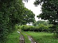
 A Secluded Road - geograph.org.uk - 835342.jpg 640 × 423; 80 KB
-
 A wet corner, Dumblehole - geograph.org.uk - 988660.jpg 640 × 480; 98 KB
-

-
 Ashford Weir - geograph.org.uk - 1470573.jpg 640 × 480; 159 KB
-
 Barratt's Mill Lane - geograph.org.uk - 843184.jpg 640 × 480; 139 KB
-
 Barrett's Mill Lane - geograph.org.uk - 506870.jpg 640 × 480; 119 KB
-
 Big Field At Mill Turn - geograph.org.uk - 1759217.jpg 640 × 480; 181 KB
-
 Bossy wee notice - no. 94 - geograph.org.uk - 1636649.jpg 640 × 359; 112 KB
-
 Culverted Brook - geograph.org.uk - 672572.jpg 480 × 640; 140 KB
-
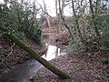 Dumblehole Brook - geograph.org.uk - 1202707.jpg 640 × 480; 164 KB
-
 Dumblehole Lane - geograph.org.uk - 1596771.jpg 640 × 359; 93 KB
-
 Dumblehole Lane - geograph.org.uk - 1759236.jpg 640 × 480; 144 KB
-
 Dumblehole Lane - geograph.org.uk - 506873.jpg 480 × 640; 145 KB
-
 Feeding time - geograph.org.uk - 300150.jpg 480 × 640; 93 KB
-
 Flood scoured river bed - geograph.org.uk - 839176.jpg 640 × 480; 137 KB
-
 Hay meadow, Dumblehole - geograph.org.uk - 843189.jpg 640 × 480; 126 KB
-
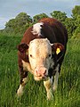
 Hereford bull - geograph.org.uk - 1093795.jpg 480 × 640; 119 KB
-
 Hereford bull calf - geograph.org.uk - 842674.jpg 480 × 640; 86 KB
-
 Hereford heifers - geograph.org.uk - 1638281.jpg 640 × 480; 103 KB
-
 Herefords - geograph.org.uk - 842675.jpg 640 × 480; 112 KB
-
 Land slip, Dumblehole Lane - geograph.org.uk - 988659.jpg 480 × 640; 141 KB
-
 Lane to Teme's Green - geograph.org.uk - 839697.jpg 480 × 640; 121 KB
-
 Limousin heifers - geograph.org.uk - 506810.jpg 640 × 480; 101 KB
-
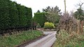
 Mill Turn - geograph.org.uk - 1613603.jpg 640 × 480; 128 KB
-
 New House At A Dead End - geograph.org.uk - 835328.jpg 640 × 424; 53 KB
-
 No need to shut the gate - geograph.org.uk - 1202699.jpg 640 × 480; 109 KB
-
 Oilseed rape, Lea Hill - geograph.org.uk - 1596752.jpg 640 × 480; 97 KB
-
 Old ash, Home Farm - geograph.org.uk - 1636584.jpg 480 × 640; 104 KB
-
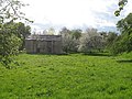 Old barn, Ashford Carbonel - geograph.org.uk - 1470587.jpg 640 × 480; 120 KB
-
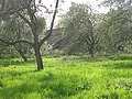 Orchard, Ashford Carbonel - geograph.org.uk - 1470538.jpg 640 × 480; 153 KB
-
 Orchard, The Mill - geograph.org.uk - 1613629.jpg 640 × 480; 122 KB
-
 Over wintering sheep - geograph.org.uk - 1202689.jpg 640 × 480; 95 KB
-
 Ride, Dumblehole Brook - geograph.org.uk - 988653.jpg 480 × 640; 134 KB
-
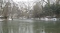
 River Teme - geograph.org.uk - 839156.jpg 640 × 480; 109 KB
-
 River Teme, Ashford Carbonel - geograph.org.uk - 1636594.jpg 640 × 359; 86 KB
-
 Ryeland sheep - geograph.org.uk - 1543697.jpg 640 × 431; 62 KB
-
 Sewage Works, Ashford Carbonell - geograph.org.uk - 1636590.jpg 640 × 480; 128 KB
-
 Snowdrops - geograph.org.uk - 1202712.jpg 640 × 480; 183 KB
-
 Soft fruit under polythene - geograph.org.uk - 988661.jpg 640 × 480; 104 KB
-
 Teme's Green - geograph.org.uk - 213737.jpg 640 × 480; 139 KB
-
 The island, Teme's Green - geograph.org.uk - 1636607.jpg 640 × 359; 87 KB
-
 The Serpent, Ashford Carbonell.jpg 1,024 × 768; 258 KB
-
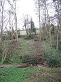
 The wood, New House Farm - geograph.org.uk - 1202067.jpg 640 × 480; 84 KB
-
 Tip Meadow - geograph.org.uk - 506804.jpg 640 × 480; 94 KB
-
 Top field, Dumblehole - geograph.org.uk - 1093815.jpg 640 × 480; 90 KB
-
 Woodland, Ashford Court park - geograph.org.uk - 1635542.jpg 640 × 480; 139 KB


