Category:Ashbury, Devon
Jump to navigation
Jump to search
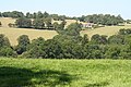
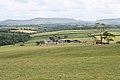
English: Ashbury is a village in Devon, England. It is 5 miles south-west of Hatherleigh. Its population is 65.
village and former civil parish in Devon, UK  | |||||
| Upload media | |||||
| Instance of |
| ||||
|---|---|---|---|---|---|
| Location | Northlew, West Devon, Devon, South West England, England | ||||
 | |||||
Subcategories
This category has the following 2 subcategories, out of 2 total.
A
- Ashbury railway station (3 F)
M
- St Mary's Church, Ashbury (2 F)
Media in category "Ashbury, Devon"
The following 14 files are in this category, out of 14 total.
-
 Ashbury, by Ten Acre Plantation - geograph.org.uk - 203160.jpg 640 × 427; 202 KB
-
 Ashbury, ford on bridleway - geograph.org.uk - 203182.jpg 640 × 427; 316 KB
-
 Ashbury, near Broomhill Bridge - geograph.org.uk - 204777.jpg 640 × 427; 250 KB
-
 Ashbury, on Scobchester Down - geograph.org.uk - 204776.jpg 640 × 427; 194 KB
-
 Ashbury, Scobchester - geograph.org.uk - 203168.jpg 640 × 427; 235 KB
-
 Ashbury, Ten Acre Plantation - geograph.org.uk - 198473.jpg 640 × 427; 260 KB
-
 Ashbury, towards Wadland Barton - geograph.org.uk - 198475.jpg 640 × 427; 159 KB
-
 Dead wood by the footpath - geograph.org.uk - 331879.jpg 640 × 480; 127 KB
-
 Field and wood near Ashbury - geograph.org.uk - 374121.jpg 640 × 426; 87 KB
-
 Kigbeare Golf Club - geograph.org.uk - 968732.jpg 640 × 480; 93 KB
-

-
 Okehampton Hamlets, Cruft Gate Farm - geograph.org.uk - 203051.jpg 640 × 427; 139 KB
-
 Okehampton Hamlets, golf course - geograph.org.uk - 204775.jpg 640 × 427; 148 KB
-
 Okehampton Hamlets, towards Venn Down - geograph.org.uk - 203191.jpg 640 × 427; 193 KB


