Category:Aschau im Chiemgau
Jump to navigation
Jump to search
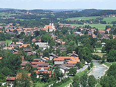
Deutsch: Aschau im Chiemgau (amtlich: Aschau i.Chiemgau) ist eine Gemeinde im oberbayerischen Landkreis Rosenheim mit den Ortsteilen Aschau und Sachrang. Überragt wird der Fremdenverkehrsort von der 1.669 m hohen Kampenwand und dem mitten im Priental thronenden Schloss Hohenaschau (12. Jahrhundert).
Esperanto: Aschau im Chiemgau estas komunumo en Germanio. Ĝi apartenas al distrikto Rosenheim, Bavario. En la 30-a de junio 2005 la komunumo havis 5541 loĝantojn.
Nederlands: Aschau im Chiemgau is een plaats in de Duitse deelstaat Beieren, en maakt deel uit van het district .
Polski: Aschau im Chiemgau – gmina w Niemczech, w Bawarii, w rejencji Górna Bawaria, w powiecie Rosenheim, w Chiemgauer Alpen, około 18 km na południowy-wschód od Rosenheim, nad Prien, przy linii kolejowej (Prien am Chiemsee - Aschau im Chiemgau).
municipality of Germany | |||||
| Upload media | |||||
| Instance of |
| ||||
|---|---|---|---|---|---|
| Part of |
| ||||
| Location | Rosenheim, Upper Bavaria, Bavaria, Germany | ||||
| Head of government |
| ||||
| Population |
| ||||
| Area |
| ||||
| Elevation above sea level |
| ||||
| official website | |||||
 | |||||
Subcategories
This category has the following 17 subcategories, out of 17 total.
Pages in category "Aschau im Chiemgau"
This category contains only the following page.
Media in category "Aschau im Chiemgau"
The following 49 files are in this category, out of 49 total.
-
Wappen Aschau.png 190 × 222; 42 KB
-
Wappen von Aschau im Chiemgau.svg 699 × 739; 210 KB
-
83229 Aschau im Chiemgau, Germany - panoramio (101).jpg 4,608 × 3,456; 4.51 MB
-
83229 Aschau im Chiemgau, Germany - panoramio (105).jpg 4,608 × 3,456; 5.23 MB
-
83229 Aschau im Chiemgau, Germany - panoramio (106).jpg 4,608 × 3,456; 4.05 MB
-
83229 Aschau im Chiemgau, Germany - panoramio (111).jpg 4,608 × 3,456; 4.61 MB
-
83229 Aschau im Chiemgau, Germany - panoramio (112).jpg 4,608 × 3,456; 3.95 MB
-
83229 Aschau im Chiemgau, Germany - panoramio (114).jpg 4,608 × 3,456; 3.84 MB
-
83229 Aschau im Chiemgau, Germany - panoramio (115).jpg 4,608 × 3,456; 4.37 MB
-
83229 Aschau im Chiemgau, Germany - panoramio (116).jpg 4,608 × 3,456; 4.24 MB
-
83229 Aschau im Chiemgau, Germany - panoramio (117).jpg 4,608 × 3,456; 3.84 MB
-
83229 Aschau im Chiemgau, Germany - panoramio (118).jpg 4,608 × 3,456; 5.21 MB
-
83229 Aschau im Chiemgau, Germany - panoramio (124).jpg 2,352 × 1,568; 1.42 MB
-
83229 Aschau im Chiemgau, Germany - panoramio (70).jpg 4,608 × 3,456; 4.32 MB
-
83229 Aschau im Chiemgau, Germany - panoramio (71).jpg 4,608 × 3,456; 4.4 MB
-
83229 Aschau im Chiemgau, Germany - panoramio (75).jpg 4,608 × 3,456; 4.45 MB
-
83229 Aschau im Chiemgau, Germany - panoramio (79).jpg 4,912 × 1,080; 1.69 MB
-
83229 Aschau im Chiemgau, Germany - panoramio (80).jpg 4,608 × 3,456; 3.72 MB
-
AK - Aschau im Chiemgau - 1922.jpg 1,600 × 2,040; 2.84 MB
-
Aschau - Lage im Landkreis.png 252 × 310; 45 KB
-
Aschau im Chiemgau 2.jpg 2,592 × 1,944; 1.27 MB
-
Aschau im Chiemgau in RO.svg 836 × 836; 1.28 MB
-
Aschau im Chiemgau, Kurpark, Konzerthalle.jpg 4,032 × 3,024; 6.61 MB
-
Aschau im Chiemgau.jpg 3,451 × 1,397; 1.95 MB
-
Aschau von Pölching.jpg 4,032 × 3,024; 6.81 MB
-
Blick von Hoehenberg auf Aschau-1.jpg 5,380 × 3,272; 1.99 MB
-
Blick von Hoehenberg auf Aschau-2.jpg 5,470 × 3,345; 2.97 MB
-
Campingplatz Am Moor - geo.hlipp.de - 21220.jpg 640 × 480; 154 KB
-
Clarin Hans.jpg 324 × 286; 42 KB
-
Feldkreuz auf der Riesenalm - geo.hlipp.de - 10377.jpg 640 × 425; 150 KB
-
Germany 2015-07-21 (19841076864).jpg 4,397 × 2,057; 922 KB
-
Germany 2015-07-21 (20455014072).jpg 4,752 × 2,736; 1.75 MB
-
Germany 2015-07-21 (20455015292).jpg 4,284 × 3,056; 1.32 MB
-
Germany 2015-07-21 (20463714525).jpg 4,088 × 2,400; 1,014 KB
-
Germany 2015-07-21 (20469975951).jpg 3,168 × 4,614; 1.37 MB
-
Germany 2015-07-21 (20469978981).jpg 4,752 × 3,168; 1.3 MB
-
Gästehaus berge.jpg 2,480 × 3,720; 5.39 MB
-
Hauptstelle Aschau.png 3,600 × 1,224; 292 KB
-
Kampenwandbahn - panoramio.jpg 3,264 × 2,448; 1.72 MB
-
Laubenstein Aschau Chiemsee.jpg 5,700 × 3,800; 11.18 MB
-
Maibaum im Aschau (Aschau's Maypole) - geo.hlipp.de - 21239.jpg 480 × 640; 45 KB
-
Maschine Priental.jpg 4,000 × 3,000; 4.46 MB
-
Panorpa germanica 145664247.jpg 1,684 × 1,684; 554 KB
-
Riesenalm am Riesenberg - geo.hlipp.de - 15802.jpg 640 × 480; 108 KB
-
Schloss Hohenaschau - geo.hlipp.de - 21226.jpg 640 × 480; 45 KB
-
Sportzplatz im Aschau - geo.hlipp.de - 21229.jpg 640 × 480; 86 KB
-
The Priental Valley near Aschau - geo.hlipp.de - 21238.jpg 640 × 480; 61 KB
-
Unterrichtungstafel Aschau im Chiemgau (2009).jpg 1,441 × 1,748; 587 KB


