Category:Arthog
Jump to navigation
Jump to search
village and community in Gwynedd, Wales, UK   | |||||
| Upload media | |||||
| Instance of | |||||
|---|---|---|---|---|---|
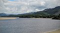
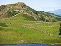
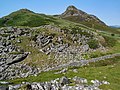
| Location | Gwynedd, Wales | ||||
| Population |
| ||||
| Area |
| ||||
 | |||||
Cymraeg: Pentref a chymuned arfordirol yng Ngwynedd yw Arthog. Cyfeirnod OS: SH 64388 14585. Saif ar ochr ddeheuol aber Afon Mawddach, i'r de-ddwyrain o Abermaw ac ar y briffordd A493. Mae Afon Arthog yn llifo trwy'r pentref i ymuno ag Afon Mawddach, a cheir rhaeadr gerllaw.
Subcategories
This category has the following 9 subcategories, out of 9 total.
A
- Afon Gwynant, Arthog (11 F)
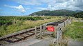
- Arthog railway station (2 F)
C
- Capel Rehoboth, Arthog (7 F)
- Capel Salem, Arthog (4 F)
F
L
- Llyn y Gadair (Arthog, Gwynedd) (47 F)
- Llynnau Cregennen (149 F)
M
- Morfa Mawddach railway station (36 F)
T
- Ty'n-y-Coed quarry (7 F)
Media in category "Arthog"
The following 200 files are in this category, out of 1,181 total.
(previous page) (next page)-

-
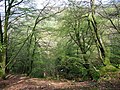
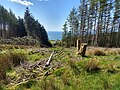 A clearing through the forest - geograph.org.uk - 6230949.jpg 4,032 × 3,024; 3.4 MB
-
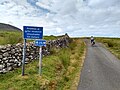
 A gate across the mountain road - geograph.org.uk - 6231008.jpg 4,032 × 3,024; 3.56 MB
-

-
 A murky day on the Mawddach Trail - geograph.org.uk - 4900698.jpg 640 × 479; 59 KB
-
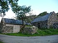 A pair of old barns near Gefnir Farm - geograph.org.uk - 2027775.jpg 640 × 480; 99 KB
-
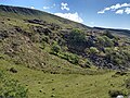 A rocky hollow near the road - geograph.org.uk - 6230996.jpg 4,032 × 3,024; 3.3 MB
-
 A section of NCN82 on Ffordd Ddu - geograph.org.uk - 5850444.jpg 1,600 × 1,200; 565 KB
-
 A small bridge on the Mawddach Trail - geograph.org.uk - 5407720.jpg 640 × 480; 314 KB
-
 A small ex-railway bridge at Garth Isaf - geograph.org.uk - 1100298.jpg 640 × 480; 150 KB
-
 A Steep climb.jpg 4,000 × 3,000; 4.35 MB
-
 A stream under the track - geograph.org.uk - 6230945.jpg 4,032 × 3,024; 3.85 MB
-
 A windswept Llyn Pen Moelyn - geograph.org.uk - 1312308.jpg 640 × 480; 70 KB
-

-
 Abandoned farmland below the Tyrrau Mawr - geograph.org.uk - 2397597.jpg 640 × 480; 113 KB
-
 Abandoned petrol station at Friog - geograph.org.uk - 2950978.jpg 1,600 × 1,200; 358 KB
-
 Aberdwyafon - geograph.org.uk - 4300348.jpg 800 × 534; 180 KB
-
 Abergwynant Lodge - geograph.org.uk - 219853.jpg 640 × 500; 160 KB
-
 Above Arthog falls - geograph.org.uk - 2379568.jpg 640 × 480; 229 KB
-
 Above the Blue Lake - geograph.org.uk - 6523141.jpg 1,024 × 768; 698 KB
-
-
 Across fields to the Cambrian Coast Line - geograph.org.uk - 4536115.jpg 2,000 × 1,500; 265 KB
-
 Across the estuary - geograph.org.uk - 4576689.jpg 640 × 428; 89 KB
-
 Across the estuary - geograph.org.uk - 4577524.jpg 640 × 428; 67 KB
-
 Across the estuary - geograph.org.uk - 5998839.jpg 1,024 × 683; 464 KB
-
 Across the estuary towards Barmouth - geograph.org.uk - 4582087.jpg 640 × 428; 76 KB
-
 Across the fields to Bwlchgwyn - geograph.org.uk - 3208853.jpg 640 × 434; 66 KB
-
 Across the Mawddach - geograph.org.uk - 5998622.jpg 1,024 × 683; 431 KB
-
 Across the Mawddach estuary - geograph.org.uk - 3207426.jpg 640 × 377; 58 KB
-
 Across the Mawddach estuary - geograph.org.uk - 4582014.jpg 640 × 428; 74 KB
-
-

-
 Afon Arthog - geograph.org.uk - 2379151.jpg 640 × 480; 125 KB
-
 Afon Arthog - geograph.org.uk - 2379173.jpg 640 × 480; 106 KB
-
 Afon Arthog - geograph.org.uk - 2379630.jpg 640 × 480; 168 KB
-
 Afon Arthog - geograph.org.uk - 4576669.jpg 640 × 428; 85 KB
-
 Afon Arthog - geograph.org.uk - 4900821.jpg 640 × 480; 51 KB
-
 Afon Arthog above the waterfalls - geograph.org.uk - 2379593.jpg 640 × 480; 233 KB
-
 Afon Arthog and Craig-y-llyn - geograph.org.uk - 2390280.jpg 640 × 480; 96 KB
-
 Afon Arthog meets the Mawddach - geograph.org.uk - 1313593.jpg 640 × 480; 99 KB
-
 Afon Gwynant - geograph.org.uk - 4900687.jpg 640 × 480; 106 KB
-
 Afon Mawddach - geograph.org.uk - 4900704.jpg 640 × 480; 39 KB
-
 Afon Mawddach - geograph.org.uk - 5122292.jpg 1,024 × 768; 101 KB
-
 Afon Mawddach - geograph.org.uk - 5122300.jpg 1,024 × 769; 141 KB
-
 Afon Mawddach - geograph.org.uk - 6144336.jpg 800 × 540; 82 KB
-
 Afon Mawddach - panoramio (10).jpg 4,000 × 3,000; 4.29 MB
-
 Afon Mawddach - panoramio (11).jpg 4,000 × 3,000; 3.66 MB
-
 Afon Mawddach - panoramio (12).jpg 4,000 × 3,000; 3.1 MB
-
 Afon Mawddach - panoramio (13).jpg 4,000 × 3,000; 4.07 MB
-
 Afon Mawddach - panoramio (14).jpg 4,000 × 3,000; 3.78 MB
-
 Afon Mawddach - panoramio (15).jpg 4,000 × 3,000; 4.16 MB
-
 Afon Mawddach - panoramio (5).jpg 4,000 × 3,000; 3.29 MB
-
 Afon Mawddach - panoramio (6).jpg 4,000 × 3,000; 3.85 MB
-
 Afon Mawddach - panoramio (7).jpg 4,000 × 3,000; 3.37 MB
-
 Afon Mawddach - panoramio (8).jpg 4,000 × 3,000; 3.21 MB
-
 Afon Mawddach - panoramio (9).jpg 4,000 × 3,000; 3.35 MB
-
 Afon Mawddach and the Mawddach Trail - geograph.org.uk - 1092416.jpg 640 × 480; 216 KB
-
 Afon Mawddach and the Mawddach Trail - geograph.org.uk - 1092417.jpg 640 × 480; 236 KB
-
 Afon Mawddach estuary - geograph.org.uk - 4713471.jpg 4,288 × 3,216; 3.95 MB
-
 Afon Mawddach estuary - geograph.org.uk - 4713489.jpg 4,288 × 3,216; 4.19 MB
-
 Afon Mawddach estuary - geograph.org.uk - 4713512.jpg 4,288 × 3,216; 4.83 MB
-
 Afon Mawddach estuary - geograph.org.uk - 4713531.jpg 4,288 × 3,216; 5.01 MB
-
 Afon Mawddach from the Mawddach Trail - geograph.org.uk - 1100263.jpg 640 × 480; 200 KB
-
 Afon Mawddach from the Mawddach Trail - geograph.org.uk - 1100344.jpg 640 × 480; 160 KB
-
 After sunset (20809826390).jpg 5,444 × 3,629; 9.3 MB
-
 Along the Mawddach trail - geograph.org.uk - 4577522.jpg 640 × 428; 81 KB
-
 Along the Mawddach trail - geograph.org.uk - 4578279.jpg 640 × 428; 89 KB
-
 Along the Mawddach trail - geograph.org.uk - 4582007.jpg 640 × 428; 82 KB
-
 Along the Mawddach trail near Arthog - geograph.org.uk - 4576678.jpg 640 × 428; 112 KB
-
 Alyn Road, Fairbourne - geograph.org.uk - 4726903.jpg 1,024 × 768; 132 KB
-

-
 Another view of Barmouth - geograph.org.uk - 6230990.jpg 4,032 × 3,024; 2.93 MB
-
 Approaching a cattle grid - geograph.org.uk - 5409755.jpg 640 × 480; 217 KB
-
 Approaching Llyn Pen Moelyn - geograph.org.uk - 1312295.jpg 640 × 480; 35 KB
-
 Approaching Morfa Mawddach - geograph.org.uk - 5089823.jpg 640 × 480; 157 KB
-
 Approaching Morfa Mawddach station on the Mawddach Trail - geograph.org.uk - 5406317.jpg 4,896 × 3,672; 5.74 MB
-
 Arthog - geograph.org.uk - 2376035.jpg 640 × 480; 171 KB
-
 Arthog - geograph.org.uk - 245796.jpg 640 × 480; 149 KB
-
 Arthog - geograph.org.uk - 4900834.jpg 640 × 480; 58 KB
-
 Arthog car park - geograph.org.uk - 3045567.jpg 640 × 360; 83 KB
-
 Arthog estuary - geograph.org.uk - 3740310.jpg 1,024 × 683; 961 KB
-
 Arthog Estuary - geograph.org.uk - 4576680.jpg 640 × 428; 88 KB
-
 Arthog falls - geograph.org.uk - 2379585.jpg 480 × 640; 245 KB
-
 Arthog Falls-LCCN2002696356.jpg 2,791 × 3,732; 3.76 MB
-
 Arthog Falls-LCCN2002696356.tif 2,791 × 3,732; 29.83 MB
-
 Arthog Field - geograph.org.uk - 392644.jpg 640 × 480; 84 KB
-
 Arthog from the bridge - geograph.org.uk - 1313619.jpg 640 × 480; 98 KB
-
 Arthog near Barmouth by B.W. Evans.jpg 1,024 × 738; 170 KB
-
 Arthog stone row and kerbed cairn - geograph.org.uk - 5681901.jpg 1,600 × 993; 793 KB
-
 Arthog Terrace - geograph.org.uk - 5407704.jpg 640 × 480; 342 KB
-
 Arthog waterfalls (lower) - geograph.org.uk - 2379311.jpg 1,280 × 853; 689 KB
-
 Arthog waterfalls - geograph.org.uk - 2379267.jpg 853 × 1,280; 333 KB
-
 Arthog waterfalls - geograph.org.uk - 2379296.jpg 1,280 × 853; 952 KB
-
 Arthog Waterfalls - geograph.org.uk - 610636.jpg 640 × 480; 139 KB
-
 Arthog Woods from the Mawddach Trail - geograph.org.uk - 1312000.jpg 640 × 480; 72 KB
-
 Arthog, UK - panoramio - IIya Kuzhekin (1).jpg 4,000 × 3,000; 3.59 MB
-
 Arthog, UK - panoramio - IIya Kuzhekin (2).jpg 4,000 × 3,000; 3.72 MB
-
 Arthog, UK - panoramio - IIya Kuzhekin (3).jpg 4,000 × 2,250; 3.18 MB
-
 Arthog, UK - panoramio - IIya Kuzhekin (4).jpg 3,879 × 2,914; 3.67 MB
-
 Arthog, UK - panoramio - IIya Kuzhekin (5).jpg 4,000 × 2,250; 1.92 MB
-
 Arthog, UK - panoramio - IIya Kuzhekin.jpg 4,000 × 3,000; 3.9 MB
-
 Arthog, UK - panoramio.jpg 4,000 × 3,000; 3.5 MB
-
 Artog - panoramio (10).jpg 4,608 × 3,456; 4.46 MB
-
 Artog - panoramio (11).jpg 4,608 × 3,456; 5.63 MB
-
 Artog - panoramio (12).jpg 4,608 × 3,456; 4.84 MB
-
 Artog - panoramio (13).jpg 4,608 × 3,456; 5.14 MB
-
 Artog - panoramio (14).jpg 4,608 × 3,456; 4.57 MB
-
 Artog - panoramio (15).jpg 4,608 × 3,456; 5.11 MB
-
 Artog - panoramio (16).jpg 4,608 × 3,456; 4.21 MB
-
 Artog - panoramio (17).jpg 4,608 × 3,456; 4.59 MB
-
 Artog - panoramio (18).jpg 4,608 × 3,456; 4.61 MB
-
 Artog - panoramio (19).jpg 4,608 × 3,456; 4.72 MB
-
 Artog - panoramio (2).jpg 4,608 × 3,456; 5.23 MB
-
 Artog - panoramio (20).jpg 4,608 × 3,456; 5.04 MB
-
 Artog - panoramio (3).jpg 4,608 × 3,456; 4.58 MB
-
 Artog - panoramio (5).jpg 4,608 × 3,456; 4.78 MB
-
 Artog - panoramio (6).jpg 4,608 × 3,456; 4.58 MB
-
 Artog - panoramio (7).jpg 4,608 × 3,456; 3.99 MB
-
 Artog - panoramio (8).jpg 4,608 × 3,456; 4.76 MB
-
 Artog - panoramio (9).jpg 4,608 × 3,456; 4.86 MB
-
 Artog - panoramio.jpg 4,608 × 3,456; 4.53 MB
-
 Ascending Cyfrwy - geograph.org.uk - 2411108.jpg 2,560 × 1,920; 639 KB
-
 Assorted grazing near Hafod Taliadau farm - geograph.org.uk - 4389599.jpg 1,024 × 683; 839 KB
-
 At Fairbourne Beach - geograph.org.uk - 3463546.jpg 1,600 × 1,200; 289 KB
-
 At the top of the Arthog ravine - geograph.org.uk - 2379553.jpg 640 × 480; 201 KB
-
-
 Authorised cars only - geograph.org.uk - 4299692.jpg 800 × 534; 188 KB
-
 Barmouth view - geograph.org.uk - 1017958.jpg 640 × 426; 52 KB
-
 Barmouth Viking II moored by Fairbourne spit - geograph.org.uk - 2562739.jpg 4,752 × 3,168; 5.01 MB
-
 Barmouth's Power Supply - geograph.org.uk - 910657.jpg 640 × 480; 81 KB
-
 Barn at Hafod Dywyll Farm - geograph.org.uk - 2388469.jpg 853 × 1,280; 588 KB
-
 Barn conversion at Arthog - geograph.org.uk - 3040985.jpg 640 × 480; 113 KB
-
-
 Basalt outcrops and wetlands - geograph.org.uk - 3509378.jpg 640 × 480; 105 KB
-
 Beautiful green moss - geograph.org.uk - 3952146.jpg 640 × 480; 124 KB
-
 Below Pen Moelyn - geograph.org.uk - 3509453.jpg 640 × 480; 105 KB
-
 Beneath Craig-las on Ffordd Ddu - geograph.org.uk - 5409700.jpg 640 × 480; 258 KB
-
 Beside the Mawddach Trail - geograph.org.uk - 1100306.jpg 640 × 480; 246 KB
-
 Beudy Uchaf Cottage - geograph.org.uk - 3244191.jpg 1,074 × 805; 330 KB
-
 Big blocks of slate - geograph.org.uk - 4577539.jpg 640 × 428; 159 KB
-
 Black cattle on Arthog marshes - geograph.org.uk - 2026976.jpg 640 × 480; 89 KB
-
 Blackthorn in flower by the Afon Arthog - geograph.org.uk - 2379601.jpg 480 × 640; 249 KB
-
 Boat on the Mawddach - geograph.org.uk - 2590349.jpg 1,000 × 669; 186 KB
-
 Boats at Fairbourne sand and shingle spit - geograph.org.uk - 3005953.jpg 3,264 × 2,448; 3.31 MB
-
 Boats in the Mawddach Estuary - geograph.org.uk - 3005994.jpg 2,045 × 1,571; 1.14 MB
-
 Boats Stranded on Tidal Flats at Arthog - panoramio.jpg 4,320 × 3,240; 2.7 MB
-
 Bontddu - geograph.org.uk - 3963343.jpg 3,600 × 2,400; 3.83 MB
-
 Boulder on the Pony Path - geograph.org.uk - 2379368.jpg 1,280 × 853; 650 KB
-
 Boulder on the Pony Path - geograph.org.uk - 2410644.jpg 2,560 × 1,920; 2.15 MB
-
 Boulder-strewn moraine - geograph.org.uk - 5024001.jpg 640 × 480; 75 KB
-
 Bow in the estuary - geograph.org.uk - 5998037.jpg 1,024 × 683; 457 KB
-

-
 Bracket fungus - geograph.org.uk - 3388784.jpg 640 × 480; 59 KB
-
 Breakwater and Ferry boat - geograph.org.uk - 4551561.jpg 1,600 × 1,158; 294 KB
-
 Bridge near Abergwynant - geograph.org.uk - 2926090.jpg 640 × 427; 72 KB
-
 Bridge near Arthog - geograph.org.uk - 2922033.jpg 640 × 427; 66 KB
-
 Bridge near Arthog - geograph.org.uk - 2926071.jpg 640 × 427; 115 KB
-
 Bridge near Arthog - geograph.org.uk - 5998614.jpg 1,024 × 683; 400 KB
-
 Bridge over stream, near Ty-nant - geograph.org.uk - 5258657.jpg 640 × 426; 466 KB
-
 Bridge over the Afon Arthog - geograph.org.uk - 4576665.jpg 640 × 428; 88 KB
-
 Bridge over untroubled water - Morfa Mawddach, Gwynedd - geograph.org.uk - 4897983.jpg 3,072 × 2,304; 2.89 MB
-
 Bridleway to Cefn-yr-Owen-uchaf - geograph.org.uk - 5410119.jpg 640 × 480; 196 KB
-
 Broad ridge east from Penygadair - geograph.org.uk - 5902888.jpg 2,000 × 1,320; 1.93 MB
-
 Bron Llety Ifan - geograph.org.uk - 3388766.jpg 640 × 480; 80 KB
-
 Bryn Celyn on the estuary of the Afon Mawddach - geograph.org.uk - 2615732.jpg 3,264 × 2,448; 3.06 MB
-
 Bryn Seward stone row - geograph.org.uk - 5682182.jpg 1,600 × 1,190; 963 KB
-
 Bryn-Meirig steading - geograph.org.uk - 2952497.jpg 1,600 × 1,200; 587 KB
-
 Bryniau uwchben Arthog - Hills above Arthog - geograph.org.uk - 3965074.jpg 3,264 × 2,448; 3.46 MB
-
 Burnt dune - geograph.org.uk - 5997863.jpg 1,024 × 683; 592 KB
-
 Bwlch islaw Craig Las - Col below Craig Las - geograph.org.uk - 4087479.jpg 3,600 × 2,400; 4.03 MB
-
 Bwlchgwyn Farm - geograph.org.uk - 6092091.jpg 4,000 × 3,000; 2.24 MB
-
 Cadair Idris - geograph.org.uk - 5410130.jpg 640 × 480; 287 KB
-
 Cadair Idris from Llechfraith - geograph.org.uk - 3542927.jpg 756 × 567; 112 KB
-
 Cadair Idris from near Gwernan Lake - geograph.org.uk - 2379494.jpg 1,280 × 853; 559 KB
-
 Cader Idris - geograph.org.uk - 2958432.jpg 640 × 480; 80 KB
-
 Cader Idris in the distance - geograph.org.uk - 3952173.jpg 640 × 480; 64 KB
-
 Cae ger Fegla Fach - Field near Fegla Fach - geograph.org.uk - 3963179.jpg 3,600 × 2,400; 3.99 MB
-
 Caeau ger Hafod Dywyll - Fields near Hafod Dywyll - geograph.org.uk - 3913086.jpg 3,264 × 2,448; 3.58 MB
-
 Caerdon chapel and graveyard, Arthog - geograph.org.uk - 2379281.jpg 640 × 480; 153 KB
-
 Camfa gerrig. Stone stile. - geograph.org.uk - 415754.jpg 427 × 640; 89 KB
-
 Camped at Coppice Corner - geograph.org.uk - 4299721.jpg 800 × 534; 193 KB
-

-
 Car park at Fairbourne spit - geograph.org.uk - 3052833.jpg 640 × 480; 52 KB
-
 Carreg y Big, Maen hir - Carreg y Big, Standing stone - geograph.org.uk - 3965001.jpg 3,264 × 2,448; 3.62 MB
-
 Carreg y Big, Maen hir - Carreg y Big, Standing stone - geograph.org.uk - 3965020.jpg 3,264 × 2,448; 3.48 MB
-
 Carreg-y-big - geograph.org.uk - 4307879.jpg 800 × 535; 179 KB
-
 Carreg-y-big standing stone - geograph.org.uk - 2397662.jpg 640 × 480; 113 KB
-
 Cast Iron Milepost - geograph.org.uk - 5124662.jpg 768 × 1,024; 292 KB
-
 Cattle grid on Ffordd Ddu - geograph.org.uk - 5409656.jpg 640 × 480; 255 KB
-

-
 Cattle in Bryn-Meirig steading - geograph.org.uk - 2951115.jpg 1,600 × 1,200; 488 KB
-
 Cefn-yr-Owen Uchaf - geograph.org.uk - 6507795.jpg 1,024 × 686; 178 KB
-
 Cerig y Gorwylln - geograph.org.uk - 6082076.jpg 1,024 × 768; 97 KB
-
 Cerrig y gorllwyn - Barmouth, Gwynedd - geograph.org.uk - 4892893.jpg 3,072 × 2,304; 2.23 MB
-

-
 Cerrig-y-Gorllwyn - geograph.org.uk - 3911214.jpg 3,264 × 2,448; 3.66 MB
-
 Chalets at south end of Fairbourne - geograph.org.uk - 3207578.jpg 640 × 480; 60 KB
-

-
 Chinooks over Barmouth - geograph.org.uk - 3006008.jpg 1,748 × 1,518; 817 KB
-
 Chinooks over Barmouth beach - geograph.org.uk - 3006029.jpg 3,264 × 2,448; 2.73 MB


.jpg)
.jpg)
.jpg)
.jpg)
.jpg)
.jpg)
.jpg)
.jpg)
.jpg)
.jpg)
.jpg)


.jpg)


_-_geograph.org.uk_-_2379311.jpg)


.jpg)
.jpg)
.jpg)
.jpg)
.jpg)


.jpg)
.jpg)
.jpg)
.jpg)
.jpg)
.jpg)
.jpg)
.jpg)
.jpg)
.jpg)
.jpg)
.jpg)
.jpg)
.jpg)
.jpg)
.jpg)
.jpg)
.jpg)


