Category:Armoy, County Antrim
Jump to navigation
Jump to search
village in County Antrim, Northern Ireland  | |||||
| Upload media | |||||
| Instance of | |||||
|---|---|---|---|---|---|
| Location | County Antrim, Northern Ireland | ||||
 | |||||
Subcategories
This category has the following 2 subcategories, out of 2 total.
A
- Armoy Presbyterian Church (3 F)
- Armoy Round Tower and Church (7 F)
Media in category "Armoy, County Antrim"
The following 22 files are in this category, out of 22 total.
-
 Bridge over Bush River, Armoy, Co. Antrim - geograph.org.uk - 460502.jpg 640 × 427; 137 KB
-
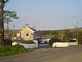
 Chatham Hall Masonic Hall - geograph.org.uk - 1300470.jpg 640 × 480; 66 KB
-
 Clintyfinnan Road.JPG 3,968 × 2,976; 3.19 MB
-
 Crossroads near Armoy - geograph.org.uk - 1022226.jpg 640 × 373; 64 KB
-
 Glenshesk Road, Armoy - geograph.org.uk - 1728374.jpg 3,648 × 2,736; 2.34 MB
-
 Hillside Road, Armoy - geograph.org.uk - 1728371.jpg 3,648 × 2,736; 2.24 MB
-

-
 Lisnagat Road near Armoy - geograph.org.uk - 1255760.jpg 544 × 640; 279 KB
-
 Main Street, Armoy - geograph.org.uk - 1728363.jpg 3,648 × 2,736; 2.37 MB
-
 Old weir on Bush River, Armoy, Co.Antrim - geograph.org.uk - 460494.jpg 640 × 427; 138 KB
-
 Road junction - geograph.org.uk - 1300560.jpg 640 × 480; 79 KB
-
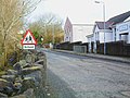
 Road sign near Armoy - geograph.org.uk - 796227.jpg 640 × 429; 85 KB
-
 The Dry Arch near Armoy - geograph.org.uk - 306740.jpg 640 × 426; 135 KB
-
 The Glen Bar - geograph.org.uk - 417473.jpg 640 × 480; 67 KB
-
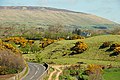
 The Glenshesk Road near Armoy - geograph.org.uk - 796199.jpg 640 × 399; 75 KB
-
 The Hillside Road near Armoy - geograph.org.uk - 1259160.jpg 640 × 352; 90 KB
-
 The Lagge Road near Armoy - geograph.org.uk - 1260041.jpg 640 × 429; 91 KB
-
 The Magheramore Road near Armoy - geograph.org.uk - 1259194.jpg 640 × 341; 86 KB
-
 Tree lined road - geograph.org.uk - 852555.jpg 640 × 480; 203 KB
-

-
 "The Isle" Townland - geograph.org.uk - 866751.jpg 640 × 479; 58 KB
-
 Forestry gate at Altarichard - geograph.org.uk - 418284.jpg 640 × 480; 126 KB


