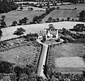
Category:Arkley
Jump to navigation
Jump to search
village in the United Kingdom | |||||
| Upload media | |||||
| Instance of | |||||
|---|---|---|---|---|---|
| Location | London Borough of Barnet, Greater London, London, England | ||||
 | |||||
English: Arkley is a village in the London Borough of Barnet, historically in Hertfordshire. It is located above sea level is one of the highest points in London.
日本語: アークリー(Arkley)は、 ロンドンのバーネット・ロンドン特別区にある都市である。チャリング・クロスより10.6マイル(17.1キロメートル)の北北西にある。標高は482フィート(147メートル)に位置しており、ロンドンの標高最高地点の一つである。
Norsk bokmål: Arkley er et område i Barnet i London, historiskt i Hertfordshire. Det ligger helt i utkanten av Stor-London, omkring 17 km nord-nordvest for Charing Cross, og regnes fortsatt som en landsby selv om folketallet har steget voldsomt. Stedet strekker seg mellom Barnet og Stirling Corner, med det nærmeste man kan komme et sentrum ved puben Gate. Arkley har en av det sørlige Englands eldste vindmøller.
Subcategories
This category has the following 4 subcategories, out of 4 total.
Media in category "Arkley"
The following 45 files are in this category, out of 45 total.
-
"Lorraine", Arkley.jpg 512 × 492; 60 KB
-
Arkley & Barnet Gate on Map of Middlesex Sheet 006, Ordnance Survey, 1868-1883.jpg 1,970 × 1,790; 1.68 MB
-
Arkley bulls.jpg 1,600 × 1,200; 627 KB
-
Arkley Drive - geograph.org.uk - 2730920.jpg 1,600 × 1,200; 620 KB
-
Arkley Drive - geograph.org.uk - 384553.jpg 640 × 480; 78 KB
-
Arkley Lane - geograph.org.uk - 2349599.jpg 640 × 430; 88 KB
-
Arkley Lane - geograph.org.uk - 3411458.jpg 640 × 480; 167 KB
-
Arkley Lane - geograph.org.uk - 384529.jpg 640 × 480; 128 KB
-
Arkley, A411 Barnet Road - geograph.org.uk - 4380355.jpg 640 × 480; 86 KB
-
Arkley, Garthland Drive - geograph.org.uk - 4380401.jpg 640 × 480; 64 KB
-
Arkley, Quinta Drive - geograph.org.uk - 4380451.jpg 640 × 480; 55 KB
-
Barnet Rd (A411) - geograph.org.uk - 2349393.jpg 640 × 430; 82 KB
-
Barnet Rd (A411) - geograph.org.uk - 2349407.jpg 640 × 430; 58 KB
-
Barnet Rd (A411) - geograph.org.uk - 2349437.jpg 640 × 430; 76 KB
-
Barnet Rd off Barnet Rd - geograph.org.uk - 2349314.jpg 640 × 430; 92 KB
-
Barnet Road (A411) - geograph.org.uk - 5352809.jpg 640 × 480; 105 KB
-
Chartridge Close - geograph.org.uk - 2349335.jpg 640 × 430; 84 KB
-
Cottage Garden Nursery, Arkley - geograph.org.uk - 2349395.jpg 640 × 430; 57 KB
-
Dingle Close - geograph.org.uk - 2349421.jpg 640 × 430; 84 KB
-
Driveway on Rowley Lane, Arkley - geograph.org.uk - 4551422.jpg 2,304 × 1,728; 781 KB
-
Elizabeth II postbox on Quinta Drive, Arkley, Barnet - geograph.org.uk - 5358883.jpg 2,736 × 3,648; 4.36 MB
-
End of Oaklands Lane - geograph.org.uk - 2349283.jpg 640 × 430; 89 KB
-
Footpath to Oakland Lane - geograph.org.uk - 2349281.jpg 640 × 430; 104 KB
-
Gates to Hyver Hall Arkley - geograph.org.uk - 24793.jpg 640 × 480; 37 KB
-
Glebe Lane - geograph.org.uk - 2349397.jpg 640 × 430; 81 KB
-
Hazel Mead off Barnet Rd - geograph.org.uk - 2349304.jpg 640 × 430; 71 KB
-
Hedgerow Lane - geograph.org.uk - 2349320.jpg 640 × 430; 68 KB
-
Houses on Galley Lane, Arkley - geograph.org.uk - 2665134.jpg 1,600 × 1,200; 654 KB
-
Houses on Rowley Green Road, Arkley - geograph.org.uk - 2713244.jpg 1,600 × 1,200; 548 KB
-
Hyver Hall & Arkley area map.jpg 9,120 × 11,420; 9.52 MB
-
Kates Close, Arkley - geograph.org.uk - 2349400.jpg 640 × 430; 49 KB
-
Meadowbanks, Arkley - geograph.org.uk - 2349405.jpg 640 × 430; 75 KB
-
Oaklands Lane - geograph.org.uk - 2349287.jpg 640 × 430; 83 KB
-
Oaklands Lane - geograph.org.uk - 2349295.jpg 640 × 430; 103 KB
-
Postbox on Quinta Drive - geograph.org.uk - 5295257.jpg 640 × 480; 146 KB
-
Rockways - geograph.org.uk - 2349427.jpg 640 × 430; 80 KB
-
Rose Cottage - geograph.org.uk - 384578.jpg 640 × 480; 149 KB
-
Rowley Green Rd - geograph.org.uk - 2349342.jpg 640 × 430; 79 KB
-
Rowley Lane, Arkley - geograph.org.uk - 2349419.jpg 640 × 430; 108 KB
-
Saddlers Close - geograph.org.uk - 2349331.jpg 640 × 430; 81 KB
-
Shell petrol station on Barnet Road, Arkley - geograph.org.uk - 2713202.jpg 1,600 × 1,200; 603 KB
-
The Gate - geograph.org.uk - 384654.jpg 640 × 464; 103 KB
-
Trees on the corner of Arkley Drive - geograph.org.uk - 2730963.jpg 1,600 × 1,200; 578 KB
-
Windmill Lane - geograph.org.uk - 2349431.jpg 640 × 430; 77 KB


