Category:Argiles à silex (Paleocene-Eocene; Loiret) - maps
Jump to navigation
Jump to search
.svg)
Subcategories
This category has only the following subcategory.
Media in category "Argiles à silex (Paleocene-Eocene; Loiret) - maps"
The following 9 files are in this category, out of 9 total.
-
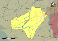
 45001-Adon-géologie.svg 1,052 × 744; 2.13 MB
-
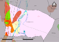
 45023-Batilly-en-Puisaye-géologie.svg 1,052 × 744; 1.87 MB
-
 45070-Champoulet-géologie.svg 1,052 × 744; 1.38 MB
-
 45096-Les Choux-géologie.svg 1,052 × 744; 2.28 MB
-
 45105-Cortrat-géologie.svg 1,052 × 744; 2.23 MB
-
 45120-Dammarie-en-Puisaye-géologie.svg 1,052 × 744; 1.9 MB
-
 45121-Dammarie-sur-Loing-géologie.svg 1,052 × 744; 2.06 MB
-
 45141-Faverelles-géologie.svg 1,052 × 744; 2.02 MB
-
 45257-Pressigny-les-Pins-géologie.svg 1,052 × 744; 1.43 MB


