Category:Argile à faciès sparnacien (Paleocene-Eocene; Loiret) - maps
Jump to navigation
Jump to search
.svg)
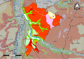
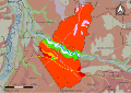
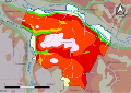
Media in category "Argile à faciès sparnacien (Paleocene-Eocene; Loiret) - maps"
The following 10 files are in this category, out of 10 total.
-
 45127-Dordives-géologie.svg 1,052 × 744; 2.21 MB
-
 45145-Ferrières-en-Gâtinais-géologie.svg 1,052 × 744; 3.4 MB
-
 45161-Griselles-géologie.svg 1,052 × 744; 3.23 MB
-
 45165-Gy-les-Nonains-géologie.svg 1,052 × 744; 2.67 MB
-
 45189-Louzouer-géologie.svg 1,052 × 744; 1.34 MB
-
 45212-Montcresson-géologie.svg 1,052 × 744; 2.67 MB
-
 45249-Paucourt-géologie.svg 1,052 × 744; 2.52 MB
-
 45279-Saint-Germain-des-Prés-géologie.svg 1,052 × 744; 2.9 MB
-
 45306-La Selle-en-Hermoy-géologie.svg 1,052 × 744; 1.9 MB
-
 45307-La Selle-sur-le-Bied-géologie.svg 1,052 × 744; 2.23 MB


