Category:Ardullie
Jump to navigation
Jump to search
human settlement in Highland, Scotland, UK  | |||||
| Upload media | |||||
| Instance of | |||||
|---|---|---|---|---|---|
| Location |
| ||||
 | |||||
English: Ardullie , on the north shore of the Cromarty Firth, is a village in Dingwall, Ross-shire, in Highland, Scotland.
Nederlands: Ardullie is een dorp dat ligt op de noordelijke oever van Cromarty Firth in de buurt van Dingwall in Ross and Cromarty in de Schotse Hooglanden.
Media in category "Ardullie"
The following 47 files are in this category, out of 47 total.
-
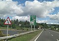 Approaching the Ardulie Roundabout - geograph.org.uk - 2458345.jpg 3,529 × 2,465; 867 KB
-
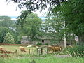
 Ardullie farm cottages - geograph.org.uk - 207602.jpg 640 × 480; 79 KB
-
 Ardullie geograph-3482649-by-Ben-Brooksbank.jpg 2,396 × 1,403; 3 MB
-
 Ardullie Lodge - geograph.org.uk - 764087.jpg 640 × 458; 126 KB
-
 Ardullie Point - geograph.org.uk - 2068399.jpg 3,456 × 2,304; 2.29 MB
-
 Cromarty Bridge - geograph.org.uk - 4691356.jpg 640 × 480; 68 KB
-
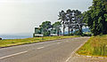
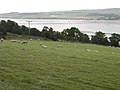
 Cromarty Firth - geograph.org.uk - 2068402.jpg 3,456 × 2,304; 1.75 MB
-
 Cromarty Firth at Ardullie - geograph.org.uk - 5478817.jpg 1,024 × 682; 96 KB
-
 Cromarty Firth View - geograph.org.uk - 4403436.jpg 640 × 403; 64 KB
-
 Cromarty Firth, Ardullie - geograph.org.uk - 1117492.jpg 640 × 480; 102 KB
-
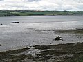
 Foreshore at Ardullie Point - geograph.org.uk - 4138145.jpg 1,024 × 768; 176 KB
-
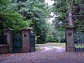 Lemlair Farm entrance - geograph.org.uk - 207586.jpg 640 × 480; 144 KB
-
 Mains of Mountgerald - geograph.org.uk - 207915.jpg 640 × 480; 77 KB
-
 Mount Gerald farm - geograph.org.uk - 207573.jpg 640 × 480; 137 KB
-
 Ordnance Survey Sheet NH 56 Ardullie, Published 1963.jpg 7,624 × 8,789; 12.92 MB
-
 Snowdrops at Knockancurin - geograph.org.uk - 368186.jpg 640 × 480; 175 KB
-
 South west from Ardullie Point - geograph.org.uk - 6346779.jpg 1,275 × 642; 538 KB
-
 Spring at Ardullie - geograph.org.uk - 763653.jpg 640 × 480; 126 KB
-
 The Cromarty Firth - geograph.org.uk - 3044604.jpg 2,048 × 1,152; 617 KB
-
 The Cromarty Firth - geograph.org.uk - 4403428.jpg 640 × 379; 72 KB
-
 The Cromarty Firth - geograph.org.uk - 5991957.jpg 1,024 × 576; 222 KB
-
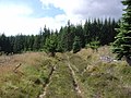
 Track to sheepfold above Lemlair farm - geograph.org.uk - 207595.jpg 640 × 480; 150 KB
-

-
 Ardullie Farm - geograph.org.uk - 207603.jpg 640 × 480; 74 KB
-
 Clare Plantation - geograph.org.uk - 1423963.jpg 640 × 480; 101 KB
-
 Cnoc a Mhargadaidh trig - geograph.org.uk - 135288.jpg 640 × 480; 95 KB
-
 Cnoc Mhabairn forestry track - geograph.org.uk - 368214.jpg 640 × 480; 96 KB
-
 Culnaskeath - geograph.org.uk - 368223.jpg 640 × 480; 104 KB
-
 Entrance to Mount Gerald farm - geograph.org.uk - 207580.jpg 640 × 480; 99 KB
-
 Fannyfield - geograph.org.uk - 65368.jpg 640 × 480; 138 KB
-
 Fannyfield - geograph.org.uk - 65371.jpg 640 × 480; 132 KB
-
 Forest Clearing - geograph.org.uk - 1422543.jpg 640 × 480; 90 KB
-
 Forest Edge - geograph.org.uk - 1424071.jpg 640 × 480; 75 KB
-
 Forestry track to Culnaskeath - geograph.org.uk - 368204.jpg 480 × 640; 91 KB
-
 Junction of track from Knockancurin - geograph.org.uk - 653100.jpg 640 × 480; 66 KB
-
 Lemlair Farm - geograph.org.uk - 207600.jpg 640 × 480; 138 KB
-
 Mains of Mount Gerald - geograph.org.uk - 207569.jpg 640 × 480; 140 KB
-
 Milton Lodge Stables - geograph.org.uk - 65374.jpg 640 × 480; 79 KB
-
 Road to Katewell - geograph.org.uk - 368191.jpg 480 × 640; 126 KB
-
 Rock design on trackside - geograph.org.uk - 653120.jpg 640 × 480; 91 KB
-
 Ruined house at Achleach - geograph.org.uk - 653104.jpg 640 × 480; 98 KB
-
 Scots pine near Corriefoulis - geograph.org.uk - 368196.jpg 480 × 640; 98 KB
-
 Sheep fold above Lemlair farm - geograph.org.uk - 207588.jpg 640 × 480; 87 KB
-
 Strath Sgitheach - geograph.org.uk - 653086.jpg 640 × 480; 56 KB
-
 Swordale - geograph.org.uk - 368233.jpg 480 × 640; 94 KB
-
 Yellow Wells - geograph.org.uk - 33578.jpg 640 × 359; 107 KB
-
 Yellow Wells - geograph.org.uk - 368206.jpg 640 × 480; 148 KB


