Category:Ardeley
Jump to navigation
Jump to search

English: Ardeley is a small village and civil parish in East Hertfordshire, England. The parish includes the hamlet of Cromer.
village in East Hertfordshire, England | |||||
| Upload media | |||||
| Instance of | |||||
|---|---|---|---|---|---|
| Location | East Hertfordshire, Hertfordshire, East of England, England | ||||
| Said to be the same as | Ardeley (Wikimedia duplicated page, civil parish) | ||||
 | |||||
Subcategories
This category has the following 9 subcategories, out of 9 total.
A
- Ardeley Village Hall (3 F)
- Ardeley Village Pump (3 F)
C
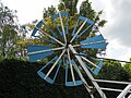
- Cromer Windmill (12 F)
- Cromer, Hertfordshire (6 F)
J
- The Jolly Waggoner, Ardeley (2 F)
L
- St Lawrence Church, Ardeley (24 F)
M
- Moor Green, Hertfordshire (6 F)
W
Media in category "Ardeley"
The following 122 files are in this category, out of 122 total.
-
 "The Jolly Waggoner" public house - geograph.org.uk - 4091504.jpg 767 × 600; 220 KB
-
 A mixture of buildings at Bury Grange Farm - geograph.org.uk - 2997521.jpg 2,560 × 1,920; 1.14 MB
-
 Acre Farm - geograph.org.uk - 4626953.jpg 640 × 480; 124 KB
-
 Acre farmhouse on Moor Green - geograph.org.uk - 4664924.jpg 2,560 × 1,920; 2.06 MB
-
 Anode sign in Luffenhall - geograph.org.uk - 5581238.jpg 2,048 × 1,536; 1.58 MB
-
 Ardeley (5476919321).jpg 2,696 × 2,023; 1.26 MB
-
 Ardeley Brook, Ardeley (51115014977).jpg 4,608 × 3,456; 4.96 MB
-
 Ardeley Brook, Ardeley (51115329574).jpg 4,608 × 3,456; 5.57 MB
-
 Ardeley Brook, Ardeley (51116372425).jpg 4,608 × 3,456; 5.08 MB
-
 Ardeley Brook, Flanders Green, Cottered (51100577301).jpg 4,608 × 3,456; 4.83 MB
-
 Ardeley Brook, Flanders Green, Cottered (51100674452).jpg 4,608 × 3,456; 5.01 MB
-
 Ardeley Pond - geograph.org.uk - 214677.jpg 640 × 480; 178 KB
-
 Ardeley Village Hall - geograph.org.uk - 3612684.jpg 1,600 × 1,200; 497 KB
-
 Back Lane looking towards Hare Street - geograph.org.uk - 415469.jpg 640 × 480; 154 KB
-
 Bend before Wood End - geograph.org.uk - 4669923.jpg 2,560 × 1,920; 2.04 MB
-
 Blind Lane at the junction of Hare Street - geograph.org.uk - 4664008.jpg 2,560 × 1,920; 1.99 MB
-
 Blind Lane joins the B1037 - geograph.org.uk - 3445229.jpg 4,320 × 3,240; 4.1 MB
-
 Blind Lane towards Ardeley - geograph.org.uk - 3102121.jpg 640 × 480; 50 KB
-
 Blind Lane, Hare Street - geograph.org.uk - 4670042.jpg 2,560 × 1,920; 1.32 MB
-
 Brake Wheel at Cromer Mill - geograph.org.uk - 3458811.jpg 1,600 × 1,200; 414 KB
-
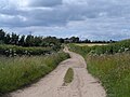
 Byway near Ardeley - geograph.org.uk - 214655.jpg 480 × 640; 141 KB
-
 Cherry Farm, Wood End - geograph.org.uk - 4664929.jpg 2,560 × 1,920; 2.05 MB
-
 Clipping the Hedge - geograph.org.uk - 214670.jpg 640 × 480; 98 KB
-
 Common land at Moor Green - geograph.org.uk - 2997556.jpg 2,560 × 1,920; 1.09 MB
-
 Corner and crossways on B1037 - geograph.org.uk - 4626891.jpg 640 × 480; 139 KB
-
 Cottage on Moor Green - geograph.org.uk - 4669962.jpg 2,560 × 1,920; 1.98 MB
-
 Cottage, Ardeley - geograph.org.uk - 2472285.jpg 1,000 × 595; 143 KB
-
 Cottages, Ardeley - geograph.org.uk - 2472283.jpg 1,000 × 556; 105 KB
-
 Cromer Windmill - geograph.org.uk - 3102127.jpg 480 × 640; 49 KB
-
 Cromer Windmill - geograph.org.uk - 3457321.jpg 2,592 × 1,944; 1.1 MB
-
 Cromer Windmill - geograph.org.uk - 3607140.jpg 1,600 × 1,000; 394 KB
-
 Cromer Windmill - geograph.org.uk - 3607142.jpg 1,200 × 1,600; 410 KB
-
 Cromer Windmill - geograph.org.uk - 3985170.jpg 4,320 × 3,240; 2.85 MB
-
 Cromer Windmill - geograph.org.uk - 4664010.jpg 1,920 × 2,560; 1.92 MB
-
 Cromer Windmill - geograph.org.uk - 6161903.jpg 1,024 × 768; 223 KB
-
 Entering Ardeley - geograph.org.uk - 4626938.jpg 640 × 480; 163 KB
-
 Entering Moor Green - geograph.org.uk - 4664625.jpg 2,560 × 1,920; 1.99 MB
-
 Entering Moor Green - geograph.org.uk - 4669930.jpg 2,560 × 1,920; 1.24 MB
-
 Entrance to path, Ardeley - geograph.org.uk - 4664623.jpg 2,560 × 1,920; 2.02 MB
-
 Fan Tail at Cromer Mill - geograph.org.uk - 3458827.jpg 1,200 × 1,600; 493 KB
-
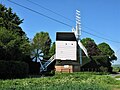
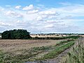
 Farm buildings, Cromer, Hertfordshire - geograph.org.uk - 2534943.jpg 3,017 × 1,750; 5.04 MB
-
 Farm track NE of Leycroft - geograph.org.uk - 3607151.jpg 1,600 × 1,000; 457 KB
-
 Farmland near Ardeley - geograph.org.uk - 3102125.jpg 640 × 480; 75 KB
-
 Farmland near Whitehall Farm - geograph.org.uk - 3102137.jpg 640 × 480; 62 KB
-
 Farmland off Blind Lane - geograph.org.uk - 3102119.jpg 640 × 480; 74 KB
-
 Farmyard in Luffenhall - geograph.org.uk - 5581237.jpg 2,048 × 1,536; 1.55 MB
-
 Field by Blind Lane, Ardeley - geograph.org.uk - 4670021.jpg 2,560 × 1,920; 1.33 MB
-
 Field by the B1037, Cromer - geograph.org.uk - 4664011.jpg 2,560 × 1,920; 1.97 MB
-
 Fields near Ardeley (51105418228).jpg 4,608 × 3,456; 5.72 MB
-
 Footpath to Cromer - geograph.org.uk - 3102135.jpg 640 × 480; 79 KB
-
 Footpath towards Hare Street - geograph.org.uk - 3102122.jpg 640 × 480; 78 KB
-
 Former Chequers public house - geograph.org.uk - 4233931.jpg 2,884 × 2,160; 969 KB
-
 Geese at Cherry Farm, Wood End - geograph.org.uk - 4664928.jpg 2,560 × 1,920; 2.03 MB
-
 Green in Wood End - geograph.org.uk - 4664927.jpg 2,560 × 1,920; 1.4 MB
-
 Hall's Green - geograph.org.uk - 5549003.jpg 3,264 × 2,448; 3.34 MB
-
 House across a wheat field - geograph.org.uk - 4626962.jpg 640 × 480; 148 KB
-
 House in Ardeley - geograph.org.uk - 4670005.jpg 2,560 × 1,920; 1.99 MB
-

-
 Houses and entrance to Byway, near to Ardeley - geograph.org.uk - 2997539.jpg 2,560 × 1,920; 1.09 MB
-
 Houses at Moor Green - geograph.org.uk - 2997562.jpg 2,560 × 1,920; 1.11 MB
-
 Houses on the outskirts of Ardeley - geograph.org.uk - 214671.jpg 640 × 480; 108 KB
-

-
 Junction in Wood End - geograph.org.uk - 4664007.jpg 2,498 × 1,834; 1.09 MB
-
 Junction on White Hill, Cromer - geograph.org.uk - 4664576.jpg 2,560 × 1,920; 1.13 MB
-
 Lane heading south towards Ardeley - geograph.org.uk - 3102126.jpg 640 × 480; 87 KB
-
 Lane heading south, Luffenhall - geograph.org.uk - 3102136.jpg 640 × 480; 48 KB
-
 Little road to Ardeley Bury - geograph.org.uk - 4664613.jpg 2,560 × 1,920; 1.87 MB
-
 Looking north from Cromer Windmill - geograph.org.uk - 3985176.jpg 4,320 × 3,240; 3.92 MB
-
 Main Post and Crown Tree at Cromer Mill - geograph.org.uk - 3458759.jpg 1,200 × 1,600; 365 KB
-
 Main Post at Cromer Windmill - geograph.org.uk - 3457370.jpg 1,600 × 1,200; 410 KB
-
 Moor Green - geograph.org.uk - 4664627.jpg 2,556 × 1,914; 1.27 MB
-
 Pair of houses in Ardeley - geograph.org.uk - 4670015.jpg 2,560 × 1,920; 1.99 MB
-
 Project 365 Day 139 Fantail (5737442734).jpg 2,640 × 1,980; 1.11 MB
-
 Project 365 Day 153 Circular Farm Walk (5791088926).jpg 2,640 × 1,980; 1,003 KB
-
 Pump on green, Ardeley - geograph.org.uk - 4626927.jpg 640 × 480; 147 KB
-
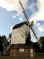
 Recently restored windmill, Cromer, Hertfordshire - geograph.org.uk - 2534933.jpg 1,858 × 2,686; 3.73 MB
-
 River Beane near Cromer - geograph.org.uk - 3655666.jpg 640 × 426; 70 KB
-
 Road into Wood End - geograph.org.uk - 2997570.jpg 2,560 × 1,920; 1.08 MB
-
 Road to Ardeley off the B1037 - geograph.org.uk - 2997507.jpg 2,560 × 1,920; 1.07 MB
-
 Roman Road towards Hare Street - geograph.org.uk - 3607178.jpg 1,600 × 1,200; 1 MB
-
 Shaded bend in the lane - geograph.org.uk - 4626970.jpg 640 × 480; 159 KB
-
 Sharp bend on the B1037, Cromer - geograph.org.uk - 4664012.jpg 2,560 × 1,920; 1.98 MB
-
 Shooting hide near to Ardeley - geograph.org.uk - 4538632.jpg 4,320 × 3,240; 5 MB
-
 Shrine by St Lawrence's Church, Ardeley - geograph.org.uk - 4664016.jpg 2,560 × 1,920; 2.53 MB
-
 Spur wheel at Cromer Mill - geograph.org.uk - 3458793.jpg 1,200 × 1,600; 430 KB
-
 St Lawrence Primary School - geograph.org.uk - 214652.jpg 640 × 480; 114 KB
-
 St Lawrence's Church garden - geograph.org.uk - 4664017.jpg 2,560 × 1,920; 2.05 MB
-
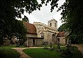
 St Lawrence's church, Ardeley (2) - geograph.org.uk - 4476723.jpg 4,320 × 3,240; 5.49 MB
-
 St Lawrence's church, Ardeley - geograph.org.uk - 4476704.jpg 4,320 × 3,240; 4.8 MB
-
 St Lawrence, Ardeley - geograph.org.uk - 2472281.jpg 1,000 × 699; 186 KB
-
 St Lawrence, Ardeley - Head board - geograph.org.uk - 2472286.jpg 1,000 × 700; 274 KB
-
 St Lawrence, Ardeley - Water trough - geograph.org.uk - 2472282.jpg 1,000 × 696; 230 KB
-
 Start of footpath to wood end - geograph.org.uk - 2997547.jpg 2,560 × 1,920; 1.13 MB
-
 Start of track to Gardners End - geograph.org.uk - 4626944.jpg 640 × 480; 154 KB
-
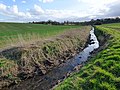
 Stream near Ardeley - geograph.org.uk - 214663.jpg 640 × 480; 125 KB
-
 Sunset - geograph.org.uk - 395117.jpg 640 × 480; 57 KB
-
 Tethered goat near to Hare Street - geograph.org.uk - 4479900.jpg 4,320 × 3,240; 5.34 MB
-
 The B1037 by Bancroft Farm, Hare Street - geograph.org.uk - 4664560.jpg 2,560 × 1,920; 1.41 MB
-
 The centre of Ardeley - geograph.org.uk - 4664015.jpg 2,560 × 1,920; 1.99 MB
-
 The Green, Ardeley - geograph.org.uk - 3612671.jpg 1,600 × 1,000; 353 KB
-
 The Jolly Waggoner and Rose Cottage, Ardeley (51022911681).jpg 4,201 × 3,150; 3.95 MB
-
 The Jolly Waggoner and Rose Cottage, Ardeley (51023007322).jpg 3,617 × 2,715; 3.18 MB
-
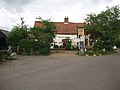 The Jolly Waggoner pub at Ardeley - geograph.org.uk - 2997545.jpg 2,560 × 1,920; 1.02 MB
-
 The Jolly Waggoner, Ardeley - geograph.org.uk - 4664617.jpg 2,510 × 1,852; 1.18 MB
-
 The Post House, Ardeley (51023007612).jpg 4,608 × 3,456; 5.31 MB
-
 The Post House, Ardeley (51023007757).jpg 3,719 × 2,791; 3.84 MB
-
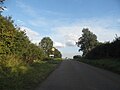
 The road leaving Cromer - geograph.org.uk - 5581232.jpg 2,048 × 1,536; 1.5 MB
-
 The road to Ardeley - geograph.org.uk - 4670125.jpg 2,560 × 1,920; 1.99 MB
-
 The road to Ardeley from Cromer - geograph.org.uk - 4664014.jpg 2,560 × 1,920; 2.02 MB
-
 The road to Cromer - geograph.org.uk - 4669925.jpg 2,560 × 1,920; 1.99 MB
-
 Track at Bury Grange farm - geograph.org.uk - 2997515.jpg 2,560 × 1,920; 1.07 MB
-
 Track to Hare Street - geograph.org.uk - 4538642.jpg 4,320 × 3,240; 5.56 MB
-
 Tree in blossom, road to Ardeley - geograph.org.uk - 4476672.jpg 4,320 × 3,240; 5.19 MB
-
 Tree tunnel - geograph.org.uk - 4538627.jpg 4,320 × 3,240; 6.85 MB
-
 Unnamed road north of Cromer - geograph.org.uk - 5581233.jpg 2,048 × 1,536; 1,006 KB
-
 View north from B1037 - geograph.org.uk - 4626905.jpg 640 × 480; 117 KB
-
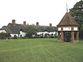 Village Green - Ardeley - geograph.org.uk - 214674.jpg 640 × 480; 90 KB
-
 White Hill, Cromer - geograph.org.uk - 4664013.jpg 2,560 × 1,920; 2 MB
-
 Whitehall Farm - geograph.org.uk - 3102138.jpg 640 × 480; 59 KB
-
 Young Trees and Thistles - geograph.org.uk - 215694.jpg 640 × 480; 120 KB
-
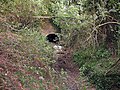
 Bridge over The Old Bourne - geograph.org.uk - 214492.jpg 640 × 480; 155 KB
-
 Bridge over The Old Bourne - geograph.org.uk - 214494.jpg 640 × 480; 234 KB


.jpg)
.jpg)
.jpg)
.jpg)
.jpg)
.jpg)


.jpg)


.jpg)
.jpg)


_-_geograph.org.uk_-_4476723.jpg)


.jpg)
.jpg)


.jpg)
.jpg)


