Category:Arclid
Jump to navigation
Jump to search
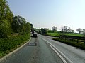
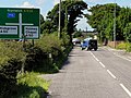
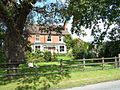
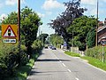
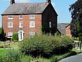
English: Arclid is a village and civil parish in the unitary authority of Cheshire East and the ceremonial county of Cheshire, England. It is about two miles east of Sandbach and five miles west of Congleton. The parish had a population of 199 according to the 2001 census.
village and civil parish in Cheshire East, United Kingdom  | |||||
| Upload media | |||||
| Instance of | |||||
|---|---|---|---|---|---|
| Location | Cheshire East, Cheshire, North West England, England | ||||
| Population |
| ||||
 | |||||
Media in category "Arclid"
The following 32 files are in this category, out of 32 total.
-
 A533 at Arclid Green - geograph.org.uk - 1918507.jpg 640 × 480; 185 KB
-
 A533 at Arclid Green - geograph.org.uk - 2377359.jpg 3,072 × 2,304; 2.97 MB
-
 A534 approaching Arclid Crossroads - geograph.org.uk - 4146643.jpg 640 × 480; 313 KB
-
 A534, Congleton Road - geograph.org.uk - 4146652.jpg 640 × 480; 342 KB
-
 Arclid - Springbank Farm.jpg 640 × 480; 76 KB
-
 Arclid Crossroads - geograph.org.uk - 1918490.jpg 640 × 480; 165 KB
-
 Arclid, A534 - geograph.org.uk - 4146364.jpg 640 × 480; 302 KB
-
 Arclid, Spark Lane - geograph.org.uk - 4146636.jpg 640 × 480; 338 KB
-
 Big field near Cottage Farm - geograph.org.uk - 1917768.jpg 640 × 480; 226 KB
-
 Brick House Farm, Arclid - geograph.org.uk - 4146656.jpg 640 × 480; 340 KB
-
 Close up, Elizabeth II postbox on Newcastle Road - geograph.org.uk - 5000400.jpg 1,533 × 2,809; 670 KB
-
 Congleton Road, Arclid Green - geograph.org.uk - 4146646.jpg 640 × 480; 328 KB
-
 Crop field off Newcastle Road (A50) - geograph.org.uk - 4993508.jpg 640 × 480; 70 KB
-
 Depot off Newcastle Road (A50) - geograph.org.uk - 4993499.jpg 640 × 480; 49 KB
-

-
 Exit from Arclid Green industrial units (geograph 1918506).jpg 640 × 480; 223 KB
-
 Grassland near Arclid - geograph.org.uk - 4993494.jpg 640 × 480; 57 KB
-
 House at Arclid Junction on A50 - geograph.org.uk - 2377372.jpg 2,837 × 1,847; 1.83 MB
-
 Italian Lounge restaurant, Arclid - geograph.org.uk - 1918501.jpg 640 × 480; 167 KB
-
 New housing, Arclid - geograph.org.uk - 1918488.jpg 640 × 480; 161 KB
-
 Newcastle Road (A50) - geograph.org.uk - 4993496.jpg 640 × 480; 65 KB
-
 Newcastle Road (A50) - geograph.org.uk - 4993510.jpg 640 × 480; 54 KB
-
 Newcastle Road (A50), Arclid - geograph.org.uk - 5000401.jpg 640 × 480; 65 KB
-
 Peaceful Cheshire - geograph.org.uk - 1917763.jpg 640 × 480; 215 KB
-
 Road to Springbank Farm - geograph.org.uk - 4993505.jpg 640 × 480; 51 KB
-
 Rose and Crown, Arclid crossroads - geograph.org.uk - 230394.jpg 640 × 480; 32 KB
-
 Snow covered light aircraft, S of Arclid - geograph.org.uk - 5626409.jpg 5,184 × 2,920; 5.63 MB
-
 Snow on plant stalks SE of Arclid Green Farm, Arclid - geograph.org.uk - 5626405.jpg 5,184 × 2,920; 4.74 MB
-
 Spark Lane, Arclid - geograph.org.uk - 4146638.jpg 640 × 480; 294 KB
-
 Sparklane Farm, Arclid - geograph.org.uk - 1478640.jpg 640 × 480; 51 KB
-
 Westcot Farmhouse - geograph.org.uk - 2179800.jpg 1,024 × 768; 150 KB
-
 Zest, Arclid - geograph.org.uk - 4993502.jpg 640 × 419; 44 KB


_-_geograph.org.uk_-_4993508.jpg)
_-_geograph.org.uk_-_4993499.jpg)

.jpg)


_-_geograph.org.uk_-_4993496.jpg)
_-_geograph.org.uk_-_4993510.jpg)
,_Arclid_-_geograph.org.uk_-_5000401.jpg)


