Category:Archives nationales (France) - sous-série F/2
Jump to navigation
Jump to search
Sub-series of the Archives nationales | |||||
| Upload media | |||||
| Instance of |
| ||||
|---|---|---|---|---|---|
| Subclass of | |||||
| Part of | |||||
| Main subject |
| ||||
| Location |
| ||||
| |||||
Media in category "Archives nationales (France) - sous-série F/2"
The following 34 files are in this category, out of 34 total.
-
 Andorran en costume de cérémonie - Archives nationales (France).jpg 2,055 × 3,326; 1.4 MB
-
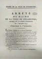
 Arrêté circulation vélo 1896 - Archives nationales (France).pdf 1,239 × 1,754, 3 pages; 245 KB
-
 Aubervilliers photographie bidonville années 1930.jpg 1,304 × 963; 215 KB
-
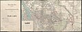
 Carte de la commune de Bégard 1814.jpg 2,669 × 2,046; 511 KB
-
 Décret qui érige Bégard en commune 1793.jpg 1,722 × 2,166; 1.19 MB
-
 Epinay-sur-Seine photographie bords de Seine années 1930 (1).jpg 1,322 × 1,368; 251 KB
-
 Epinay-sur-Seine photographie bords de Seine années 1930 (2).jpg 1,344 × 1,363; 262 KB
-
 Epinay-sur-Seine photographie CGE années 1930.jpg 1,300 × 1,167; 224 KB
-
 Epinay-sur-Seine photographie depuis le pont sur la Seine années 1930.jpg 1,371 × 1,404; 263 KB
-
 Epinay-sur-Seine photographie pont sur la Seine années 1930.jpg 1,339 × 1,380; 261 KB
-
 Epinay-sur-Seine photographie Seine aval années 1930 (1).jpg 1,355 × 1,197; 274 KB
-
 Epinay-sur-Seine photographie Seine aval années 1930 (2).jpg 1,367 × 1,289; 263 KB
-
 Epinay-sur-Seine photographie usine années 1930.jpg 1,312 × 1,175; 272 KB
-
 Extrait de plan de Perros-Hamon 1824.jpg 2,294 × 1,562; 186 KB
-
 Extrait du plan de réunion de Paimpol et Lanvignec 1824.png 2,420 × 1,744; 1.13 MB
-
 Ile-Saint-Denis notice présentation 1933.pdf 1,239 × 1,754, 9 pages; 5.54 MB
-
 Ile-Saint-Denis plan des zones d'aménagement 1932.jpg 4,682 × 3,353; 6.94 MB
-
 Pierrefitte notice présentation 1931.pdf 1,239 × 1,754, 12 pages; 7.97 MB
-
 Pierrefitte notice présentation 1956.pdf 1,239 × 1,754, 4 pages; 3.62 MB
-
 Pierrefitte plan aménagement 1929 (1).jpg 2,293 × 3,378; 1.18 MB
-
 Pierrefitte plan aménagement 1929 (2).jpg 3,034 × 5,266; 9.01 MB
-
 Pierrefitte plan des zones d'aménagement 1929.jpg 4,354 × 3,194; 6.24 MB
-
 Plan de Lannévez 1824.jpg 2,233 × 1,955; 255 KB
-
 Plan de Ploubazlanec Lannévez Perros-Hamon 1824.jpg 8,541 × 5,670; 2.05 MB
-
 Plan d’ensemble de Paris et de son enceinte en 1920- Archives nationales- F-2-2712.jpg 7,667 × 7,557; 27.1 MB
-
 Plan réunion de Paimpol et Lanvignec 1824.png 7,137 × 4,961; 5.06 MB
-
 Plan Saint-Denis Épinay hameau La Briche 1803.jpg 3,686 × 2,845; 1.19 MB
-
 Saint-Denis photographie Porte de Paris années 1930.jpg 1,389 × 1,448; 321 KB
-
 Stains notice présentation 1936.pdf 1,239 × 1,754, 31 pages; 22.92 MB
-
 Stains plan d'aménagement 1936 (1).jpg 2,294 × 3,339; 1.18 MB
-
 Stains plan d'aménagement 1936 (2).jpg 7,690 × 6,602; 27.79 MB
-
 Stains plan des zones d'aménagement 1936.jpg 6,697 × 4,281; 10.67 MB
-
 Tracé du Croult à Saint-Denis 1944.jpg 8,817 × 3,449; 13.63 MB
-
 Vaccination variole obligatoire 1814 - Archives nationales (France).pdf 1,239 × 1,754, 2 pages; 539 KB
.jpg)


.jpg)
.jpg)


.jpg)
.jpg)


.jpg)
.jpg)


.jpg)
.jpg)
